AppBrain
|
Apps
Apps
Apps being viewed right now
Trending apps today
Most popular apps
All-time most downloaded apps
Top rated apps
Statistics
Docs
Developers
Sign up
Log in
Android Apps
>
Maps & Navigation
>
Paid
Category
Maps & Navigation
Sort by
Trending
Recent downloads
All-time downloads
Top rated
Popular in
Filter by
Off
Free
Paid
New
Updated
Price Reduced
No ads
Page 9 of the
popular Paid Maps & Navigation Apps for Android in Australia
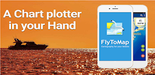
Huron Erie Ontario Lakes Chart – Click to show
Huron Erie Ontario Lakes Chart
FLYTOMAP INC
Flytomap is a valid and interesting alternative, Featured on the Deck Featured on Geomedia Worldwide Marine and Outdoor Maps available when connected, thanks to viewer.flytomap.com Worldwide Satelli…
$3.99
0.0
10+ downloads
|
Maps & Navigation
0.0
$3.99
FLYTOMAP INC
10+ downloads
TRANSPORTATION
Huron Erie Ontario Lakes Chart
Flytomap is a valid and interesting alternative, Featured on the Deck Featured on Geomedia Worldwide Marine and Outdoo…
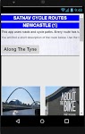
Satnav Cycle Routes-Newcastle1 – Click to show
Satnav Cycle Routes-Newcastle1
Ian Lochhead
1. Along the Tyne - 15 miles 2. Newcastle to Gateshead - 23.5 miles 3. Newcastle to Sunderland - 39 miles Satnav Cycle Routes around Newcastle using cycle paths and roads. Every route has turn-by-tu…
$0.99
0.0
0+ downloads
|
Maps & Navigation
0.0
$0.99
Ian Lochhead
0+ downloads
TRANSPORTATION
Satnav Cycle Routes-Newcastle1
1. Along the Tyne - 15 miles 2. Newcastle to Gateshead - 23.5 miles 3. Newcastle to Sunderland - 39 miles Satnav Cycle…
Thorsborne Trail
Jonathan Ide
This is the only app for hikers either walking or thinking of walking the iconic Thorsborne Trail on World Heritage listed Hinchinbrook Island in Far North Queensland, Australia. It is the perfect el…
$4.49
0.0
1,000+ downloads
|
Maps & Navigation
0.0
$4.49
Jonathan Ide
1,000+ downloads
TRANSPORTATION
Thorsborne Trail
This is the only app for hikers either walking or thinking of walking the iconic Thorsborne Trail on World Heritage lis…
Como Park Lake Zoo Map & Guide – Click to show
Como Park Lake Zoo Map & Guide
GeoPOI LLC
Como Park is one of the most visited destinations in Minnesota, and for good reason! Located in northwest Saint Paul in Ramsey County, Como Park was established in 1884 and has a rich history as an p…
$0.49
0.0
1+ downloads
|
Maps & Navigation
0.0
$0.49
GeoPOI LLC
1+ downloads
TRANSPORTATION
Como Park Lake Zoo Map & Guide
Como Park is one of the most visited destinations in Minnesota, and for good reason! Located in northwest Saint Paul in…
Satnav CycleRoutes–Dunfermline – Click to show
Satnav CycleRoutes–Dunfermline
Ian Lochhead
Dunfermline - Kincardine. 28.6 miles Dunfermline - Limekilns. 14.4 miles Satnav Cycle Routes around Dunfermline using cycle paths and roads. Every route has turn-by-turn navigation with voice instru…
$0.99
0.0
0+ downloads
|
Maps & Navigation
0.0
$0.99
Ian Lochhead
0+ downloads
TRANSPORTATION
Satnav CycleRoutes–Dunfermline
Dunfermline - Kincardine. 28.6 miles Dunfermline - Limekilns. 14.4 miles Satnav Cycle Routes around Dunfermline using …
Speed Camera AI: Radar Alerts
MyCarTracks
Imagine a navigation where you don't enter a destination but it still guides you by avoiding traffic jams, accidents, and bad weather, and even warns you about speed camera radars. Now stop imagining…
$0.99
0.0
10+ downloads
|
Maps & Navigation
0.0
$0.99
MyCarTracks
10+ downloads
TRANSPORTATION
Speed Camera AI: Radar Alerts
Imagine a navigation where you don't enter a destination but it still guides you by avoiding traffic jams, accidents, a…
PORTA DEL CEL – Click to show
PORTA DEL CEL
Jorge Rodríguez-Flores Esparza
"Porta del Cel" is a medium distance circular route located in the Spanish and French Pyrenees. The trail runs through the "Parc Natural de l'Alt Pirineu" and the "Parc natur…
$1.99
0.0
0+ downloads
|
Maps & Navigation
0.0
$1.99
Jorge Rodríguez-Flores Esparza
0+ downloads
TRANSPORTATION
PORTA DEL CEL
"Porta del Cel" is a medium distance circular route located in the Spanish and French Pyrenees. The trail run…
樂客導航王 全3D Pro
Kingwaytek Technology Co.,Ltd
1️⃣【特色】 1) 測速照相,罰單掰掰 2) 路口不錯過,匝道放心走 - 複雜路口實景圖超強大 3) 不走小路避塞車 - 路徑規劃超方便 2️⃣【詳細說明】 「樂客導航王全3D Pro」是全台唯一全3D立體導航軟體,業界領先3D圖資,3D立體地標、建物以及獨家立體標誌及立體指引,帶給您賽車級的實境導航體驗及視覺震撼。獨家3D立體高速導航引擎提供多條路徑規劃及前方即時路況之高畫質影像、測速照相…
$30.99
3.3
100,000+ downloads
|
Maps & Navigation
3.3
$30.99
Kingwaytek Technology Co.,Ltd
100,000+ downloads
TRANSPORTATION
樂客導航王 全3D Pro
1️⃣【特色】 1) 測速照相,罰單掰掰 2) 路口不錯過,匝道放心走 - 複雜路口實景圖超強大 3) 不走小路避塞車 - 路徑規劃超方便 2️⃣【詳細說明】 「樂客導航王全3D Pro」是全台唯一全3D立體導航軟體,業界領先3D圖資,…
Lake Yellowstone Wyoming Chart – Click to show
Lake Yellowstone Wyoming Chart
FLYTOMAP INC
Flytomap is a valid and interesting alternative, Featured on the Deck Featured on Geomedia Worldwide Marine and Outdoor Maps available when connected, thanks to viewer.flytomap.com Worldwide Satelli…
$3.99
0.0
0+ downloads
|
Maps & Navigation
0.0
$3.99
FLYTOMAP INC
0+ downloads
TRANSPORTATION
Lake Yellowstone Wyoming Chart
Flytomap is a valid and interesting alternative, Featured on the Deck Featured on Geomedia Worldwide Marine and Outdoo…
Transit Tracker+ - Chicago
hillman apps
Transit Tracker is not affiliated with any transit or government agency; this is not an official CTA app. All data is obtained through public APIs provided by CTA. Details can be found here: https://…
$1.99
5.0
1+ downloads
|
Maps & Navigation
5.0
$1.99
hillman apps
1+ downloads
TRANSPORTATION
Transit Tracker+ - Chicago
Transit Tracker is not affiliated with any transit or government agency; this is not an official CTA app. All data is o…
Agro Measure Map Pro
Blue Blink One, SL
Agro Measure Map Pro lets you quickly and easily measure multiple distances, perimeters and areas with laser sharp precision! It even takes into account the curvature of the earth’s surface. Us…
$94.99
4.4
500+ downloads
|
Maps & Navigation
4.4
$94.99
Blue Blink One, SL
500+ downloads
TRANSPORTATION
Agro Measure Map Pro
Agro Measure Map Pro lets you quickly and easily measure multiple distances, perimeters and areas with laser sharp prec…
SG BusLeh Full Unlock
OriginallyUS.SG - Award Winning App Consultancy
NOTE 1: BusLeh Unlock does not currently remove BusLeh announcements, which may contain important announcements such as traffic breakdown, data service breakdown, as well as text-based deals and offe…
$74.99
0.0
1,000+ downloads
|
Maps & Navigation
0.0
$74.99
OriginallyUS.SG - Award Winning App Consultancy
1,000+ downloads
TRANSPORTATION
SG BusLeh Full Unlock
NOTE 1: BusLeh Unlock does not currently remove BusLeh announcements, which may contain important announcements such as…
Lake Pend Oreille Idaho Charts – Click to show
Lake Pend Oreille Idaho Charts
MAPITECH LTD
MapiTech launches on the market the best official up-to-date NOAA RNC (raster) combined with S57 nautical charts (digital): marinas, wrecks, fishing spots, boat ramps, POI. This app displays seamles…
$4.99
0.0
1+ downloads
|
Maps & Navigation
0.0
$4.99
MAPITECH LTD
1+ downloads
TRANSPORTATION
Lake Pend Oreille Idaho Charts
MapiTech launches on the market the best official up-to-date NOAA RNC (raster) combined with S57 nautical charts (digit…
Lake Leman Geneva Offline Maps – Click to show
Lake Leman Geneva Offline Maps
FLYTOMAP INC
Flytomap is a valid and interesting alternative, Featured on the Deck Featured on Geomedia Worldwide Marine and Outdoor Maps available when connected, thanks to viewer.flytomap.com Worldwide Satelli…
$3.99
0.0
100+ downloads
|
Maps & Navigation
0.0
$3.99
FLYTOMAP INC
100+ downloads
TRANSPORTATION
Lake Leman Geneva Offline Maps
Flytomap is a valid and interesting alternative, Featured on the Deck Featured on Geomedia Worldwide Marine and Outdoo…
Lake Chiemsee GPS Navigator – Click to show
Lake Chiemsee GPS Navigator
FLYTOMAP INC
Flytomap is a valid and interesting alternative, Featured on the Deck Featured on Geomedia Worldwide Marine and Outdoor Maps available when connected, thanks to viewer.flytomap.com Worldwide Satelli…
$3.99
0.0
10+ downloads
|
Maps & Navigation
0.0
$3.99
FLYTOMAP INC
10+ downloads
TRANSPORTATION
Lake Chiemsee GPS Navigator
Flytomap is a valid and interesting alternative, Featured on the Deck Featured on Geomedia Worldwide Marine and Outdoo…
Galveston to Rio Grande Charts – Click to show
Galveston to Rio Grande Charts
MAPITECH LTD
MapiTech launches on the market the best official up-to-date NOAA RNC (raster) combined with S57 nautical charts (digital): marinas, wrecks, fishing spots, boat ramps, POI. This app displays seamles…
$4.99
0.0
0+ downloads
|
Maps & Navigation
0.0
$4.99
MAPITECH LTD
0+ downloads
TRANSPORTATION
Galveston to Rio Grande Charts
MapiTech launches on the market the best official up-to-date NOAA RNC (raster) combined with S57 nautical charts (digit…
Mojo TSD Navigator
RallyOn
Mojo TSD Navigator allows a time-speed-distance rally navigator (co-driver) to report to the driver whether to speed up or slow down in order to arrive at the next rally checkpoint exactly on time an…
$19.99
0.0
10+ downloads
|
Maps & Navigation
0.0
$19.99
RallyOn
10+ downloads
TRANSPORTATION
Mojo TSD Navigator
Mojo TSD Navigator allows a time-speed-distance rally navigator (co-driver) to report to the driver whether to speed up…
Coordinates Pro
Orbital Motion
Converts decimal to sexagesimal coordinates (degrees, minutes and seconds) , UTM and MGRS coordinates. Show on the map the exact location of the coordinates. Maps types: Normal, Satellite, Terrain …
$0.99
4.8
5,000+ downloads
|
Maps & Navigation
4.8
$0.99
Orbital Motion
5,000+ downloads
TRANSPORTATION
Coordinates Pro
Converts decimal to sexagesimal coordinates (degrees, minutes and seconds) , UTM and MGRS coordinates. Show on the map…
Navigator for Amazfit devices
Francesco Re
This app lets you receive Google Maps directions directly to your device. Notifications are highly customizable. It requires Zepp (ex Amazfit Watch) app. The compatibility with third party apps is …
$1.99
3.2
10,000+ downloads
|
Maps & Navigation
3.2
$1.99
Francesco Re
10,000+ downloads
TRANSPORTATION
Navigator for Amazfit devices
This app lets you receive Google Maps directions directly to your device. Notifications are highly customizable. It r…
3D Map
Stéphane Sandon
3D Map displays Maps in 3D with offline mode with world wide coverage. Very useful on trails or for outdoors activities. Totally compatible with *offline* mode : you can go and explore back-country…
$6.99
0.0
1,000+ downloads
|
Maps & Navigation
0.0
$6.99
Stéphane Sandon
1,000+ downloads
TRANSPORTATION
3D Map
3D Map displays Maps in 3D with offline mode with world wide coverage. Very useful on trails or for outdoors activitie…
United States
United Kingdom
Germany
Norway
Sweden
Australia
Netherlands
Italy
Denmark
Hong Kong
Brazil
France
Canada
Spain
Portugal
South Korea
Japan
Poland
Hungary
India
Finland
Thailand
Russia
General
Overall
Applications
Games
Join AppBrain
Join AppBrain to get app recommendations
Apps
Art & Design
Auto & Vehicles
Beauty
Books & Reference
Business
Comics
Communication
Dating
Education
Entertainment
Events
Finance
Food & Drink
Health & Fitness
House & Home
Libraries & Demo
Lifestyle
Maps & Navigation
Medical
Music & Audio
News & Magazines
Parenting
Personalization
Photography
Productivity
Shopping
Social
Sports
Tools
Travel & Local
Video Players & Editors
Weather
Games
Action
Adventure
Arcade
Board
Card
Casino
Casual
Educational
Music
Puzzle
Racing
Role Playing
Simulation
Sports Games
Strategy
Trivia
Word