AppBrain
|
Apps
Apps
Apps being viewed right now
Trending apps today
Most popular apps
All-time most downloaded apps
Top rated apps
Statistics
Docs
Developers
Sign up
Log in
Android Apps
>
Maps & Navigation
>
Paid
Category
Maps & Navigation
Sort by
Trending
Recent downloads
All-time downloads
Top rated
Popular in
Filter by
Off
Free
Paid
New
Updated
Price Reduced
No ads
Page 4 of the
popular Paid Maps & Navigation Apps for Android in Australia
SledNH 2026
Mapgears
**This purchase allows you to access up-to-date SledNH trail information for the 2025-2026 winter season. A new purchase will be required for the 2026-2027 season.** Out exploring NH on your snowmob…
$4.99
0.0
100+ downloads
|
Maps & Navigation
0.0
$4.99
Mapgears
100+ downloads
TRANSPORTATION
SledNH 2026
**This purchase allows you to access up-to-date SledNH trail information for the 2025-2026 winter season. A new purchas…
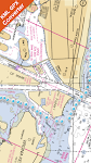
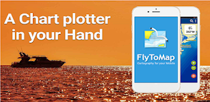
Martha's Vine & Nantuket chart – Click to show
Martha's Vine & Nantuket chart
FLYTOMAP INC
Flytomap is a valid and interesting alternative, Featured on the Deck Featured on Geomedia Worldwide Marine and Outdoor Maps available when connected, thanks to viewer.flytomap.com Worldwide Satelli…
$3.99
0.0
0+ downloads
|
Maps & Navigation
0.0
$3.99
FLYTOMAP INC
0+ downloads
TRANSPORTATION
Martha's Vine & Nantuket chart
Flytomap is a valid and interesting alternative, Featured on the Deck Featured on Geomedia Worldwide Marine and Outdoo…
Ireland GPS Map Navigator – Click to show
Ireland GPS Map Navigator
FLYTOMAP INC
Flytomap is a valid and interesting alternative, Featured on the Deck Featured on Geomedia Worldwide Marine and Outdoor Maps available when connected, thanks to viewer.flytomap.com Worldwide Satelli…
$3.99
0.0
10+ downloads
|
Maps & Navigation
0.0
$3.99
FLYTOMAP INC
10+ downloads
TRANSPORTATION
Ireland GPS Map Navigator
Flytomap is a valid and interesting alternative, Featured on the Deck Featured on Geomedia Worldwide Marine and Outdoo…
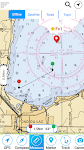
Grand lake o the Cherokees Map – Click to show
Grand lake o the Cherokees Map
MAPITECH LTD
MapiTech launches on the market the best official up-to-date NOAA RNC (raster) combined with S57 nautical charts (digital): marinas, wrecks, fishing spots, boat ramps, POI. This app displays seamles…
$4.99
0.0
1+ downloads
|
Maps & Navigation
0.0
$4.99
MAPITECH LTD
1+ downloads
TRANSPORTATION
Grand lake o the Cherokees Map
MapiTech launches on the market the best official up-to-date NOAA RNC (raster) combined with S57 nautical charts (digit…
UK Ireland GPS Map Navigator – Click to show
UK Ireland GPS Map Navigator
FLYTOMAP INC
Flytomap is a valid and interesting alternative, Featured on the Deck Featured on Geomedia Worldwide Marine and Outdoor Maps available when connected, thanks to viewer.flytomap.com Worldwide Satellit…
$4.99
0.0
10+ downloads
|
Maps & Navigation
0.0
$4.99
FLYTOMAP INC
10+ downloads
TRANSPORTATION
UK Ireland GPS Map Navigator
Flytomap is a valid and interesting alternative, Featured on the Deck Featured on Geomedia Worldwide Marine and Outdoor…
Treinenradar
René van den Berg
Volg treinen op het Nederlands spoor. Inclusief: - NS intercity's en sprinters - Arriva - Thalys (HSL-Zuid) - TRAXX (HSL-Zuid) Recent changes: - Verbeterde interface - Nieuw logo - Extra filters - …
$3.99
0.0
100+ downloads
|
Maps & Navigation
0.0
$3.99
René van den Berg
100+ downloads
TRANSPORTATION
Treinenradar
Volg treinen op het Nederlands spoor. Inclusief: - NS intercity's en sprinters - Arriva - Thalys (HSL-Zuid) - TRAXX (H…
Lake Norman GPS Offline Charts – Click to show
Lake Norman GPS Offline Charts
FLYTOMAP INC
Flytomap is a valid and interesting alternative Featured on the Deck Featured on Geomedia Lake Norman coverage resident in the app. It works WITHOUT mobile coverage! Worldwide Marine and Outdoor M…
$3.99
0.0
100+ downloads
|
Maps & Navigation
0.0
$3.99
FLYTOMAP INC
100+ downloads
TRANSPORTATION
Lake Norman GPS Offline Charts
Flytomap is a valid and interesting alternative Featured on the Deck Featured on Geomedia Lake Norman coverage residen…
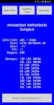
World Airports Pro
Waterline Software
World Airports Pro is a worldwide database of over 5000 of the world's principle airports and their runways permitting location and orientation through the medium of Google® Maps. Within this ap…
$1.49
0.0
100+ downloads
|
Maps & Navigation
0.0
$1.49
Waterline Software
100+ downloads
TRANSPORTATION
World Airports Pro
World Airports Pro is a worldwide database of over 5000 of the world's principle airports and their runways permitting …
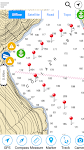
Compass Pro
Fulmine Software
Always be informed about north, your heading (azimuth) and location. Main advantages of our Compass app: • Beautiful and modern material design style. • Status bar notification - know your…
$2.49
4.6
5,000+ downloads
|
Maps & Navigation
4.6
$2.49
Fulmine Software
5,000+ downloads
TRANSPORTATION
Compass Pro
Always be informed about north, your heading (azimuth) and location. Main advantages of our Compass app: • Beauti…
Estepona Sines Offline GPS Map – Click to show
Estepona Sines Offline GPS Map
MAPITECH LTD
MapiTech launches on the market the best official up-to-date RNC (raster) combined with S57 nautical charts (digital): marinas, wrecks, fishing spots, boat ramps, POI. This app displays seamlessly …
$4.99
0.0
5+ downloads
|
Maps & Navigation
0.0
$4.99
MAPITECH LTD
5+ downloads
TRANSPORTATION
Estepona Sines Offline GPS Map
MapiTech launches on the market the best official up-to-date RNC (raster) combined with S57 nautical charts (digital):…
US East Gps Map Navigator – Click to show
US East Gps Map Navigator
FLYTOMAP INC
Flytomap is a valid and interesting alternative, Worldwide Marine and Outdoor Maps available when connected, thanks to viewer.flytomap.com Worldwide Satellite images overlay on charts Worldwide Terr…
$4.99
0.0
10+ downloads
|
Maps & Navigation
0.0
$4.99
FLYTOMAP INC
10+ downloads
TRANSPORTATION
US East Gps Map Navigator
Flytomap is a valid and interesting alternative, Worldwide Marine and Outdoor Maps available when connected, thanks to …
Picardie GPS Map Navigator – Click to show
Picardie GPS Map Navigator
FLYTOMAP INC
Flytomap is a valid and interesting alternative, Featured on the Deck Featured on Geomedia Worldwide Marine and Outdoor Maps available when connected, thanks to viewer.flytomap.com Worldwide Satelli…
$3.99
0.0
0+ downloads
|
Maps & Navigation
0.0
$3.99
FLYTOMAP INC
0+ downloads
TRANSPORTATION
Picardie GPS Map Navigator
Flytomap is a valid and interesting alternative, Featured on the Deck Featured on Geomedia Worldwide Marine and Outdoo…
Lake St.Clair GPS Navigator – Click to show
Lake St.Clair GPS Navigator
FLYTOMAP INC
Flytomap is a valid and interesting alternative Featured on the Deck Featured on Geomedia Worldwide Marine and Outdoor Maps available when connected, thanks to viewer.flytomap.com Worldwide Satellite…
$3.99
0.0
100+ downloads
|
Maps & Navigation
0.0
$3.99
FLYTOMAP INC
100+ downloads
TRANSPORTATION
Lake St.Clair GPS Navigator
Flytomap is a valid and interesting alternative Featured on the Deck Featured on Geomedia Worldwide Marine and Outdoor …
Egadi Island Offline GPS Chart – Click to show
Egadi Island Offline GPS Chart
MAPITECH LTD
MapiTech launches on the market the best official up-to-date RNC (raster) combined with S57 nautical charts (digital): marinas, wrecks, fishing spots, boat ramps, POI. This app displays seamlessly …
$4.99
0.0
1+ downloads
|
Maps & Navigation
0.0
$4.99
MAPITECH LTD
1+ downloads
TRANSPORTATION
Egadi Island Offline GPS Chart
MapiTech launches on the market the best official up-to-date RNC (raster) combined with S57 nautical charts (digital):…
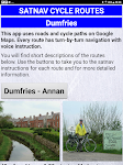
Satnav Cycle Routes - Dumfries – Click to show
Satnav Cycle Routes - Dumfries
Ian Lochhead
Dumfries - Annan. 43 miles Dumfries - Lochmabon. 40 miles Dumfries - New Abbey. 27 miles 3 Satnav Cycle Routes around Dumfries using cycle paths and roads on Google Maps. Every route has turn-by-tur…
$0.99
0.0
0+ downloads
|
Maps & Navigation
0.0
$0.99
Ian Lochhead
0+ downloads
TRANSPORTATION
Satnav Cycle Routes - Dumfries
Dumfries - Annan. 43 miles Dumfries - Lochmabon. 40 miles Dumfries - New Abbey. 27 miles 3 Satnav Cycle Routes around …
Oslo fjord Norway Offline Maps – Click to show
Oslo fjord Norway Offline Maps
MAPITECH LTD
MapiTech launches on the market the best official up-to-date RNC (raster) combined with S57 nautical charts (digital): marinas, wrecks, fishing spots, boat ramps, POI. This app displays seamlessly …
$4.99
0.0
5+ downloads
|
Maps & Navigation
0.0
$4.99
MAPITECH LTD
5+ downloads
TRANSPORTATION
Oslo fjord Norway Offline Maps
MapiTech launches on the market the best official up-to-date RNC (raster) combined with S57 nautical charts (digital):…
Greece West GPS Map Navigator – Click to show
Greece West GPS Map Navigator
FLYTOMAP INC
Flytomap is a valid and interesting alternative, Featured on the Deck Featured on Geomedia Worldwide Marine and Outdoor Maps available when connected, thanks to viewer.flytomap.com Worldwide Satellit…
$3.99
0.0
10+ downloads
|
Maps & Navigation
0.0
$3.99
FLYTOMAP INC
10+ downloads
TRANSPORTATION
Greece West GPS Map Navigator
Flytomap is a valid and interesting alternative, Featured on the Deck Featured on Geomedia Worldwide Marine and Outdoor…
Lake Leman Geneva Offline Maps – Click to show
Lake Leman Geneva Offline Maps
FLYTOMAP INC
Flytomap is a valid and interesting alternative, Featured on the Deck Featured on Geomedia Worldwide Marine and Outdoor Maps available when connected, thanks to viewer.flytomap.com Worldwide Satelli…
$3.99
0.0
100+ downloads
|
Maps & Navigation
0.0
$3.99
FLYTOMAP INC
100+ downloads
TRANSPORTATION
Lake Leman Geneva Offline Maps
Flytomap is a valid and interesting alternative, Featured on the Deck Featured on Geomedia Worldwide Marine and Outdoo…
Tank Buddy
Droidsoft UK
Tired of Guessing Your Fuel on Your Motorcycle? Ride with Confidence with Tank Buddy! For many passionate motorcyclists, the thrill of the open road is often accompanied by a nagging worry: "Ho…
$3.49
0.0
1+ downloads
|
Maps & Navigation
0.0
$3.49
Droidsoft UK
1+ downloads
TRANSPORTATION
Tank Buddy
Tired of Guessing Your Fuel on Your Motorcycle? Ride with Confidence with Tank Buddy! For many passionate motorcyclist…
iLogbook Unlocker
Zeroed
This application will unlock the full version of iLogbook. The full version includes: -Access to new features before free users -Faster support -Warm fuzzy feeling for helping out a solo developer …
$1.85
0.0
10+ downloads
|
Maps & Navigation
0.0
$1.85
Zeroed
10+ downloads
TRANSPORTATION
iLogbook Unlocker
This application will unlock the full version of iLogbook. The full version includes: -Access to new features before f…
United States
United Kingdom
Germany
Norway
Sweden
Australia
Netherlands
Italy
Denmark
Hong Kong
Brazil
France
Canada
Spain
Portugal
South Korea
Japan
Poland
Hungary
India
Finland
Thailand
Russia
General
Overall
Applications
Games
Join AppBrain
Join AppBrain to get app recommendations
Apps
Art & Design
Auto & Vehicles
Beauty
Books & Reference
Business
Comics
Communication
Dating
Education
Entertainment
Events
Finance
Food & Drink
Health & Fitness
House & Home
Libraries & Demo
Lifestyle
Maps & Navigation
Medical
Music & Audio
News & Magazines
Parenting
Personalization
Photography
Productivity
Shopping
Social
Sports
Tools
Travel & Local
Video Players & Editors
Weather
Games
Action
Adventure
Arcade
Board
Card
Casino
Casual
Educational
Music
Puzzle
Racing
Role Playing
Simulation
Sports Games
Strategy
Trivia
Word