AppBrain
|
Apps
Apps
Apps being viewed right now
Trending apps today
Most popular apps
All-time most downloaded apps
Top rated apps
Statistics
Docs
Developers
Sign up
Log in
Android Apps
>
Maps & Navigation
>
Paid
Category
Maps & Navigation
Sort by
Trending
Recent downloads
All-time downloads
Top rated
Popular in
Filter by
Off
Free
Paid
New
Updated
Price Reduced
No ads
Page 2 of the
popular Paid Maps & Navigation Apps for Android in Denmark
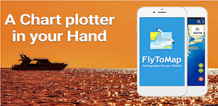
Lake St.Clair GPS Navigator – Click to show
Lake St.Clair GPS Navigator
FLYTOMAP INC
Flytomap is a valid and interesting alternative Featured on the Deck Featured on Geomedia Worldwide Marine and Outdoor Maps available when connected, thanks to viewer.flytomap.com Worldwide Satellite…
$3.99
0.0
100+ downloads
|
Maps & Navigation
0.0
$3.99
FLYTOMAP INC
100+ downloads
TRANSPORTATION
Lake St.Clair GPS Navigator
Flytomap is a valid and interesting alternative Featured on the Deck Featured on Geomedia Worldwide Marine and Outdoor …
Satnav Cycle Routes -Dundee(2) – Click to show
Satnav Cycle Routes -Dundee(2)
Ian Lochhead
Dundee - Piperdam. 23 miles Dundee - Carnoustie. 31 miles Satnav Cycle Routes around Dundee using cycle paths and roads. Every route has turn-by-turn navigation with voice instruction. Enjoy the ben…
$0.99
0.0
0+ downloads
|
Maps & Navigation
0.0
$0.99
Ian Lochhead
0+ downloads
TRANSPORTATION
Satnav Cycle Routes -Dundee(2)
Dundee - Piperdam. 23 miles Dundee - Carnoustie. 31 miles Satnav Cycle Routes around Dundee using cycle paths and road…
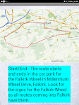
Satnav Cycle Routes – Falkirk – Click to show
Satnav Cycle Routes – Falkirk
Ian Lochhead
Around the Falkirk Wheel. 12.5 miles Falkirk - Avonbridge. 24 miles Falkirk - Fannyside Loch. 20 miles Falkirk Wheel & Helix Park. 12 miles Satnav Cycle Routes around Falkirk using cycle paths a…
$0.99
0.0
0+ downloads
|
Maps & Navigation
0.0
$0.99
Ian Lochhead
0+ downloads
TRANSPORTATION
Satnav Cycle Routes – Falkirk
Around the Falkirk Wheel. 12.5 miles Falkirk - Avonbridge. 24 miles Falkirk - Fannyside Loch. 20 miles Falkirk Wheel &a…
UK Ireland GPS Map Navigator – Click to show
UK Ireland GPS Map Navigator
FLYTOMAP INC
Flytomap is a valid and interesting alternative, Featured on the Deck Featured on Geomedia Worldwide Marine and Outdoor Maps available when connected, thanks to viewer.flytomap.com Worldwide Satellit…
$4.99
0.0
10+ downloads
|
Maps & Navigation
0.0
$4.99
FLYTOMAP INC
10+ downloads
TRANSPORTATION
UK Ireland GPS Map Navigator
Flytomap is a valid and interesting alternative, Featured on the Deck Featured on Geomedia Worldwide Marine and Outdoor…
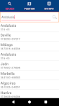
Andalusia GPS Map Navigator – Click to show
Andalusia GPS Map Navigator
FLYTOMAP INC
Flytomap is a valid and interesting alternative, Featured on the Deck Featured on Geomedia Worldwide Marine and Outdoor Maps available when connected, thanks to viewer.flytomap.com Worldwide Satellit…
$3.99
0.0
10+ downloads
|
Maps & Navigation
0.0
$3.99
FLYTOMAP INC
10+ downloads
TRANSPORTATION
Andalusia GPS Map Navigator
Flytomap is a valid and interesting alternative, Featured on the Deck Featured on Geomedia Worldwide Marine and Outdoor…
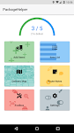
PackageHelper
Netsyms Technologies
Tired of scanning "leftover" Amazon boxes no access? Need to focus your attention on avoiding animal interference? Don't want to worry about finding that white SPR full of pills when you'…
$1.99
4.8
100+ downloads
|
Maps & Navigation
4.8
$1.99
Netsyms Technologies
100+ downloads
TRANSPORTATION
PackageHelper
Tired of scanning "leftover" Amazon boxes no access? Need to focus your attention on avoiding animal interfe…
Wisconsin Mushroom Forager Map – Click to show
Wisconsin Mushroom Forager Map
GeoPOI LLC
The forests and woodlands of Wisconsin and the Midwest are ecosystems rich with edible wild mushrooms if you know where to look. Trouble is, seasoned wild edible collectors seldom share their 'honey …
$1.49
0.0
1+ downloads
|
Maps & Navigation
0.0
$1.49
GeoPOI LLC
1+ downloads
TRANSPORTATION
Wisconsin Mushroom Forager Map
The forests and woodlands of Wisconsin and the Midwest are ecosystems rich with edible wild mushrooms if you know where…
Tank Buddy
Droidsoft UK
Tired of Guessing Your Fuel on Your Motorcycle? Ride with Confidence with Tank Buddy! For many passionate motorcyclists, the thrill of the open road is often accompanied by a nagging worry: "Ho…
$3.49
0.0
1+ downloads
|
Maps & Navigation
0.0
$3.49
Droidsoft UK
1+ downloads
TRANSPORTATION
Tank Buddy
Tired of Guessing Your Fuel on Your Motorcycle? Ride with Confidence with Tank Buddy! For many passionate motorcyclist…
iLogbook Unlocker
Zeroed
This application will unlock the full version of iLogbook. The full version includes: -Access to new features before free users -Faster support -Warm fuzzy feeling for helping out a solo developer …
$1.85
0.0
10+ downloads
|
Maps & Navigation
0.0
$1.85
Zeroed
10+ downloads
TRANSPORTATION
iLogbook Unlocker
This application will unlock the full version of iLogbook. The full version includes: -Access to new features before f…
East England GPS Map Navigator – Click to show
East England GPS Map Navigator
FLYTOMAP INC
Flytomap is a valid and interesting alternative, Featured on the Deck Featured on Geomedia Worldwide Marine and Outdoor Maps available when connected, thanks to viewer.flytomap.com Worldwide Satellit…
$5.99
0.0
0+ downloads
|
Maps & Navigation
0.0
$5.99
FLYTOMAP INC
0+ downloads
TRANSPORTATION
East England GPS Map Navigator
Flytomap is a valid and interesting alternative, Featured on the Deck Featured on Geomedia Worldwide Marine and Outdoor…
SledNH 2026
Mapgears
**This purchase allows you to access up-to-date SledNH trail information for the 2025-2026 winter season. A new purchase will be required for the 2026-2027 season.** Out exploring NH on your snowmob…
$4.99
4.0
1,000+ downloads
|
Maps & Navigation
4.0
$4.99
Mapgears
1,000+ downloads
TRANSPORTATION
SledNH 2026
**This purchase allows you to access up-to-date SledNH trail information for the 2025-2026 winter season. A new purchas…
Spain Atlantic Map Navigator – Click to show
Spain Atlantic Map Navigator
FLYTOMAP INC
Flytomap is a valid and interesting alternative, Featured on the Deck Featured on Geomedia Worldwide Marine and Outdoor Maps available when connected, thanks to viewer.flytomap.com Worldwide Satellit…
$4.99
0.0
10+ downloads
|
Maps & Navigation
0.0
$4.99
FLYTOMAP INC
10+ downloads
TRANSPORTATION
Spain Atlantic Map Navigator
Flytomap is a valid and interesting alternative, Featured on the Deck Featured on Geomedia Worldwide Marine and Outdoor…
Barcelona Benidorm Offline Map – Click to show
Barcelona Benidorm Offline Map
MAPITECH LTD
MapiTech launches on the market the best official up-to-date RNC (raster) combined with S57 nautical charts (digital): marinas, wrecks, fishing spots, boat ramps, POI. This app displays seamlessly …
$4.99
0.0
0+ downloads
|
Maps & Navigation
0.0
$4.99
MAPITECH LTD
0+ downloads
TRANSPORTATION
Barcelona Benidorm Offline Map
MapiTech launches on the market the best official up-to-date RNC (raster) combined with S57 nautical charts (digital):…
Balaton Lake GPS Map Navigator – Click to show
Balaton Lake GPS Map Navigator
FLYTOMAP INC
Flytomap is a valid and interesting alternative, Worldwide Marine and Outdoor Maps available when connected, thanks to viewer.flytomap.com Worldwide Satellite images overlay on charts Worldwide Terr…
$3.99
0.0
100+ downloads
|
Maps & Navigation
0.0
$3.99
FLYTOMAP INC
100+ downloads
TRANSPORTATION
Balaton Lake GPS Map Navigator
Flytomap is a valid and interesting alternative, Worldwide Marine and Outdoor Maps available when connected, thanks to …
Greenfield Lake - IOWA GPS Map – Click to show
Greenfield Lake - IOWA GPS Map
FLYTOMAP INC
Flytomap is a valid and interesting alternative, Featured on the Deck Featured on Geomedia Worldwide Marine and Outdoor Maps available when connected, thanks to viewer.flytomap.com Worldwide Satellit…
$2.99
0.0
1+ downloads
|
Maps & Navigation
0.0
$2.99
FLYTOMAP INC
1+ downloads
TRANSPORTATION
Greenfield Lake - IOWA GPS Map
Flytomap is a valid and interesting alternative, Featured on the Deck Featured on Geomedia Worldwide Marine and Outdoor…
Lower Gar Lake - IOWA GPS Map – Click to show
Lower Gar Lake - IOWA GPS Map
FLYTOMAP INC
Flytomap is a valid and interesting alternative, Benetti Yachts Featured on the Deck Featured on Geomedia Worldwide Marine and Outdoor Maps available when connected, thanks to viewer.flytomap.com Wor…
$1.99
0.0
0+ downloads
|
Maps & Navigation
0.0
$1.99
FLYTOMAP INC
0+ downloads
TRANSPORTATION
Lower Gar Lake - IOWA GPS Map
Flytomap is a valid and interesting alternative, Benetti Yachts Featured on the Deck Featured on Geomedia Worldwide Mar…
Sam Rayburn Offline GPS Charts – Click to show
Sam Rayburn Offline GPS Charts
FLYTOMAP INC
Flytomap is a valid and interesting alternative Worldwide Marine and Outdoor Maps available when connected, thanks to viewer.flytomap.com Worldwide Satellite images overlay on charts Worldwide Terra…
$3.99
0.0
50+ downloads
|
Maps & Navigation
0.0
$3.99
FLYTOMAP INC
50+ downloads
TRANSPORTATION
Sam Rayburn Offline GPS Charts
Flytomap is a valid and interesting alternative Worldwide Marine and Outdoor Maps available when connected, thanks to v…
Golfe Du Lion Offline Charts – Click to show
Golfe Du Lion Offline Charts
MAPITECH LTD
MapiTech launches on the market the best official up-to-date RNC (raster) combined with S57 nautical charts (digital): marinas, wrecks, fishing spots, boat ramps, POI. This app displays seamlessly …
$4.99
0.0
0+ downloads
|
Maps & Navigation
0.0
$4.99
MAPITECH LTD
0+ downloads
TRANSPORTATION
Golfe Du Lion Offline Charts
MapiTech launches on the market the best official up-to-date RNC (raster) combined with S57 nautical charts (digital):…
SG BusLeh Full Unlock
OriginallyUS.SG - Award Winning App Consultancy
NOTE 1: BusLeh Unlock does not currently remove BusLeh announcements, which may contain important announcements such as traffic breakdown, data service breakdown, as well as text-based deals and offe…
$74.99
0.0
1,000+ downloads
|
Maps & Navigation
0.0
$74.99
OriginallyUS.SG - Award Winning App Consultancy
1,000+ downloads
TRANSPORTATION
SG BusLeh Full Unlock
NOTE 1: BusLeh Unlock does not currently remove BusLeh announcements, which may contain important announcements such as…
Light pollution map
Deneb, Jurij Stare, s.p.
Light Pollution Map helps you easily find the darkest places nearby by combining high-resolution VIIRS satellite data with an interactive global map. Explore sky brightness, compare light pollution l…
$5.49
4.3
5,000+ downloads
|
Maps & Navigation
4.3
$5.49
Deneb, Jurij Stare, s.p.
5,000+ downloads
TRANSPORTATION
Light pollution map
Light Pollution Map helps you easily find the darkest places nearby by combining high-resolution VIIRS satellite data w…
United States
United Kingdom
Germany
Norway
Sweden
Australia
Netherlands
Italy
Denmark
Hong Kong
Brazil
France
Canada
Spain
Portugal
South Korea
Japan
Poland
Hungary
India
Finland
Thailand
Russia
General
Overall
Applications
Games
Join AppBrain
Join AppBrain to get app recommendations
Apps
Art & Design
Auto & Vehicles
Beauty
Books & Reference
Business
Comics
Communication
Dating
Education
Entertainment
Events
Finance
Food & Drink
Health & Fitness
House & Home
Libraries & Demo
Lifestyle
Maps & Navigation
Medical
Music & Audio
News & Magazines
Parenting
Personalization
Photography
Productivity
Shopping
Social
Sports
Tools
Travel & Local
Video Players & Editors
Weather
Games
Action
Adventure
Arcade
Board
Card
Casino
Casual
Educational
Music
Puzzle
Racing
Role Playing
Simulation
Sports Games
Strategy
Trivia
Word