AppBrain
|
Apps
Apps
Apps being viewed right now
Trending apps today
Most popular apps
All-time most downloaded apps
Top rated apps
Statistics
Docs
Developers
Sign up
Log in
Android Apps
>
Maps & Navigation
>
Paid
Category
Maps & Navigation
Sort by
Trending
Recent downloads
All-time downloads
Top rated
Popular in
Filter by
Off
Free
Paid
New
Updated
Price Reduced
No ads
Page 9 of the
popular Paid Maps & Navigation Apps for Android in Italy
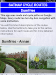
Satnav Cycle Routes - Dumfries – Click to show
Satnav Cycle Routes - Dumfries
Ian Lochhead
Dumfries - Annan. 43 miles Dumfries - Lochmabon. 40 miles Dumfries - New Abbey. 27 miles 3 Satnav Cycle Routes around Dumfries using cycle paths and roads on Google Maps. Every route has turn-by-tur…
$0.99
0.0
0+ downloads
|
Maps & Navigation
0.0
$0.99
Ian Lochhead
0+ downloads
TRANSPORTATION
Satnav Cycle Routes - Dumfries
Dumfries - Annan. 43 miles Dumfries - Lochmabon. 40 miles Dumfries - New Abbey. 27 miles 3 Satnav Cycle Routes around …
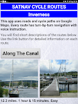
Satnav Cycle Routes –Inverness – Click to show
Satnav Cycle Routes –Inverness
Ian Lochhead
Satnav Cycle Routes around Inverness using cycle paths and quiet roads. Every route has turn-by-turn navigation with voice instruction. Enjoy the benefits of cycling a whole route by following Sat Na…
$0.99
0.0
0+ downloads
|
Maps & Navigation
0.0
$0.99
Ian Lochhead
0+ downloads
TRANSPORTATION
Satnav Cycle Routes –Inverness
Satnav Cycle Routes around Inverness using cycle paths and quiet roads. Every route has turn-by-turn navigation with vo…
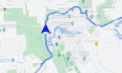
Satnav Cycle Routes – York – Click to show
Satnav Cycle Routes – York
Ian Lochhead
3 Satnav Cycle Routes around York. 1. Around York - 19.5 miles 2. York to Stamford Bridge - 28.3 miles 3. York to Tadcaster - 21.3 miles Satnav Cycle Routes around York using cycle paths and roads. …
$0.99
0.0
1+ downloads
|
Maps & Navigation
0.0
$0.99
Ian Lochhead
1+ downloads
TRANSPORTATION
Satnav Cycle Routes – York
3 Satnav Cycle Routes around York. 1. Around York - 19.5 miles 2. York to Stamford Bridge - 28.3 miles 3. York to Tadca…
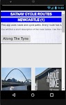
Satnav Cycle Routes-Newcastle1 – Click to show
Satnav Cycle Routes-Newcastle1
Ian Lochhead
1. Along the Tyne - 15 miles 2. Newcastle to Gateshead - 23.5 miles 3. Newcastle to Sunderland - 39 miles Satnav Cycle Routes around Newcastle using cycle paths and roads. Every route has turn-by-tu…
$0.99
0.0
0+ downloads
|
Maps & Navigation
0.0
$0.99
Ian Lochhead
0+ downloads
TRANSPORTATION
Satnav Cycle Routes-Newcastle1
1. Along the Tyne - 15 miles 2. Newcastle to Gateshead - 23.5 miles 3. Newcastle to Sunderland - 39 miles Satnav Cycle…
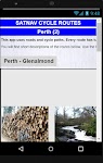
Satnav Cycle Routes – Perth(2) – Click to show
Satnav Cycle Routes – Perth(2)
Ian Lochhead
Perth - Glenalmond. 35 miles Perth - Crieff. 38 miles Perth - Milnathort. 38 miles Satnav Cycle Routes around Perth using cycle paths and roads. Every route has turn-by-turn navigation with voice in…
$0.99
0.0
0+ downloads
|
Maps & Navigation
0.0
$0.99
Ian Lochhead
0+ downloads
TRANSPORTATION
Satnav Cycle Routes – Perth(2)
Perth - Glenalmond. 35 miles Perth - Crieff. 38 miles Perth - Milnathort. 38 miles Satnav Cycle Routes around Perth us…
Qibla compass: Direction Mecca
HALALGUIDE LTD., CHK
Qibla Direction is an essential tool for Muslims to find the Qibla wherever they are: • Accurate compass direction • Sun-based alignment method • Location map to see Kaaba direction…
$0.99
0.0
10+ downloads
|
Maps & Navigation
0.0
$0.99
HALALGUIDE LTD., CHK
10+ downloads
TRANSPORTATION
Qibla compass: Direction Mecca
Qibla Direction is an essential tool for Muslims to find the Qibla wherever they are: • Accurate compass directio…
Ceuta GPS Map Navigator – Click to show
Ceuta GPS Map Navigator
FLYTOMAP INC
Flytomap is a valid and interesting alternative, Featured on the Deck Featured on Geomedia Worldwide Marine and Outdoor Maps available when connected, thanks to viewer.flytomap.com Worldwide Satellit…
$3.99
0.0
5+ downloads
|
Maps & Navigation
0.0
$3.99
FLYTOMAP INC
5+ downloads
TRANSPORTATION
Ceuta GPS Map Navigator
Flytomap is a valid and interesting alternative, Featured on the Deck Featured on Geomedia Worldwide Marine and Outdoor…
East England GPS Map Navigator – Click to show
East England GPS Map Navigator
FLYTOMAP INC
Flytomap is a valid and interesting alternative, Featured on the Deck Featured on Geomedia Worldwide Marine and Outdoor Maps available when connected, thanks to viewer.flytomap.com Worldwide Satellit…
$5.99
0.0
0+ downloads
|
Maps & Navigation
0.0
$5.99
FLYTOMAP INC
0+ downloads
TRANSPORTATION
East England GPS Map Navigator
Flytomap is a valid and interesting alternative, Featured on the Deck Featured on Geomedia Worldwide Marine and Outdoor…
Navigation [Huawei watches] – Click to show
Navigation [Huawei watches]
Mobiteka
This is a companion app of Navigation Viewer client app for Huawei Harmony NEXT / Harmony OS / Harmony Lite OS series smartwatches. ⓘ If your watch is connected but this app shows unauthorized stat…
$2.99
0.0
10,000+ downloads
|
Maps & Navigation
0.0
$2.99
Mobiteka
10,000+ downloads
TRANSPORTATION
Navigation [Huawei watches]
This is a companion app of Navigation Viewer client app for Huawei Harmony NEXT / Harmony OS / Harmony Lite OS series …
Lake Maggiore Offline Charts – Click to show
Lake Maggiore Offline Charts
MAPITECH LTD
MapiTech launches on the market the best official up-to-date RNC (raster) combined with S57 nautical charts (digital): marinas, wrecks, fishing spots, boat ramps, POI. This app displays seamlessly …
$4.99
0.0
50+ downloads
|
Maps & Navigation
0.0
$4.99
MAPITECH LTD
50+ downloads
TRANSPORTATION
Lake Maggiore Offline Charts
MapiTech launches on the market the best official up-to-date RNC (raster) combined with S57 nautical charts (digital):…
FootPrint
T.creations
Rediscover your steps with FootPrint! See every street you've explored and every path you've taken with this powerful and private GPS logger. FootPrint is your personal travel diary, designed to map …
$3.49
0.0
100+ downloads
|
Maps & Navigation
0.0
$3.49
T.creations
100+ downloads
TRANSPORTATION
FootPrint
Rediscover your steps with FootPrint! See every street you've explored and every path you've taken with this powerful a…
PgW Navigation App
Aerotools
This application is a navigation assistant which provides useful information about all the airports and navaids located around you (40Nm range max). Directly on your watch, with your location informa…
$15.99
0.0
100+ downloads
|
Maps & Navigation
0.0
$15.99
Aerotools
100+ downloads
TRANSPORTATION
PgW Navigation App
This application is a navigation assistant which provides useful information about all the airports and navaids located…
Lake Joe Pool Texas GPS Charts – Click to show
Lake Joe Pool Texas GPS Charts
FLYTOMAP INC
Flytomap is a valid and interesting alternative, Featured on the Deck Featured on Geomedia Worldwide Marine and Outdoor Maps available when connected, thanks to viewer.flytomap.com Worldwide Satelli…
$3.99
0.0
5+ downloads
|
Maps & Navigation
0.0
$3.99
FLYTOMAP INC
5+ downloads
TRANSPORTATION
Lake Joe Pool Texas GPS Charts
Flytomap is a valid and interesting alternative, Featured on the Deck Featured on Geomedia Worldwide Marine and Outdoo…
Portugal GPS Map Navigator – Click to show
Portugal GPS Map Navigator
FLYTOMAP INC
Flytomap is a valid and interesting alternative, Featured on the Deck Featured on Geomedia Worldwide Marine and Outdoor Maps available when connected, thanks to viewer.flytomap.com Worldwide Satelli…
$3.99
0.0
10+ downloads
|
Maps & Navigation
0.0
$3.99
FLYTOMAP INC
10+ downloads
TRANSPORTATION
Portugal GPS Map Navigator
Flytomap is a valid and interesting alternative, Featured on the Deck Featured on Geomedia Worldwide Marine and Outdoo…
Greenfield Lake - IOWA GPS Map – Click to show
Greenfield Lake - IOWA GPS Map
FLYTOMAP INC
Flytomap is a valid and interesting alternative, Featured on the Deck Featured on Geomedia Worldwide Marine and Outdoor Maps available when connected, thanks to viewer.flytomap.com Worldwide Satellit…
$2.99
0.0
1+ downloads
|
Maps & Navigation
0.0
$2.99
FLYTOMAP INC
1+ downloads
TRANSPORTATION
Greenfield Lake - IOWA GPS Map
Flytomap is a valid and interesting alternative, Featured on the Deck Featured on Geomedia Worldwide Marine and Outdoor…
Forager's Buddy Pro Key
G.H IT Services
This product is the Activation Code of Forager's Buddy. Once purchased, you can upgrade Forager's Buddy Free version to Forager's Buddy Pro version. You must have Forager's Buddy Free Edition insta…
$2.99
4.4
1,000+ downloads
|
Maps & Navigation
4.4
$2.99
G.H IT Services
1,000+ downloads
TRANSPORTATION
Forager's Buddy Pro Key
This product is the Activation Code of Forager's Buddy. Once purchased, you can upgrade Forager's Buddy Free version to…
Lake Taupo Offline GPS Charts – Click to show
Lake Taupo Offline GPS Charts
FLYTOMAP INC
Flytomap is a valid and interesting alternative, Featured on the Deck Featured on Geomedia Worldwide Marine and Outdoor Maps available when connected, thanks to viewer.flytomap.com Worldwide Satelli…
$3.99
0.0
10+ downloads
|
Maps & Navigation
0.0
$3.99
FLYTOMAP INC
10+ downloads
TRANSPORTATION
Lake Taupo Offline GPS Charts
Flytomap is a valid and interesting alternative, Featured on the Deck Featured on Geomedia Worldwide Marine and Outdoo…
Cape Cod GPS Map Navigator – Click to show
Cape Cod GPS Map Navigator
FLYTOMAP INC
Flytomap is a valid and interesting alternative, Featured on the Deck Featured on Geomedia Worldwide Marine and Outdoor Maps available when connected, thanks to viewer.flytomap.com Worldwide Satellit…
$3.99
0.0
5+ downloads
|
Maps & Navigation
0.0
$3.99
FLYTOMAP INC
5+ downloads
TRANSPORTATION
Cape Cod GPS Map Navigator
Flytomap is a valid and interesting alternative, Featured on the Deck Featured on Geomedia Worldwide Marine and Outdoor…
Lake Sakakawea GPS Charts – Click to show
Lake Sakakawea GPS Charts
FLYTOMAP INC
Flytomap is a valid and interesting alternative, Worldwide Marine and Outdoor Maps available when connected, thanks to viewer.flytomap.com Worldwide Satellite images overlay on charts Worldwide Ter…
$3.99
0.0
50+ downloads
|
Maps & Navigation
0.0
$3.99
FLYTOMAP INC
50+ downloads
TRANSPORTATION
Lake Sakakawea GPS Charts
Flytomap is a valid and interesting alternative, Worldwide Marine and Outdoor Maps available when connected, thanks to…
Mushrooms on the map
appyourpizza
All mushroom enthusiasts have had to remember the place of that fabulous harvest. Boletus In Map, by means of GPS and the map, will help you find the places of your collections. The new app has been…
$9.00
0.0
100+ downloads
|
Maps & Navigation
0.0
$9.00
appyourpizza
100+ downloads
TRANSPORTATION
Mushrooms on the map
All mushroom enthusiasts have had to remember the place of that fabulous harvest. Boletus In Map, by means of GPS and t…
United States
United Kingdom
Germany
Norway
Sweden
Australia
Netherlands
Italy
Denmark
Hong Kong
Brazil
France
Canada
Spain
Portugal
South Korea
Japan
Poland
Hungary
India
Finland
Thailand
Russia
General
Overall
Applications
Games
Join AppBrain
Join AppBrain to get app recommendations
Apps
Art & Design
Auto & Vehicles
Beauty
Books & Reference
Business
Comics
Communication
Dating
Education
Entertainment
Events
Finance
Food & Drink
Health & Fitness
House & Home
Libraries & Demo
Lifestyle
Maps & Navigation
Medical
Music & Audio
News & Magazines
Parenting
Personalization
Photography
Productivity
Shopping
Social
Sports
Tools
Travel & Local
Video Players & Editors
Weather
Games
Action
Adventure
Arcade
Board
Card
Casino
Casual
Educational
Music
Puzzle
Racing
Role Playing
Simulation
Sports Games
Strategy
Trivia
Word