AppBrain
|
Apps
Apps
Apps being viewed right now
Trending apps today
Most popular apps
All-time most downloaded apps
Top rated apps
Statistics
Docs
Developers
Sign up
Log in
Android Apps
>
Maps & Navigation
>
Paid
Category
Maps & Navigation
Sort by
Trending
Recent downloads
All-time downloads
Top rated
Popular in
Filter by
Off
Free
Paid
New
Updated
Price Reduced
No ads
Page 9 of the
popular Paid Maps & Navigation Apps for Android in Norway
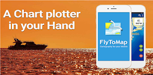
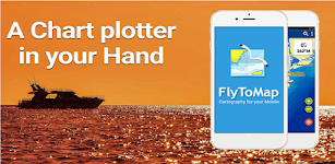
Picardie GPS Map Navigator – Click to show
Picardie GPS Map Navigator
FLYTOMAP INC
Flytomap is a valid and interesting alternative, Featured on the Deck Featured on Geomedia Worldwide Marine and Outdoor Maps available when connected, thanks to viewer.flytomap.com Worldwide Satelli…
$3.99
0.0
0+ downloads
|
Maps & Navigation
0.0
$3.99
FLYTOMAP INC
0+ downloads
TRANSPORTATION
Picardie GPS Map Navigator
Flytomap is a valid and interesting alternative, Featured on the Deck Featured on Geomedia Worldwide Marine and Outdoo…
Compass Pro
Fulmine Software
Always be informed about north, your heading (azimuth) and location. Main advantages of our Compass app: • Beautiful and modern material design style. • Status bar notification - know your…
$2.49
4.6
5,000+ downloads
|
Maps & Navigation
4.6
$2.49
Fulmine Software
5,000+ downloads
TRANSPORTATION
Compass Pro
Always be informed about north, your heading (azimuth) and location. Main advantages of our Compass app: • Beauti…
Lake Norman GPS Offline Charts – Click to show
Lake Norman GPS Offline Charts
FLYTOMAP INC
Flytomap is a valid and interesting alternative Featured on the Deck Featured on Geomedia Lake Norman coverage resident in the app. It works WITHOUT mobile coverage! Worldwide Marine and Outdoor M…
$3.99
0.0
100+ downloads
|
Maps & Navigation
0.0
$3.99
FLYTOMAP INC
100+ downloads
TRANSPORTATION
Lake Norman GPS Offline Charts
Flytomap is a valid and interesting alternative Featured on the Deck Featured on Geomedia Lake Norman coverage residen…
Florida Everglades GPS Charts – Click to show
Florida Everglades GPS Charts
FLYTOMAP INC
Flytomap is a valid and interesting alternative, Featured on the Deck Featured on Geomedia Worldwide Marine and Outdoor Maps available when connected, thanks to viewer.flytomap.com Worldwide Satellit…
$3.99
0.0
0+ downloads
|
Maps & Navigation
0.0
$3.99
FLYTOMAP INC
0+ downloads
TRANSPORTATION
Florida Everglades GPS Charts
Flytomap is a valid and interesting alternative, Featured on the Deck Featured on Geomedia Worldwide Marine and Outdoor…
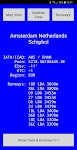
World Airports Pro
Waterline Software
World Airports Pro is a worldwide database of over 5000 of the world's principle airports and their runways permitting location and orientation through the medium of Google® Maps. Within this ap…
$1.49
0.0
100+ downloads
|
Maps & Navigation
0.0
$1.49
Waterline Software
100+ downloads
TRANSPORTATION
World Airports Pro
World Airports Pro is a worldwide database of over 5000 of the world's principle airports and their runways permitting …
Black Hills NF Map Navigator – Click to show
Black Hills NF Map Navigator
FLYTOMAP INC
Flytomap is a valid and interesting alternative, Featured on the Deck Featured on Geomedia Try now the new FlyToMap web viewer to see all available maps worldwide !!! Visit viewer.flytomap.com &ldqu…
$3.99
0.0
1+ downloads
|
Maps & Navigation
0.0
$3.99
FLYTOMAP INC
1+ downloads
TRANSPORTATION
Black Hills NF Map Navigator
Flytomap is a valid and interesting alternative, Featured on the Deck Featured on Geomedia Try now the new FlyToMap web…
Lake St.Clair GPS Navigator – Click to show
Lake St.Clair GPS Navigator
FLYTOMAP INC
Flytomap is a valid and interesting alternative Featured on the Deck Featured on Geomedia Worldwide Marine and Outdoor Maps available when connected, thanks to viewer.flytomap.com Worldwide Satellite…
$3.99
0.0
100+ downloads
|
Maps & Navigation
0.0
$3.99
FLYTOMAP INC
100+ downloads
TRANSPORTATION
Lake St.Clair GPS Navigator
Flytomap is a valid and interesting alternative Featured on the Deck Featured on Geomedia Worldwide Marine and Outdoor …
Egadi Island Offline GPS Chart – Click to show
Egadi Island Offline GPS Chart
MAPITECH LTD
MapiTech launches on the market the best official up-to-date RNC (raster) combined with S57 nautical charts (digital): marinas, wrecks, fishing spots, boat ramps, POI. This app displays seamlessly …
$4.99
0.0
1+ downloads
|
Maps & Navigation
0.0
$4.99
MAPITECH LTD
1+ downloads
TRANSPORTATION
Egadi Island Offline GPS Chart
MapiTech launches on the market the best official up-to-date RNC (raster) combined with S57 nautical charts (digital):…
Fiji Islands GPS Map Navigator – Click to show
Fiji Islands GPS Map Navigator
FLYTOMAP INC
Flytomap is a valid and interesting alternative, Worldwide Marine and Outdoor Maps available when connected, thanks to viewer.flytomap.com Worldwide Satellite images overlay on charts Worldwide Terr…
$3.99
0.0
10+ downloads
|
Maps & Navigation
0.0
$3.99
FLYTOMAP INC
10+ downloads
TRANSPORTATION
Fiji Islands GPS Map Navigator
Flytomap is a valid and interesting alternative, Worldwide Marine and Outdoor Maps available when connected, thanks to …
Estepona Sines Offline GPS Map – Click to show
Estepona Sines Offline GPS Map
MAPITECH LTD
MapiTech launches on the market the best official up-to-date RNC (raster) combined with S57 nautical charts (digital): marinas, wrecks, fishing spots, boat ramps, POI. This app displays seamlessly …
$4.99
0.0
5+ downloads
|
Maps & Navigation
0.0
$4.99
MAPITECH LTD
5+ downloads
TRANSPORTATION
Estepona Sines Offline GPS Map
MapiTech launches on the market the best official up-to-date RNC (raster) combined with S57 nautical charts (digital):…
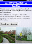
Satnav Cycle Routes - Dumfries – Click to show
Satnav Cycle Routes - Dumfries
Ian Lochhead
Dumfries - Annan. 43 miles Dumfries - Lochmabon. 40 miles Dumfries - New Abbey. 27 miles 3 Satnav Cycle Routes around Dumfries using cycle paths and roads on Google Maps. Every route has turn-by-tur…
$0.99
0.0
0+ downloads
|
Maps & Navigation
0.0
$0.99
Ian Lochhead
0+ downloads
TRANSPORTATION
Satnav Cycle Routes - Dumfries
Dumfries - Annan. 43 miles Dumfries - Lochmabon. 40 miles Dumfries - New Abbey. 27 miles 3 Satnav Cycle Routes around …
Oslo fjord Norway Offline Maps – Click to show
Oslo fjord Norway Offline Maps
MAPITECH LTD
MapiTech launches on the market the best official up-to-date RNC (raster) combined with S57 nautical charts (digital): marinas, wrecks, fishing spots, boat ramps, POI. This app displays seamlessly …
$4.99
0.0
5+ downloads
|
Maps & Navigation
0.0
$4.99
MAPITECH LTD
5+ downloads
TRANSPORTATION
Oslo fjord Norway Offline Maps
MapiTech launches on the market the best official up-to-date RNC (raster) combined with S57 nautical charts (digital):…
Greece West GPS Map Navigator – Click to show
Greece West GPS Map Navigator
FLYTOMAP INC
Flytomap is a valid and interesting alternative, Featured on the Deck Featured on Geomedia Worldwide Marine and Outdoor Maps available when connected, thanks to viewer.flytomap.com Worldwide Satellit…
$3.99
0.0
10+ downloads
|
Maps & Navigation
0.0
$3.99
FLYTOMAP INC
10+ downloads
TRANSPORTATION
Greece West GPS Map Navigator
Flytomap is a valid and interesting alternative, Featured on the Deck Featured on Geomedia Worldwide Marine and Outdoor…
Qibla compass: Direction Mecca
HALALGUIDE LTD., CHK
Qibla Direction is an essential tool for Muslims to find the Qibla wherever they are: • Accurate compass direction • Sun-based alignment method • Location map to see Kaaba direction…
$0.99
0.0
10+ downloads
|
Maps & Navigation
0.0
$0.99
HALALGUIDE LTD., CHK
10+ downloads
TRANSPORTATION
Qibla compass: Direction Mecca
Qibla Direction is an essential tool for Muslims to find the Qibla wherever they are: • Accurate compass directio…
Seoul Metro Map Route 서울 지하철도
momoStorm Entertainment
Seoul Metro Map Route is designed to allows user to get the best route within a second. - View the lastest subway map - Caculate the best route between two stations - Display estimated travel time …
$0.99
0.0
100+ downloads
|
Maps & Navigation
0.0
$0.99
momoStorm Entertainment
100+ downloads
TRANSPORTATION
Seoul Metro Map Route 서울 지하철도
Seoul Metro Map Route is designed to allows user to get the best route within a second. - View the lastest subway map …
Black Sea GPS Nautical Charts – Click to show
Black Sea GPS Nautical Charts
FLYTOMAP INC
Flytomap is a valid and interesting alternative. Featured on the Deck Featured on Geomedia Worldwide Marine and Outdoor Maps available when connected, thanks to viewer.flytomap.com Worldwide Satellit…
$3.99
0.0
10+ downloads
|
Maps & Navigation
0.0
$3.99
FLYTOMAP INC
10+ downloads
TRANSPORTATION
Black Sea GPS Nautical Charts
Flytomap is a valid and interesting alternative. Featured on the Deck Featured on Geomedia Worldwide Marine and Outdoor…
Liguria Porto Ercole GPS Chart – Click to show
Liguria Porto Ercole GPS Chart
MAPITECH LTD
MapiTech launches on the market the best official up-to-date RNC (raster) combined with S57 nautical charts (digital): marinas, wrecks, fishing spots, boat ramps, POI. This app displays seamlessly …
$4.99
0.0
10+ downloads
|
Maps & Navigation
0.0
$4.99
MAPITECH LTD
10+ downloads
TRANSPORTATION
Liguria Porto Ercole GPS Chart
MapiTech launches on the market the best official up-to-date RNC (raster) combined with S57 nautical charts (digital):…
Aeolian Islands Offline Chart – Click to show
Aeolian Islands Offline Chart
MAPITECH LTD
MapiTech launches on the market the best official up-to-date RNC (raster) combined with S57 nautical charts (digital): marinas, wrecks, fishing spots, boat ramps, POI. This app displays seamlessly …
$4.99
0.0
1+ downloads
|
Maps & Navigation
0.0
$4.99
MAPITECH LTD
1+ downloads
TRANSPORTATION
Aeolian Islands Offline Chart
MapiTech launches on the market the best official up-to-date RNC (raster) combined with S57 nautical charts (digital):…
Elba GPS Map Navigator – Click to show
Elba GPS Map Navigator
FLYTOMAP INC
Flytomap is a valid and interesting alternative, Featured on the Deck Featured on Geomedia Worldwide Marine and Outdoor Maps available when connected, thanks to viewer.flytomap.com Worldwide Satellit…
$3.99
0.0
10+ downloads
|
Maps & Navigation
0.0
$3.99
FLYTOMAP INC
10+ downloads
TRANSPORTATION
Elba GPS Map Navigator
Flytomap is a valid and interesting alternative, Featured on the Deck Featured on Geomedia Worldwide Marine and Outdoor…
Find My Device(Imei Tracker)
CodeEr
Find My Device (Imei Tracker) is the essential tracking tool for anyone who has experienced the stress, worry, and inconvenience associated with a lost or stolen device. What’s more, it’s…
$23.99
1.0
1,000+ downloads
|
Maps & Navigation
1.0
$23.99
CodeEr
1,000+ downloads
TRANSPORTATION
Find My Device(Imei Tracker)
Find My Device (Imei Tracker) is the essential tracking tool for anyone who has experienced the stress, worry, and inco…
United States
United Kingdom
Germany
Norway
Sweden
Australia
Netherlands
Italy
Denmark
Hong Kong
Brazil
France
Canada
Spain
Portugal
South Korea
Japan
Poland
Hungary
India
Finland
Thailand
Russia
General
Overall
Applications
Games
Join AppBrain
Join AppBrain to get app recommendations
Apps
Art & Design
Auto & Vehicles
Beauty
Books & Reference
Business
Comics
Communication
Dating
Education
Entertainment
Events
Finance
Food & Drink
Health & Fitness
House & Home
Libraries & Demo
Lifestyle
Maps & Navigation
Medical
Music & Audio
News & Magazines
Parenting
Personalization
Photography
Productivity
Shopping
Social
Sports
Tools
Travel & Local
Video Players & Editors
Weather
Games
Action
Adventure
Arcade
Board
Card
Casino
Casual
Educational
Music
Puzzle
Racing
Role Playing
Simulation
Sports Games
Strategy
Trivia
Word