AppBrain
|
Apps
Apps
Apps being viewed right now
Trending apps today
Most popular apps
All-time most downloaded apps
Top rated apps
Statistics
Docs
Developers
Sign up
Log in
Android Apps
>
Maps & Navigation
>
Paid
Category
Maps & Navigation
Sort by
Trending
Recent downloads
All-time downloads
Top rated
Popular in
Filter by
Off
Free
Paid
New
Updated
Price Reduced
No ads
Page 8 of the
popular Paid Maps & Navigation Apps for Android in Poland
Maps Ruler Pro
MobileRise
Maps Ruler is helping you to calculate distance between selected points. Find shortest way and save energy or use it as a golf distance(yard) calculator. -Area calculation mode (Beta) Pro feature -…
$2.99
4.7
5,000+ downloads
|
Maps & Navigation
4.7
$2.99
MobileRise
5,000+ downloads
TRANSPORTATION
Maps Ruler Pro
Maps Ruler is helping you to calculate distance between selected points. Find shortest way and save energy or use it as…
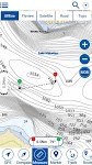
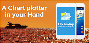
Potomac River Was GPS Charts – Click to show
Potomac River Was GPS Charts
FLYTOMAP INC
Flytomap is a valid and interesting alternative, Worldwide Marine and Outdoor Maps available when connected, thanks to viewer.flytomap.com Worldwide Satellite images overlay on charts Worldwide Ter…
$2.99
0.0
10+ downloads
|
Maps & Navigation
0.0
$2.99
FLYTOMAP INC
10+ downloads
TRANSPORTATION
Potomac River Was GPS Charts
Flytomap is a valid and interesting alternative, Worldwide Marine and Outdoor Maps available when connected, thanks to…
Treinenradar
René van den Berg
Volg treinen op het Nederlands spoor. Inclusief: - NS intercity's en sprinters - Arriva - Thalys (HSL-Zuid) - TRAXX (HSL-Zuid) Recent changes: - Verbeterde interface - Nieuw logo - Extra filters - …
$3.99
0.0
100+ downloads
|
Maps & Navigation
0.0
$3.99
René van den Berg
100+ downloads
TRANSPORTATION
Treinenradar
Volg treinen op het Nederlands spoor. Inclusief: - NS intercity's en sprinters - Arriva - Thalys (HSL-Zuid) - TRAXX (H…
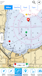
Lake Tahoe Offline GPS Charts – Click to show
Lake Tahoe Offline GPS Charts
MAPITECH LTD
MapiTech launches on the market the best official up-to-date NOAA RNC (raster) combined with S57 nautical charts (digital): marinas, wrecks, fishing spots, boat ramps, POI. This app displays seamles…
$4.99
0.0
1+ downloads
|
Maps & Navigation
0.0
$4.99
MAPITECH LTD
1+ downloads
TRANSPORTATION
Lake Tahoe Offline GPS Charts
MapiTech launches on the market the best official up-to-date NOAA RNC (raster) combined with S57 nautical charts (digit…
Go Maps
Planet Apks
5 tipos de mapas(Satélite, Tierra, Normal, Modo Oscuro y Modo Noche) , búsqueda de ruta independiente al móvil (4 rutas guardadas en favoritas), Compartir Ubicación (Por T…
$1.49
3.4
100+ downloads
|
Maps & Navigation
3.4
$1.49
Planet Apks
100+ downloads
TRANSPORTATION
Go Maps
5 tipos de mapas(Satélite, Tierra, Normal, Modo Oscuro y Modo Noche) , búsqueda de ruta independiente al …
TMBmap Tour du Mont Blanc TMB
ARiS websitewerk
This App shows the Tour du Mont Blanc route with all its variations. On the free website TMBmap.com you can organize your self-guided TMB route: Create your personal TMB route, plan accommodations …
$13.99
0.0
10+ downloads
|
Maps & Navigation
0.0
$13.99
ARiS websitewerk
10+ downloads
TRANSPORTATION
TMBmap Tour du Mont Blanc TMB
This App shows the Tour du Mont Blanc route with all its variations. On the free website TMBmap.com you can organize yo…
Norris Lake TN Offline Charts – Click to show
Norris Lake TN Offline Charts
MAPITECH LTD
MapiTech launches on the market the best official up-to-date NOAA RNC (raster) combined with S57 nautical charts (digital): marinas, wrecks, fishing spots, boat ramps, POI. This app displays seamles…
$4.99
0.0
10+ downloads
|
Maps & Navigation
0.0
$4.99
MAPITECH LTD
10+ downloads
TRANSPORTATION
Norris Lake TN Offline Charts
MapiTech launches on the market the best official up-to-date NOAA RNC (raster) combined with S57 nautical charts (digit…
Lake District Outdoor Map Pro – Click to show
Lake District Outdoor Map Pro
jonathan shutt
An offline map of the Lake District National Park in England, ideal for hiking, running, mountain biking / cycling. Being offline means unlike other map apps, you don't need a signal to access detail…
$1.99
0.0
1,000+ downloads
|
Maps & Navigation
0.0
$1.99
jonathan shutt
1,000+ downloads
TRANSPORTATION
Lake District Outdoor Map Pro
An offline map of the Lake District National Park in England, ideal for hiking, running, mountain biking / cycling. Bei…
Spain Mediterranean GPS Charts – Click to show
Spain Mediterranean GPS Charts
FLYTOMAP INC
Flytomap is a valid and interesting alternative, Featured on the Deck Featured on Geomedia Worldwide Marine and Outdoor Maps available when connected, thanks to viewer.flytomap.com Worldwide Satellit…
$4.99
0.0
50+ downloads
|
Maps & Navigation
0.0
$4.99
FLYTOMAP INC
50+ downloads
TRANSPORTATION
Spain Mediterranean GPS Charts
Flytomap is a valid and interesting alternative, Featured on the Deck Featured on Geomedia Worldwide Marine and Outdoor…
ExploreMetro VIP
Matthew Mayer
Purchase this app to become an ExploreMetro VIP, and enjoy our other metro map apps for seven cities in Asia with no ads. Supports: Explore Shanghai, Beijing, Guangzhou, Hong Kong, Singapore, Taipei…
$3.49
5.0
1,000+ downloads
|
Maps & Navigation
5.0
$3.49
Matthew Mayer
1,000+ downloads
TRANSPORTATION
ExploreMetro VIP
Purchase this app to become an ExploreMetro VIP, and enjoy our other metro map apps for seven cities in Asia with no ad…
Tims Ford Lake TN Offline Maps – Click to show
Tims Ford Lake TN Offline Maps
MAPITECH LTD
MapiTech launches on the market the best official up-to-date RNC (raster) combined with S57 nautical charts (digital): marinas, wrecks, fishing spots, boat ramps, POI. This app displays seamlessly …
$4.99
0.0
1+ downloads
|
Maps & Navigation
0.0
$4.99
MAPITECH LTD
1+ downloads
TRANSPORTATION
Tims Ford Lake TN Offline Maps
MapiTech launches on the market the best official up-to-date RNC (raster) combined with S57 nautical charts (digital):…
Catalonia GPS Map Navigator – Click to show
Catalonia GPS Map Navigator
FLYTOMAP INC
Flytomap is a valid and interesting alternative, Featured on the Deck Featured on Geomedia Worldwide Marine and Outdoor Maps available when connected, thanks to viewer.flytomap.com Worldwide Satellit…
$3.99
0.0
10+ downloads
|
Maps & Navigation
0.0
$3.99
FLYTOMAP INC
10+ downloads
TRANSPORTATION
Catalonia GPS Map Navigator
Flytomap is a valid and interesting alternative, Featured on the Deck Featured on Geomedia Worldwide Marine and Outdoor…
Lake Wakatipu NZ Offline Chart – Click to show
Lake Wakatipu NZ Offline Chart
MAPITECH LTD
MapiTech launches on the market the best official up-to-date NOAA RNC (raster) combined with S57 nautical charts (digital): marinas, wrecks, fishing spots, boat ramps, POI. This app displays seamles…
$4.99
0.0
0+ downloads
|
Maps & Navigation
0.0
$4.99
MAPITECH LTD
0+ downloads
TRANSPORTATION
Lake Wakatipu NZ Offline Chart
MapiTech launches on the market the best official up-to-date NOAA RNC (raster) combined with S57 nautical charts (digit…
Madeira Island Offline Charts – Click to show
Madeira Island Offline Charts
MAPITECH LTD
MapiTech launches on the market the best official up-to-date RNC (raster) combined with S57 nautical charts (digital): marinas, wrecks, fishing spots, boat ramps, POI. This app displays seamlessly …
$4.99
0.0
10+ downloads
|
Maps & Navigation
0.0
$4.99
MAPITECH LTD
10+ downloads
TRANSPORTATION
Madeira Island Offline Charts
MapiTech launches on the market the best official up-to-date RNC (raster) combined with S57 nautical charts (digital):…
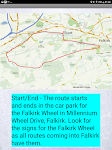
Satnav Cycle Routes – Falkirk – Click to show
Satnav Cycle Routes – Falkirk
Ian Lochhead
Around the Falkirk Wheel. 12.5 miles Falkirk - Avonbridge. 24 miles Falkirk - Fannyside Loch. 20 miles Falkirk Wheel & Helix Park. 12 miles Satnav Cycle Routes around Falkirk using cycle paths a…
$0.99
0.0
0+ downloads
|
Maps & Navigation
0.0
$0.99
Ian Lochhead
0+ downloads
TRANSPORTATION
Satnav Cycle Routes – Falkirk
Around the Falkirk Wheel. 12.5 miles Falkirk - Avonbridge. 24 miles Falkirk - Fannyside Loch. 20 miles Falkirk Wheel &a…
Pickwick Lake Al GPS Charts – Click to show
Pickwick Lake Al GPS Charts
FLYTOMAP INC
Flytomap is a valid and interesting alternative, Featured on the Deck Featured on Geomedia Worldwide Marine and Outdoor Maps available when connected, thanks to viewer.flytomap.com Worldwide Satelli…
$2.99
0.0
1+ downloads
|
Maps & Navigation
0.0
$2.99
FLYTOMAP INC
1+ downloads
TRANSPORTATION
Pickwick Lake Al GPS Charts
Flytomap is a valid and interesting alternative, Featured on the Deck Featured on Geomedia Worldwide Marine and Outdoo…
Satnav Cycle Routes -Dundee(2) – Click to show
Satnav Cycle Routes -Dundee(2)
Ian Lochhead
Dundee - Piperdam. 23 miles Dundee - Carnoustie. 31 miles Satnav Cycle Routes around Dundee using cycle paths and roads. Every route has turn-by-turn navigation with voice instruction. Enjoy the ben…
$0.99
0.0
0+ downloads
|
Maps & Navigation
0.0
$0.99
Ian Lochhead
0+ downloads
TRANSPORTATION
Satnav Cycle Routes -Dundee(2)
Dundee - Piperdam. 23 miles Dundee - Carnoustie. 31 miles Satnav Cycle Routes around Dundee using cycle paths and road…
Stora Le sjö Offline GPS Karta – Click to show
Stora Le sjö Offline GPS Karta
MAPITECH LTD
MapiTech launches on the market the best official up-to-date RNC (raster) combined with S57 nautical charts (digital): marinas, wrecks, fishing spots, boat ramps, POI. This app displays seamlessly …
$4.99
0.0
10+ downloads
|
Maps & Navigation
0.0
$4.99
MAPITECH LTD
10+ downloads
TRANSPORTATION
Stora Le sjö Offline GPS Karta
MapiTech launches on the market the best official up-to-date RNC (raster) combined with S57 nautical charts (digital):…
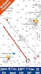
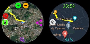
PRO Voice Navigator "IGH"
rausNT
This app is a voice-based navigator. "I'm going home" is primarily intended for trekking enthusiasts, since it's a navigator for cross-country conditions. If you are afraid of getting lost…
$2.99
5.0
10,000+ downloads
|
Maps & Navigation
5.0
$2.99
rausNT
10,000+ downloads
TRANSPORTATION
PRO Voice Navigator "IGH"
This app is a voice-based navigator. "I'm going home" is primarily intended for trekking enthusiasts, since …
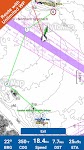
MapTools - Tracks, Measures
Julien Rozé
MapTools is your affordable trip recording and measurement tool. The app also allows you to view all your device's GPS data as well as data from several other sensors (barometer, magnetic compass, we…
$0.99
0.0
1+ downloads
|
Maps & Navigation
0.0
$0.99
Julien Rozé
1+ downloads
TRANSPORTATION
MapTools - Tracks, Measures
MapTools is your affordable trip recording and measurement tool. The app also allows you to view all your device's GPS …
United States
United Kingdom
Germany
Norway
Sweden
Australia
Netherlands
Italy
Denmark
Hong Kong
Brazil
France
Canada
Spain
Portugal
South Korea
Japan
Poland
Hungary
India
Finland
Thailand
Russia
General
Overall
Applications
Games
Join AppBrain
Join AppBrain to get app recommendations
Apps
Art & Design
Auto & Vehicles
Beauty
Books & Reference
Business
Comics
Communication
Dating
Education
Entertainment
Events
Finance
Food & Drink
Health & Fitness
House & Home
Libraries & Demo
Lifestyle
Maps & Navigation
Medical
Music & Audio
News & Magazines
Parenting
Personalization
Photography
Productivity
Shopping
Social
Sports
Tools
Travel & Local
Video Players & Editors
Weather
Games
Action
Adventure
Arcade
Board
Card
Casino
Casual
Educational
Music
Puzzle
Racing
Role Playing
Simulation
Sports Games
Strategy
Trivia
Word