AppBrain
|
Apps
Apps
Apps being viewed right now
Trending apps today
Most popular apps
All-time most downloaded apps
Top rated apps
Statistics
Docs
Developers
Sign up
Log in
Android Apps
>
Maps & Navigation
>
Paid
Category
Maps & Navigation
Sort by
Trending
Recent downloads
All-time downloads
Top rated
Popular in
Filter by
Off
Free
Paid
New
Updated
Price Reduced
No ads
Page 7 of the
popular Paid Maps & Navigation Apps for Android in the United States
Greenfield Lake - IOWA GPS Map – Click to show
Greenfield Lake - IOWA GPS Map
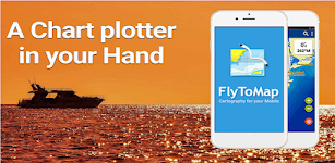
FLYTOMAP INC
Flytomap is a valid and interesting alternative, Featured on the Deck Featured on Geomedia Worldwide Marine and Outdoor Maps available when connected, thanks to viewer.flytomap.com Worldwide Satellit…
$2.99
0.0
1+ downloads
|
Maps & Navigation
0.0
$2.99
FLYTOMAP INC
1+ downloads
TRANSPORTATION
Greenfield Lake - IOWA GPS Map
Flytomap is a valid and interesting alternative, Featured on the Deck Featured on Geomedia Worldwide Marine and Outdoor…
Float LOZ
Jason Sanford
Lake of the Ozarks' boating app. Learn your way around Lake of the Ozarks. Navigate to marinas, boat launches, restaurants, mile markers, and more. Save your favorite spots and share them with friend…
$2.99
0.0
10+ downloads
|
Maps & Navigation
0.0
$2.99
Jason Sanford
10+ downloads
TRANSPORTATION
Float LOZ
Lake of the Ozarks' boating app. Learn your way around Lake of the Ozarks. Navigate to marinas, boat launches, restaura…
Costa Brava GPS Map Navigator – Click to show
Costa Brava GPS Map Navigator
FLYTOMAP INC
Flytomap is a valid and interesting alternative, Featured on the Deck Featured on Geomedia Worldwide Marine and Outdoor Maps available when connected, thanks to viewer.flytomap.com Worldwide Satellit…
$3.99
0.0
5+ downloads
|
Maps & Navigation
0.0
$3.99
FLYTOMAP INC
5+ downloads
TRANSPORTATION
Costa Brava GPS Map Navigator
Flytomap is a valid and interesting alternative, Featured on the Deck Featured on Geomedia Worldwide Marine and Outdoor…
Speedometer
Mykola Drozd
Good and easy to use speedometer, pedometer, route tracker. Convenient for sports, fitness, hiking, traveling and other purposes when you need to know about your speed and location. Allows you to sa…
$1.49
0.0
50+ downloads
|
Maps & Navigation
0.0
$1.49
Mykola Drozd
50+ downloads
TRANSPORTATION
Speedometer
Good and easy to use speedometer, pedometer, route tracker. Convenient for sports, fitness, hiking, traveling and other…
What Street?
Applorium Ltd
Welcome to What Street? – the ultimate street name identification app that tells you exactly where you are! Have you ever found yourself lost in a new city, wandering aimlessly down unfamiliar…
$1.99
0.0
100+ downloads
|
Maps & Navigation
0.0
$1.99
Applorium Ltd
100+ downloads
TRANSPORTATION
What Street?
Welcome to What Street? – the ultimate street name identification app that tells you exactly where you are! Have…
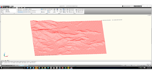
Terrain To DXF
우승호
Convert the terrain within N: -83 ~ 83 degree range as DXF files. The max resolution : 30m × 30m , Elevation : within 7~14m error CAD files can be used in a variety modeling and analysis. Rece…
$3.99
0.0
10+ downloads
|
Maps & Navigation
0.0
$3.99
우승호
10+ downloads
TRANSPORTATION
Terrain To DXF
Convert the terrain within N: -83 ~ 83 degree range as DXF files. The max resolution : 30m × 30m , Elevation : wi…
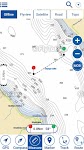
Percy Priest Lake Offline Maps – Click to show
Percy Priest Lake Offline Maps
MAPITECH LTD
MapiTech launches on the market the best official up-to-date NOAA RNC (raster) combined with S57 nautical charts (digital): marinas, wrecks, fishing spots, boat ramps, POI. This app displays seamles…
$4.99
0.0
1+ downloads
|
Maps & Navigation
0.0
$4.99
MAPITECH LTD
1+ downloads
TRANSPORTATION
Percy Priest Lake Offline Maps
MapiTech launches on the market the best official up-to-date NOAA RNC (raster) combined with S57 nautical charts (digit…
Starry Starry Day Professional
Mapsoft
Starry Starry Day Pro allows the daytime use of a total station to rapidly obtain highly accurate True and Grid North azimuths to astro objects without needing an internet connection. Brief Usage In…
$0.49
0.0
10+ downloads
|
Maps & Navigation
0.0
$0.49
Mapsoft
10+ downloads
TRANSPORTATION
Starry Starry Day Professional
Starry Starry Day Pro allows the daytime use of a total station to rapidly obtain highly accurate True and Grid North a…
Helsinki GPS Map Navigator – Click to show
Helsinki GPS Map Navigator
FLYTOMAP INC
Flytomap is a valid and interesting alternative, Featured on the Deck Featured on Geomedia Worldwide Marine and Outdoor Maps available when connected, thanks to viewer.flytomap.com Worldwide Satelli…
$3.99
0.0
5+ downloads
|
Maps & Navigation
0.0
$3.99
FLYTOMAP INC
5+ downloads
TRANSPORTATION
Helsinki GPS Map Navigator
Flytomap is a valid and interesting alternative, Featured on the Deck Featured on Geomedia Worldwide Marine and Outdoo…
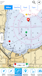
Stora Le sjö Offline GPS Karta – Click to show
Stora Le sjö Offline GPS Karta
MAPITECH LTD
MapiTech launches on the market the best official up-to-date RNC (raster) combined with S57 nautical charts (digital): marinas, wrecks, fishing spots, boat ramps, POI. This app displays seamlessly …
$4.99
0.0
10+ downloads
|
Maps & Navigation
0.0
$4.99
MAPITECH LTD
10+ downloads
TRANSPORTATION
Stora Le sjö Offline GPS Karta
MapiTech launches on the market the best official up-to-date RNC (raster) combined with S57 nautical charts (digital):…
Gps For Boat fishing & Car - P
V.Mark.
Be careful after the application is installed and the map appears, close and reopen the application to work properly. Maps: Satellite,Simple,Terrain,OpenStreetMap,Seamap,OpenTopo This GPS is speci…
$12.99
0.0
10+ downloads
|
Maps & Navigation
0.0
$12.99
V.Mark.
10+ downloads
TRANSPORTATION
Gps For Boat fishing & Car - P
Be careful after the application is installed and the map appears, close and reopen the application to work properly. …
Georgia S to N Carolina Charts – Click to show
Georgia S to N Carolina Charts
FLYTOMAP INC
Flytomap is a valid and interesting alternative, Featured on the Deck Featured on Geomedia Worldwide Marine and Outdoor Maps available when connected, thanks to viewer.flytomap.com Worldwide Satellit…
$3.99
0.0
0+ downloads
|
Maps & Navigation
0.0
$3.99
FLYTOMAP INC
0+ downloads
TRANSPORTATION
Georgia S to N Carolina Charts
Flytomap is a valid and interesting alternative, Featured on the Deck Featured on Geomedia Worldwide Marine and Outdoor…
Wagitaler Sihl Klontaler Chart – Click to show
Wagitaler Sihl Klontaler Chart
FLYTOMAP INC
Flytomap is a valid and interesting alternative, Featured on the Deck Featured on Geomedia Worldwide Marine and Outdoor Maps available when connected, thanks to viewer.flytomap.com Worldwide Satelli…
$3.99
0.0
0+ downloads
|
Maps & Navigation
0.0
$3.99
FLYTOMAP INC
0+ downloads
TRANSPORTATION
Wagitaler Sihl Klontaler Chart
Flytomap is a valid and interesting alternative, Featured on the Deck Featured on Geomedia Worldwide Marine and Outdoo…
Next Bus Dublin Pro
Stephen McBride
Next Bus Dublin uses the Dublin Bus realtime information system to tell you exactly when your bus is arriving. No more guessing using fictional timetables! The app is packed with useful features, loo…
$2.49
0.0
1,000+ downloads
|
Maps & Navigation
0.0
$2.49
Stephen McBride
1,000+ downloads
TRANSPORTATION
Next Bus Dublin Pro
Next Bus Dublin uses the Dublin Bus realtime information system to tell you exactly when your bus is arriving. No more …
Forager's Buddy Pro Key
G.H IT Services
This product is the Activation Code of Forager's Buddy. Once purchased, you can upgrade Forager's Buddy Free version to Forager's Buddy Pro version. You must have Forager's Buddy Free Edition insta…
$2.99
4.4
1,000+ downloads
|
Maps & Navigation
4.4
$2.99
G.H IT Services
1,000+ downloads
TRANSPORTATION
Forager's Buddy Pro Key
This product is the Activation Code of Forager's Buddy. Once purchased, you can upgrade Forager's Buddy Free version to…
Cayuga Seneca Lakes GPS Charts – Click to show
Cayuga Seneca Lakes GPS Charts
MAPITECH LTD
MapiTech launches on the market the best official up-to-date NOAA RNC (raster) combined with S57 nautical charts (digital): marinas, wrecks, fishing spots, boat ramps, POI. This app displays seamles…
$4.99
0.0
0+ downloads
|
Maps & Navigation
0.0
$4.99
MAPITECH LTD
0+ downloads
TRANSPORTATION
Cayuga Seneca Lakes GPS Charts
MapiTech launches on the market the best official up-to-date NOAA RNC (raster) combined with S57 nautical charts (digit…
Egadi Island Offline GPS Chart – Click to show
Egadi Island Offline GPS Chart
MAPITECH LTD
MapiTech launches on the market the best official up-to-date RNC (raster) combined with S57 nautical charts (digital): marinas, wrecks, fishing spots, boat ramps, POI. This app displays seamlessly …
$4.99
0.0
1+ downloads
|
Maps & Navigation
0.0
$4.99
MAPITECH LTD
1+ downloads
TRANSPORTATION
Egadi Island Offline GPS Chart
MapiTech launches on the market the best official up-to-date RNC (raster) combined with S57 nautical charts (digital):…
Lake Tahoe Offline GPS Charts – Click to show
Lake Tahoe Offline GPS Charts
MAPITECH LTD
MapiTech launches on the market the best official up-to-date NOAA RNC (raster) combined with S57 nautical charts (digital): marinas, wrecks, fishing spots, boat ramps, POI. This app displays seamles…
$4.99
0.0
1+ downloads
|
Maps & Navigation
0.0
$4.99
MAPITECH LTD
1+ downloads
TRANSPORTATION
Lake Tahoe Offline GPS Charts
MapiTech launches on the market the best official up-to-date NOAA RNC (raster) combined with S57 nautical charts (digit…
Norris Lake TN Offline Charts – Click to show
Norris Lake TN Offline Charts
MAPITECH LTD
MapiTech launches on the market the best official up-to-date NOAA RNC (raster) combined with S57 nautical charts (digital): marinas, wrecks, fishing spots, boat ramps, POI. This app displays seamles…
$4.99
0.0
10+ downloads
|
Maps & Navigation
0.0
$4.99
MAPITECH LTD
10+ downloads
TRANSPORTATION
Norris Lake TN Offline Charts
MapiTech launches on the market the best official up-to-date NOAA RNC (raster) combined with S57 nautical charts (digit…
Oslo fjord Norway Offline Maps – Click to show
Oslo fjord Norway Offline Maps
MAPITECH LTD
MapiTech launches on the market the best official up-to-date RNC (raster) combined with S57 nautical charts (digital): marinas, wrecks, fishing spots, boat ramps, POI. This app displays seamlessly …
$4.99
0.0
5+ downloads
|
Maps & Navigation
0.0
$4.99
MAPITECH LTD
5+ downloads
TRANSPORTATION
Oslo fjord Norway Offline Maps
MapiTech launches on the market the best official up-to-date RNC (raster) combined with S57 nautical charts (digital):…
United States
United Kingdom
Germany
Norway
Sweden
Australia
Netherlands
Italy
Denmark
Hong Kong
Brazil
France
Canada
Spain
Portugal
South Korea
Japan
Poland
Hungary
India
Finland
Thailand
Russia
General
Overall
Applications
Games
Join AppBrain
Join AppBrain to get app recommendations
Apps
Art & Design
Auto & Vehicles
Beauty
Books & Reference
Business
Comics
Communication
Dating
Education
Entertainment
Events
Finance
Food & Drink
Health & Fitness
House & Home
Libraries & Demo
Lifestyle
Maps & Navigation
Medical
Music & Audio
News & Magazines
Parenting
Personalization
Photography
Productivity
Shopping
Social
Sports
Tools
Travel & Local
Video Players & Editors
Weather
Games
Action
Adventure
Arcade
Board
Card
Casino
Casual
Educational
Music
Puzzle
Racing
Role Playing
Simulation
Sports Games
Strategy
Trivia
Word