AppBrain
|
Apps
Apps
Apps being viewed right now
Trending apps today
Most popular apps
All-time most downloaded apps
Top rated apps
Statistics
Docs
Developers
Sign up
Log in
Android Apps
>
Maps & Navigation
>
Paid
Category
Maps & Navigation
Sort by
Trending
Recent downloads
All-time downloads
Top rated
Popular in
Filter by
Off
Free
Paid
New
Updated
Price Reduced
No ads
Page 10 of the
best Paid Maps & Navigation Apps for Android
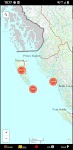
Lake Yellowstone Wyoming Chart – Click to show
Lake Yellowstone Wyoming Chart
FLYTOMAP INC
Flytomap is a valid and interesting alternative, Featured on the Deck Featured on Geomedia Worldwide Marine and Outdoor Maps available when connected, thanks to viewer.flytomap.com Worldwide Satelli…
$3.99
0.0
0+ downloads
|
Maps & Navigation
0.0
$3.99
FLYTOMAP INC
0+ downloads
TRANSPORTATION
Lake Yellowstone Wyoming Chart
Flytomap is a valid and interesting alternative, Featured on the Deck Featured on Geomedia Worldwide Marine and Outdoo…
FootPrint
T.creations
Rediscover your steps with FootPrint! See every street you've explored and every path you've taken with this powerful and private GPS logger. FootPrint is your personal travel diary, designed to map …
$3.49
0.0
100+ downloads
|
Maps & Navigation
0.0
$3.49
T.creations
100+ downloads
TRANSPORTATION
FootPrint
Rediscover your steps with FootPrint! See every street you've explored and every path you've taken with this powerful a…
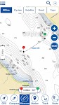
Lake Chiemsee GPS Navigator – Click to show
Lake Chiemsee GPS Navigator
FLYTOMAP INC
Flytomap is a valid and interesting alternative, Featured on the Deck Featured on Geomedia Worldwide Marine and Outdoor Maps available when connected, thanks to viewer.flytomap.com Worldwide Satelli…
$3.99
0.0
10+ downloads
|
Maps & Navigation
0.0
$3.99
FLYTOMAP INC
10+ downloads
TRANSPORTATION
Lake Chiemsee GPS Navigator
Flytomap is a valid and interesting alternative, Featured on the Deck Featured on Geomedia Worldwide Marine and Outdoo…
Lake Tarpon Florida GPS Charts – Click to show
Lake Tarpon Florida GPS Charts
FLYTOMAP INC
Flytomap is a valid and interesting alternative Featured on the Deck Featured on Geomedia Worldwide Marine and Outdoor Maps available when connected, thanks to viewer.flytomap.com Worldwide Satellite…
$2.99
0.0
0+ downloads
|
Maps & Navigation
0.0
$2.99
FLYTOMAP INC
0+ downloads
TRANSPORTATION
Lake Tarpon Florida GPS Charts
Flytomap is a valid and interesting alternative Featured on the Deck Featured on Geomedia Worldwide Marine and Outdoor …
Speed Camera AI: Radar Alerts
MyCarTracks
Take the stress out of driving with Drive AI, the AI-powered app that makes radar alerts and navigation smarter and easier. Unlike regular speed camera apps, Drive AI learns your daily routes and fig…
$0.99
0.0
10+ downloads
|
Maps & Navigation
0.0
$0.99
MyCarTracks
10+ downloads
TRANSPORTATION
Speed Camera AI: Radar Alerts
Take the stress out of driving with Drive AI, the AI-powered app that makes radar alerts and navigation smarter and eas…
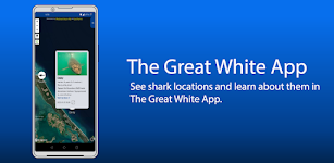
The Great White App
Sustainable Oceans Society
READ BEFORE PURCHASING: * This app will always be FREE on our website, sustainableoceansociety.co.nz * By purchasing this app you are supporting The Great White Project - a study of Great White Sha…
$2.99
0.0
1,000+ downloads
|
Maps & Navigation
0.0
$2.99
Sustainable Oceans Society
1,000+ downloads
TRANSPORTATION
The Great White App
READ BEFORE PURCHASING: * This app will always be FREE on our website, sustainableoceansociety.co.nz * By purchasing …
PORTA DEL CEL – Click to show
PORTA DEL CEL
Jorge Rodríguez-Flores Esparza
"Porta del Cel" is a medium distance circular route located in the Spanish and French Pyrenees. The trail runs through the "Parc Natural de l'Alt Pirineu" and the "Parc natur…
$1.99
0.0
0+ downloads
|
Maps & Navigation
0.0
$1.99
Jorge Rodríguez-Flores Esparza
0+ downloads
TRANSPORTATION
PORTA DEL CEL
"Porta del Cel" is a medium distance circular route located in the Spanish and French Pyrenees. The trail run…
Haida Gwaii Mushroom Forager – Click to show
Haida Gwaii Mushroom Forager
GeoPOI LLC
The forests and woodlands of the Pacific Northwest and British Columbia, Canada are ecosystems rich with edible wild mushrooms if you know where to look. Trouble is, seasoned wild edible collectors s…
$0.49
0.0
0+ downloads
|
Maps & Navigation
0.0
$0.49
GeoPOI LLC
0+ downloads
TRANSPORTATION
Haida Gwaii Mushroom Forager
The forests and woodlands of the Pacific Northwest and British Columbia, Canada are ecosystems rich with edible wild mu…
Fuel Fare
RESDAC
Calculate smart and quick the fare per person of your last trip, the cost per mile and many more. Calculate: - Fuel price per driven kilometer. - Extra charges (e.g. toll etc.) apportioned per kilom…
$1.99
0.0
100+ downloads
|
Maps & Navigation
0.0
$1.99
RESDAC
100+ downloads
TRANSPORTATION
Fuel Fare
Calculate smart and quick the fare per person of your last trip, the cost per mile and many more. Calculate: - Fuel pr…
Cozumel Island GPS Navigator – Click to show
Cozumel Island GPS Navigator
FLYTOMAP INC
Flytomap is a valid and interesting alternative, Featured on the Deck Featured on Geomedia Worldwide Marine and Outdoor Maps available when connected, thanks to viewer.flytomap.com Worldwide Satellit…
$3.99
0.0
1+ downloads
|
Maps & Navigation
0.0
$3.99
FLYTOMAP INC
1+ downloads
TRANSPORTATION
Cozumel Island GPS Navigator
Flytomap is a valid and interesting alternative, Featured on the Deck Featured on Geomedia Worldwide Marine and Outdoor…
Cayuga Seneca Lakes GPS Charts – Click to show
Cayuga Seneca Lakes GPS Charts
MAPITECH LTD
MapiTech launches on the market the best official up-to-date NOAA RNC (raster) combined with S57 nautical charts (digital): marinas, wrecks, fishing spots, boat ramps, POI. This app displays seamles…
$4.99
0.0
0+ downloads
|
Maps & Navigation
0.0
$4.99
MAPITECH LTD
0+ downloads
TRANSPORTATION
Cayuga Seneca Lakes GPS Charts
MapiTech launches on the market the best official up-to-date NOAA RNC (raster) combined with S57 nautical charts (digit…
Galveston to Rio Grande Charts – Click to show
Galveston to Rio Grande Charts
MAPITECH LTD
MapiTech launches on the market the best official up-to-date NOAA RNC (raster) combined with S57 nautical charts (digital): marinas, wrecks, fishing spots, boat ramps, POI. This app displays seamles…
$4.99
0.0
0+ downloads
|
Maps & Navigation
0.0
$4.99
MAPITECH LTD
0+ downloads
TRANSPORTATION
Galveston to Rio Grande Charts
MapiTech launches on the market the best official up-to-date NOAA RNC (raster) combined with S57 nautical charts (digit…
Pocket Compass: Navigation – Click to show
Pocket Compass: Navigation
ASD Media
**POCKET COMPASS: SIMPLE, ACCURATE NAVIGATION** Navigate with confidence using Pocket Compass, a sleek and accurate digital compass designed for outdoor enthusiasts, hikers, travellers, and anyone w…
$0.99
0.0
1+ downloads
|
Maps & Navigation
0.0
$0.99
ASD Media
1+ downloads
TRANSPORTATION
Pocket Compass: Navigation
**POCKET COMPASS: SIMPLE, ACCURATE NAVIGATION** Navigate with confidence using Pocket Compass, a sleek and accurate di…
Cancun GPS Map Navigator – Click to show
Cancun GPS Map Navigator
FLYTOMAP INC
Flytomap is a valid and interesting alternative, Featured on the Deck Featured on Geomedia Worldwide Marine and Outdoor Maps available when connected, thanks to viewer.flytomap.com Worldwide Satellit…
$3.99
0.0
5+ downloads
|
Maps & Navigation
0.0
$3.99
FLYTOMAP INC
5+ downloads
TRANSPORTATION
Cancun GPS Map Navigator
Flytomap is a valid and interesting alternative, Featured on the Deck Featured on Geomedia Worldwide Marine and Outdoor…
Lake Pend Oreille Idaho Charts – Click to show
Lake Pend Oreille Idaho Charts
MAPITECH LTD
MapiTech launches on the market the best official up-to-date NOAA RNC (raster) combined with S57 nautical charts (digital): marinas, wrecks, fishing spots, boat ramps, POI. This app displays seamles…
$4.99
0.0
1+ downloads
|
Maps & Navigation
0.0
$4.99
MAPITECH LTD
1+ downloads
TRANSPORTATION
Lake Pend Oreille Idaho Charts
MapiTech launches on the market the best official up-to-date NOAA RNC (raster) combined with S57 nautical charts (digit…
Lake Leman Geneva Offline Maps – Click to show
Lake Leman Geneva Offline Maps
FLYTOMAP INC
Flytomap is a valid and interesting alternative, Featured on the Deck Featured on Geomedia Worldwide Marine and Outdoor Maps available when connected, thanks to viewer.flytomap.com Worldwide Satelli…
$3.99
0.0
100+ downloads
|
Maps & Navigation
0.0
$3.99
FLYTOMAP INC
100+ downloads
TRANSPORTATION
Lake Leman Geneva Offline Maps
Flytomap is a valid and interesting alternative, Featured on the Deck Featured on Geomedia Worldwide Marine and Outdoo…
ViaBus + – Click to show
ViaBus +
SFR71
En ViaBus Facilitamos el trabajo a los profesionales de pasajeros por carretera. Además encuentras todo lo que en nuestro trabajo podemos necesitar. Buscar un Guía oficial de cualquier …
$16.99
0.0
100+ downloads
|
Maps & Navigation
0.0
$16.99
SFR71
100+ downloads
TRANSPORTATION
ViaBus +
En ViaBus Facilitamos el trabajo a los profesionales de pasajeros por carretera. Además encuentras todo lo que e…
Float LOZ
Jason Sanford
Lake of the Ozarks' boating app. Learn your way around Lake of the Ozarks. Navigate to marinas, boat launches, restaurants, mile markers, and more. Save your favorite spots and share them with friend…
$2.99
0.0
10+ downloads
|
Maps & Navigation
0.0
$2.99
Jason Sanford
10+ downloads
TRANSPORTATION
Float LOZ
Lake of the Ozarks' boating app. Learn your way around Lake of the Ozarks. Navigate to marinas, boat launches, restaura…
Stora Le sjö Offline GPS Karta – Click to show
Stora Le sjö Offline GPS Karta
MAPITECH LTD
MapiTech launches on the market the best official up-to-date RNC (raster) combined with S57 nautical charts (digital): marinas, wrecks, fishing spots, boat ramps, POI. This app displays seamlessly …
$4.99
0.0
10+ downloads
|
Maps & Navigation
0.0
$4.99
MAPITECH LTD
10+ downloads
TRANSPORTATION
Stora Le sjö Offline GPS Karta
MapiTech launches on the market the best official up-to-date RNC (raster) combined with S57 nautical charts (digital):…
MapTools - Tracks, Measures
Julien Rozé
MapTools is your affordable trip recording and measurement tool. The app also allows you to view all your device's GPS data as well as data from several other sensors (barometer, magnetic compass, we…
$0.99
0.0
1+ downloads
|
Maps & Navigation
0.0
$0.99
Julien Rozé
1+ downloads
TRANSPORTATION
MapTools - Tracks, Measures
MapTools is your affordable trip recording and measurement tool. The app also allows you to view all your device's GPS …
United States
United Kingdom
Germany
Norway
Sweden
Australia
Netherlands
Italy
Denmark
Hong Kong
Brazil
France
Canada
Spain
Portugal
South Korea
Japan
Poland
Hungary
India
Finland
Thailand
Russia
General
Overall
Applications
Games
Join AppBrain
Join AppBrain to get app recommendations
Apps
Art & Design
Auto & Vehicles
Beauty
Books & Reference
Business
Comics
Communication
Dating
Education
Entertainment
Events
Finance
Food & Drink
Health & Fitness
House & Home
Libraries & Demo
Lifestyle
Maps & Navigation
Medical
Music & Audio
News & Magazines
Parenting
Personalization
Photography
Productivity
Shopping
Social
Sports
Tools
Travel & Local
Video Players & Editors
Weather
Games
Action
Adventure
Arcade
Board
Card
Casino
Casual
Educational
Music
Puzzle
Racing
Role Playing
Simulation
Sports Games
Strategy
Trivia
Word