AppBrain
|
Apps
Apps
Apps being viewed right now
Trending apps today
Most popular apps
All-time most downloaded apps
Top rated apps
Statistics
Docs
Developers
Sign up
Log in
Android Apps
>
Maps & Navigation
>
Paid
Category
Maps & Navigation
Sort by
Trending
Recent downloads
All-time downloads
Top rated
Popular in
Filter by
Off
Free
Paid
New
Updated
Price Reduced
No ads
Page 10 of the
recently popular Paid Maps & Navigation Apps for Android
Electro Station Finder EUR + – Click to show
Electro Station Finder EUR +
Lepus
Electro Station Finder Plus calculates a route and searches for electric charging stations. Charging stations can be searched along this route or around a location. Charging stations along the route …
$1.99
0.0
100+ downloads
|
Maps & Navigation
0.0
$1.99
Lepus
100+ downloads
TRANSPORTATION
Electro Station Finder EUR +
Electro Station Finder Plus calculates a route and searches for electric charging stations. Charging stations can be se…
Peak District Offline Outdoor – Click to show
Peak District Offline Outdoor
jonathan shutt
An offline map of the Peak District National Park in England, ideal for hiking, running, mountain biking / cycling. Being offline means unlike other map apps, you don't need a signal to access detail…
$1.99
0.0
100+ downloads
|
Maps & Navigation
0.0
$1.99
jonathan shutt
100+ downloads
TRANSPORTATION
Peak District Offline Outdoor
An offline map of the Peak District National Park in England, ideal for hiking, running, mountain biking / cycling. Bei…
Taxii Pro - Airport Sign Board
Nick Webster
Taxii is a convenient, no hassle way to display someone's name plus a logo on your tablet. The app is meant to help taxi or cab drivers pick people up from air port terminals/busy places without the …
$1.49
0.0
100+ downloads
|
Maps & Navigation
0.0
$1.49
Nick Webster
100+ downloads
TRANSPORTATION
Taxii Pro - Airport Sign Board
Taxii is a convenient, no hassle way to display someone's name plus a logo on your tablet. The app is meant to help tax…
OkMap Mobile
OkMap team
OkMap Mobile is easy to use and its features are similar to those of the most popular GPS handhelds. Plan your routes on the map! OkMap calculates the height differences and travel times for you and …
$3.49
0.0
100+ downloads
|
Maps & Navigation
0.0
$3.49
OkMap team
100+ downloads
TRANSPORTATION
OkMap Mobile
OkMap Mobile is easy to use and its features are similar to those of the most popular GPS handhelds. Plan your routes o…
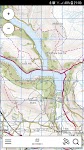
Dartmoor Outdoor Map Pro – Click to show
Dartmoor Outdoor Map Pro
jonathan shutt
An offline map of Dartmoor National Park in England, ideal for hiking, running, mountain biking / cycling. Being offline means unlike other map apps, you don't need a signal to access detailed maps o…
$1.99
0.0
100+ downloads
|
Maps & Navigation
0.0
$1.99
jonathan shutt
100+ downloads
TRANSPORTATION
Dartmoor Outdoor Map Pro
An offline map of Dartmoor National Park in England, ideal for hiking, running, mountain biking / cycling. Being offlin…
FlyToMap All in One GPS Charts – Click to show
FlyToMap All in One GPS Charts
FLYTOMAP INC
Flytomap is a valid and interesting alternative - Benetti Yachts Featured on the Deck Featured on Geomedia Live AIS - Worldwide coverage - no receiver required Worldwide Marine & Outdoor Maps ava…
$9.99
0.0
100+ downloads
|
Maps & Navigation
0.0
$9.99
FLYTOMAP INC
100+ downloads
TRANSPORTATION
FlyToMap All in One GPS Charts
Flytomap is a valid and interesting alternative - Benetti Yachts Featured on the Deck Featured on Geomedia Live AIS - W…
Lake Erie GPS Fishing Charts – Click to show
Lake Erie GPS Fishing Charts
FLYTOMAP INC
Flytomap is a valid and interesting alternative, Featured on the Deck Featured on Geomedia Worldwide Marine and Outdoor Maps available when connected, thanks to viewer.flytomap.com Worldwide Satelli…
$3.99
0.0
100+ downloads
|
Maps & Navigation
0.0
$3.99
FLYTOMAP INC
100+ downloads
TRANSPORTATION
Lake Erie GPS Fishing Charts
Flytomap is a valid and interesting alternative, Featured on the Deck Featured on Geomedia Worldwide Marine and Outdoo…
測速照相Gold
Zen's Studios
測速照相偵測程式 ,內含國道、平面、高架,固定,區間測速超速警示 測速照像機的座標,可隨時手動更新圖資 軟體特色 : ◎ GPS時速表,可提示前方是否有測速照相機 ◎ HUD 抬頭顯示器的功能(鏡像投影在前檔風玻璃) ◎ 資料可隨時自主機下載更新 ◎ 動態顯示與像機點的距離並標示像機的實境照片 ◎ 適用於騎機車的測速偵測軟體 ◎ 圖資團隊維護更新 ◎ 靠近照像點,語音提示距離與限速,不…
$9.99
4.2
5,000+ downloads
|
Maps & Navigation
4.2
$9.99
Zen's Studios
5,000+ downloads
TRANSPORTATION
測速照相Gold
測速照相偵測程式 ,內含國道、平面、高架,固定,區間測速超速警示 測速照像機的座標,可隨時手動更新圖資 軟體特色 : ◎ GPS時速表,可提示前方是否有測速照相機 ◎ HUD 抬頭顯示器的功能(鏡像投影在前檔風玻璃) ◎ 資料可隨時…
Float Lanier
Jason Sanford
Lake Lanier's boating app. Learn your way around Lake Lanier. Navigate to marinas, boat launches, restaurants, and more. Save your favorite spots and share them with friends. Favorites - Save your f…
$2.99
0.0
10+ downloads
|
Maps & Navigation
0.0
$2.99
Jason Sanford
10+ downloads
TRANSPORTATION
Float Lanier
Lake Lanier's boating app. Learn your way around Lake Lanier. Navigate to marinas, boat launches, restaurants, and more…
Float Hartwell
Jason Sanford
Lake Hartwell's boating app. Learn your way around Lake Hartwell. Navigate to marinas, boat launches, restaurants, and more. Save your favorite spots and share them with friends. Favorites - Save yo…
$2.99
0.0
10+ downloads
|
Maps & Navigation
0.0
$2.99
Jason Sanford
10+ downloads
TRANSPORTATION
Float Hartwell
Lake Hartwell's boating app. Learn your way around Lake Hartwell. Navigate to marinas, boat launches, restaurants, and …
Tavuhaka M4GM
Tavuhaka.fi
The Tavuhaka M4GM (MGRS for Global Maps) app for Android enables making and sharing tactical plans and observations on a global map: the app provides tools for drawing layers of tactical markers, lin…
$3.99
0.0
1+ downloads
|
Maps & Navigation
0.0
$3.99
Tavuhaka.fi
1+ downloads
TRANSPORTATION
Tavuhaka M4GM
The Tavuhaka M4GM (MGRS for Global Maps) app for Android enables making and sharing tactical plans and observations on …
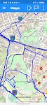
TOUR DU MONT-BLANC – Click to show
TOUR DU MONT-BLANC
Jorge Rodríguez-Flores Esparza
"Tour du Mont-Blanc" (TMB) is a medium-distance loop route in the Alps. The route runs through France, Italy and Switzerland. The entire trail is well signposted and offers guarded mountai…
$5.49
0.0
100+ downloads
|
Maps & Navigation
0.0
$5.49
Jorge Rodríguez-Flores Esparza
100+ downloads
TRANSPORTATION
TOUR DU MONT-BLANC
"Tour du Mont-Blanc" (TMB) is a medium-distance loop route in the Alps. The route runs through France, Italy …
GOLD Tracker
GoldtrackerApps
30000 people are picking over the same hammered goldfields ground each year looking for gold nuggets. If you don't find new gold locations, you will struggle to find gold. GOLD Tracker App gives peop…
$15.99
0.0
100+ downloads
|
Maps & Navigation
0.0
$15.99
GoldtrackerApps
100+ downloads
TRANSPORTATION
GOLD Tracker
30000 people are picking over the same hammered goldfields ground each year looking for gold nuggets. If you don't find…
Speedometer
NixGame
A speedometer is a tool for determining speed. During the workout, this application allows you to measure the speed and distance of your run, the amount of calories consumed. When traveling by bike, …
$2.49
4.5
500+ downloads
|
Maps & Navigation
4.5
$2.49
NixGame
500+ downloads
TRANSPORTATION
Speedometer
A speedometer is a tool for determining speed. During the workout, this application allows you to measure the speed and…
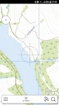
Gulf of Thailand Bangkok maps – Click to show
Gulf of Thailand Bangkok maps
FLYTOMAP INC
Flytomap is a valid and interesting alternative, Featured on the Deck Featured on Geomedia Worldwide Marine and Outdoor Maps available when connected, thanks to viewer.flytomap.com Worldwide Satelli…
$4.99
0.0
10+ downloads
|
Maps & Navigation
0.0
$4.99
FLYTOMAP INC
10+ downloads
TRANSPORTATION
Gulf of Thailand Bangkok maps
Flytomap is a valid and interesting alternative, Featured on the Deck Featured on Geomedia Worldwide Marine and Outdoo…
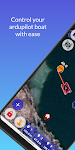
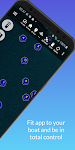
Alien Pilot
Olav Aamaas
Alien Baitboats presents the Alien Pilot, a mobile app that connects our bait boats and offers a special experience in operation and navigation. Alien Pilot is plug and play, just install and use it.…
$54.99
0.0
100+ downloads
|
Maps & Navigation
0.0
$54.99
Olav Aamaas
100+ downloads
TRANSPORTATION
Alien Pilot
Alien Baitboats presents the Alien Pilot, a mobile app that connects our bait boats and offers a special experience in …
Altimeter+
kmarq
Altimeter+ is designed to accurately display your current altitude, combining different data sources to deliver the most reliable result: barometer, GPS, and network-based location. 🎯 Enhanced accu…
$2.99
0.0
10+ downloads
|
Maps & Navigation
0.0
$2.99
kmarq
10+ downloads
TRANSPORTATION
Altimeter+
Altimeter+ is designed to accurately display your current altitude, combining different data sources to deliver the mos…
TreKing (Legacy)
Dominicoder LLC
This is the legacy version of the TreKing app which has reached end of life and is no longer supported. This app now acts like a "key" to unlock feature and remove ads from the free app. …
$40.00
4.6
5,000+ downloads
|
Maps & Navigation
4.6
$40.00
Dominicoder LLC
5,000+ downloads
TRANSPORTATION
TreKing (Legacy)
This is the legacy version of the TreKing app which has reached end of life and is no longer supported. This app now a…
seascape GCS
TechAdVision
seascape GCS is the control station application to manage TechAdVision's autonomous boats for professional surveying and SAR services. The application offers full control for manual and automatic st…
$549.99
0.0
10+ downloads
|
Maps & Navigation
0.0
$549.99
TechAdVision
10+ downloads
TRANSPORTATION
seascape GCS
seascape GCS is the control station application to manage TechAdVision's autonomous boats for professional surveying an…
Banksy's London Tour Map
SK UK Digital
British graffiti artist Banksy has acquired worldwide fame for his thought provoking and satirical street art, appearing in locations around the world. Originating in Bristol and London, some of Bank…
$0.99
0.0
500+ downloads
|
Maps & Navigation
0.0
$0.99
SK UK Digital
500+ downloads
TRANSPORTATION
Banksy's London Tour Map
British graffiti artist Banksy has acquired worldwide fame for his thought provoking and satirical street art, appearin…
United States
United Kingdom
Germany
Norway
Sweden
Australia
Netherlands
Italy
Denmark
Hong Kong
Brazil
France
Canada
Spain
Portugal
South Korea
Japan
Poland
Hungary
India
Finland
Thailand
Russia
General
Overall
Applications
Games
Join AppBrain
Join AppBrain to get app recommendations
Apps
Art & Design
Auto & Vehicles
Beauty
Books & Reference
Business
Comics
Communication
Dating
Education
Entertainment
Events
Finance
Food & Drink
Health & Fitness
House & Home
Libraries & Demo
Lifestyle
Maps & Navigation
Medical
Music & Audio
News & Magazines
Parenting
Personalization
Photography
Productivity
Shopping
Social
Sports
Tools
Travel & Local
Video Players & Editors
Weather
Games
Action
Adventure
Arcade
Board
Card
Casino
Casual
Educational
Music
Puzzle
Racing
Role Playing
Simulation
Sports Games
Strategy
Trivia
Word