

Aeronautical & Aviation Charts
Aeronautical & Aviation Charts is made and published by Corporate Smalltalk Consulting Ltd. AppBrain is an independent app data site and isn't affiliated with Corporate Smalltalk Consulting Ltd. The app name, icon, screenshots and description belong to Corporate Smalltalk Consulting Ltd and are shown as published on the App Store.
AppBrain's verdict
Established- Rating on App Store
- 1.00
- 1 ratings
- Last updated
- October 12, 2023
- Size
- 49.2 MB
It doesn't have enough ratings yet to judge what users think.
User feedback
Ratings and reviews on the App StoreComments on Aeronautical & Aviation Charts for iOS
We don't have enough comments to show example comments. Please check back later.
Store listing
By Corporate Smalltalk Consulting Ltd, from the App Store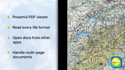

Description by Corporate Smalltalk Consulting Ltd Written by the developer, not by AppBrain. Click to read.
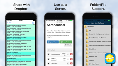
Note we don't supply the charts you must find those, in PDF, TIFF or JPEG/PNG formats, but once you have them, then you can view them with ease, either stored within the app via iTunes sharing, or passively cached from your Dropbox account.
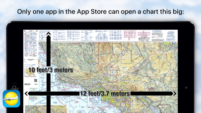
We use our accelerated PDF viewing logic, and combined with our TIFF decoder we can deal most image formats. Expanding on our LargeViewer technology then means size is not a problem.
Can act as a cloud server so you can upload/download/mange files and folders from your desktop browser.
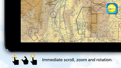
For charts under 36 megapixels effective resolution zoom and scroll time is ZERO! Above that we take an eye blink.
We can read almost every image file format: AVS, BMP, CUR, DIB, GIF, ICON, JNG, JP2, JPEC, JPEG, JPEG2000, JPG, MAT, MIFF, MTV, MVG, PBM, PCX, PGM, PICT, PIX, PNG, PNG8, PNG24, PNG32, PNM, PPM, RLE, SGI, TGA, TIFF, TIFF, TIM, VIFF, WBMP, WPG, SBM and XPM. Plus Apple quick look support for Office 97+, PAGES, RTF, iWorks, txt, and csv.
We support internal and external bookmarking, printing, TIFF to PDF conversion & free-form rotation, multi-page PDF books (any size, thousands of pages), and multi-page FAX/TIFF documents.
An aeronautical chart is a map designed to assist in navigation of aircraft, much as nautical charts do for watercraft, or a roadmap for drivers. Using these charts and other tools, pilots are able to determine their position, safe altitude, best route to a destination, navigation aids along the way, alternative landing areas in case of an in-flight emergency, and other useful information such as radio frequencies and airspace boundaries. There are charts for all land masses on Earth, and long-distance charts for trans-oceanic travel.
Safety and technology
Found in the app by AppBrain- Price
- $15.99
- App size
- 49.2 MB
- Content rating
- Everyone
Technologies used by Aeronautical & Aviation Charts
Releases
Updates seen on the App Store- Version
- 2.6.0
- Launched
- July 2011
No changelog data
Alternatives
Similar apps and more from Corporate Smalltalk Consulting LtdAlternatives to Aeronautical & Aviation Charts


More from Corporate Smalltalk Consulting Ltd





Rankings
App Store top chartsApp Store Rankings for Aeronautical & Aviation Charts
About the app and developer
About Aeronautical & Aviation Charts
Aeronautical & Aviation Charts is a navigation app developed by Corporate Smalltalk Consulting Ltd.
User Ratings
Aeronautical & Aviation Charts is rated 1.00 out of 5 stars. The rating is based on one rating ratings.
App Information
Aeronautical & Aviation Charts costs $15.99. The app size is 49.22 MB. The latest version available is 2.6.0. The last update was on October 12, 2023.
Technical Requirements
The app has a content rating of Everyone. The app has been available on the App Store since July 2011.
Developer information for Corporate Smalltalk Consulting Ltd
Corporate Smalltalk Consulting Ltd
Address:
Frequently asked questions about Aeronautical & Aviation Charts
Is Aeronautical & Aviation Charts free?
No. Aeronautical & Aviation Charts costs $15.99 on the App Store.
Is Aeronautical & Aviation Charts still available?
Yes. Aeronautical & Aviation Charts is on the App Store, and the last update we saw was on October 12, 2023.
How large is Aeronautical & Aviation Charts?
Aeronautical & Aviation Charts is 49.22 MB.
Is Aeronautical & Aviation Charts suitable for children?
App Store rates the content of Aeronautical & Aviation Charts as suitable for everyone.
How do people rate Aeronautical & Aviation Charts?
Aeronautical & Aviation Charts has one rating of 1.00 stars on the App Store.
Who made Aeronautical & Aviation Charts?
Aeronautical & Aviation Charts was developed by Corporate Smalltalk Consulting Ltd. It is listed in the navigation category on the App Store.
What are the best alternatives to Aeronautical & Aviation Charts?
People looking at Aeronautical & Aviation Charts also look at these navigation apps: AeroPointer: Aviation Weather, Flying Calmly, BC Hydro EV, Navigraph Charts, Jeppesen FliteDeck Pro.