It doesn't have enough ratings yet to judge what users think.
Air Map Israel is made and published by
Ofer Raanan.
AppBrain is an independent app data site and isn't affiliated with Ofer Raanan.
The app name, icon, screenshots and description belong to Ofer Raanan and are shown as
published on the App Store.
About Air Map Israel
Air Map Israel is a navigation app developed by Ofer Raanan.
What is the rating of Air Map Israel?
Air Map Israel is rated 5.00 out of 5 stars, based on 2 ratings.
Is Air Map Israel free?
Air Map Israel is free. The app size is 59.90 MB. The latest version available is 57.1.0. The last update was on September 29, 2026.
What are the requirements for Air Map Israel?
The app has a content rating of Everyone. The app has been available on the App Store since August 2023.
Description by Ofer Raanan(from the App Store)
Air Map Israel is a navigation application for Controlled Visual Flight Regulation as an aid for pilots
Visit us on https://sites.google.com/view/airmap-israel
Terms of Use: https://www.apple.com/legal/internet-services/itunes/dev/stdeula/
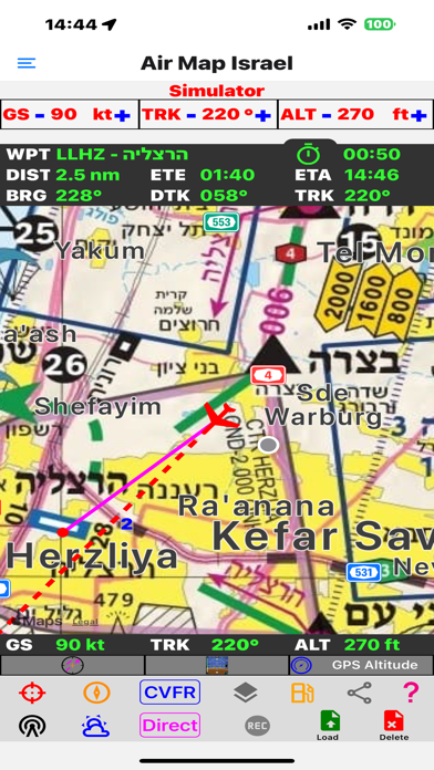
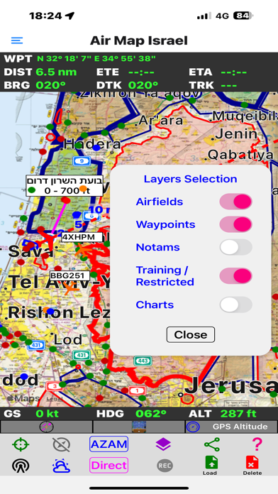
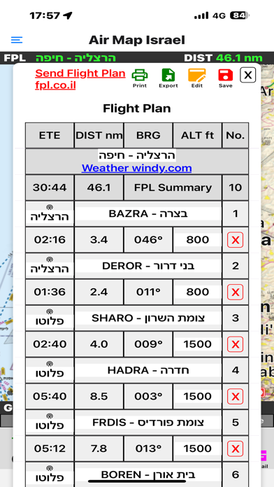
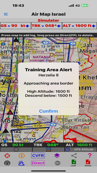
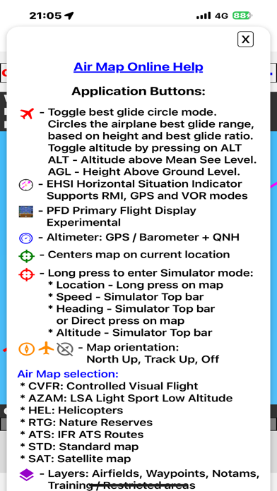
Available Features: * Show the device location on the map as a plane with its Speed, Direction, Altitude and Geo Information. Option to add 2,5,10 markers on the plane directional line in distances (nm) or times minutes. * Tracks the movement on the map with different orientation modes: North Up / Track Up / Off. * Direct mode - Allow placing a marker by touching the map at any point. Markers will focus on a nearby known waypoint when possible. This will calculate in Realtime the: DIST: distance to the marker in nautical miles. BRG: Bearing to marker. ETA: Estimated time of arrival based on current speed. ETE: Estimated time in route based on current speed. * FPL mode - Flight Plan management mode. Create new Flight Plan by placing sequential LEG markers on the map. Markers will focus on a nearby known waypoint when possible. * Options to Load, Delete, Save, Undo last LEG, Reverse Flight Plan and View the Flight Plan. * Option to edit existing Flight Plan: From the details page edit custom names remove leg points and From the map add middle point and drag a point on the Flight Plan to a different location. * Option for Flight Plan Auto Tracking, Leg Tracking Alerts and Off Track distance and altitude Alerts. Including Voice Alerts. * Fuel Consumption - Allows monitoring the fuel consumption status during flight. * Weight and Balance - Allows calculation C.G., Moment, fuel endurance and load charts * Licences and Logbook - Supports Adding Editing Importing Exporting and Printing the pilot licences and logbook entries. * Flight Recorder - Allows recording and storing flight tracks. * Options to Load, Delete, Save, and View the Flight Recordings. This will include Time, Location, Altitude, Heading, Speed, and Distance. * Adding Layers of Airfields with traffic patterns, Waypoints, Notams, Training & Restricted areas and Charts of airfields. * Option for Restricted areas Alerts and Training area borders and altitude Alerts, including Voice Alerts. When Training & Restricted Areas layers are on. * Option to create and manage custom waypoint on the map. * Print PDF, Export and Import of Flight Plans, Custom Waypoint and Flight Recording in GPX - GPS Exchange Format. * Air Map Selection: General Aviation CVFR , Light Sport Aircraft AZAM, Helicopters HEL and IFR ATS Routes Map. Other Map Selection: RTG nature reserves map, STD standard street map and SAT satellite + street map. * Altimeter Mode - Option to select GPS / Barometer along with setting QNH. * EHSI - Electronic GPS based Horizontal Situation Indicator. * PFD - Primary Flight Display with Attitude Indicator, Direction, Speed, Height, Turn rate and Slip Coordinator. * Glide mode based on AGL - Above Ground Level info and best glide ratio settings. * Open Radio common air spaces data. * Open Weather information ATIS / METAR / TAF of Israel airports for pilots. * View and Share location with APP users. * Option to view ADS-B out supported Airplanes on the map (Transponder Mode S) Israel area only. * Air Map Simulator - Allows simulating a flight from chosen location speed and heading. * Screen orientation Portrait, Landscape, Auto - design for iPad and tablets. * Measure distance between points on the map. * World VFR, IFR charts
Main menu: * Air Map page. * Settings page - Map Settings, Flight Plan, Recordings, Alerts and other application settings. * Weather page. * Radio Frequencies page. * Weight and Balance page. * Pilot Licences page. * Logbook page. * Notam page - service and airspace filtering. * Waypoint page for managing Custom Waypoints. * Resources page for managing the APP maps charts and other downloaded resources. * Help page - In APP help, APP Version, check for newer version.
Each subscription will automatically renew 3 days before the expiration date for
the same time period. Subscriptions can be cancelled at any time before the renewal.