

AltoTrails: Outdoor & Maps
AltoTrails: Outdoor & Maps is made and published by Tal Vaknin. AppBrain is an independent app data site and isn't affiliated with Tal Vaknin. The app name, icon, screenshots and description belong to Tal Vaknin and are shown as published on the App Store.
AppBrain's verdict
- Last updated
- October 15, 2026
Rankings
App Store top chartsApp Store Rankings for AltoTrails: Outdoor & Maps
Competitors
Similar apps and more from Tal VakninAlternatives to AltoTrails: Outdoor & Maps


Releases
Updates seen on the App Store- Version
- 1.3.6
- Launched
- November 2025
No changelog data
User feedback
Ratings and reviews on the App StoreComments on AltoTrails: Outdoor & Maps for iOS
We don't have enough comments to show example comments. Please check back later.
Technology
Found in the app by AppBrain- Price
- Free
- App size
- 64.2 MB
- Content rating
- Everyone
Technologies used by AltoTrails: Outdoor & Maps
About the app and developer
About AltoTrails: Outdoor & Maps
AltoTrails: Outdoor & Maps is a health & fitness app developed by Tal Vaknin.
User Ratings
The app has no ratings yet.
App Information
AltoTrails: Outdoor & Maps is freely available from the App Store. The app size is 64.15 MB. The latest version available is 1.3.6. The last update was on October 15, 2026.
Technical Requirements
The app has a content rating of Everyone. The app has been available on the App Store since November 2025.
Developer information for Tal Vaknin
Address:
Store listing
By Tal Vaknin, from the App Store


Description by Tal Vaknin Written by the developer, not by AppBrain. Click to read.
Navigate trails with precision, track outdoor activities, and explore new paths with professional GPS technology and detailed mapping tools—your ultimate companion for every adventure.
Navigate with Confidence
Alto transforms your iPhone into a reliable outdoor navigation system. Track hiking, cycling, skiing, and walking adventures with accurate GPS positioning and comprehensive trail data. Whether you're summiting mountain peaks or exploring city streets, Alto delivers the precision you need.
Key Features
Professional GPS Navigation
Real-time activity tracking with smart altitude correction
Comprehensive performance metrics and statistics
GPX import/export for seamless route sharing
Rich Mapping Experience
Multiple map types: topographic, satellite, OpenStreetMap, and more
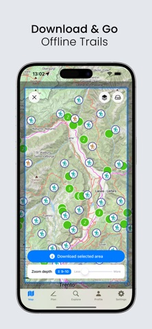
Offline maps for adventures beyond cell service (Pro)
Dual-Mode Altimeter
Accurate elevation tracking with our innovative system that combines GPS and barometric sensors—reliable data whether you're indoors or on the trail.
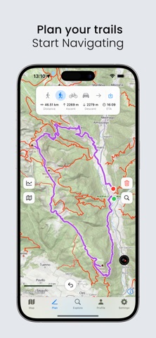
Smart Planning Tools
Precise coordinate finder
Built-in compass and weather integration
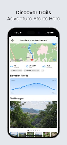
Thousands of Trails
Access a vast database of user-shared routes and contribute your own discoveries to help the outdoor community explore safely.
Perfect for Every Adventure
Hikers & Trekkers: Navigate confidently with precise elevation data and topographic maps designed for mountain terrain.
Cyclists: Track road and mountain biking with detailed metrics and intelligent route optimization.
Winter Sports: Monitor skiing and snowboarding with accurate altitude and speed tracking.
Urban Explorers: Discover walking tours and city adventures with comprehensive mapping.
Alto Pro
Unlock the full power of Alto:
Complete offline map library for remote adventures
Satellite and specialized map layers
Dark mode for low-light navigation
Need help? We're here for you:
Support Guide: https://altotrails.com/support
Email: erol1apps@gmail.com
Website: https://altotrails.com
For terms of service, visit: https://www.apple.com/legal/internet-services/itunes/us/terms.html
Download Alto today and join thousands of outdoor enthusiasts who trust our navigation technology for their adventures.