CES_MOBILE_GIS is an overall app developed by Michael Fennessy.
How many times has CES_MOBILE_GIS been downloaded?
What is the rating of CES_MOBILE_GIS?
CES_MOBILE_GIS has no ratings yet.
Is CES_MOBILE_GIS free?
CES_MOBILE_GIS is free to download. The APK download size is 44.36 MB. The latest version available is 1.0. The last update was on June 18, 2026.
What are the requirements for CES_MOBILE_GIS?
The app has a content rating of Everyone. The app has been available on Google Play 3 weeks ago.
Description
CES Mobile GIS — Professional Field Data Collection & Site Verification
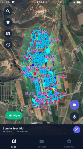
Transform your field workflows with CES Mobile GIS, the professional-grade mapping and data collection app designed for site verification teams, GIS specialists, and field engineers. Work online or offline with powerful tools to capture, edit, and manage spatial data wherever your projects take you.
Key Features:
Interactive Map Visualization
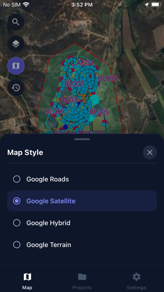
High-performance vector maps with multiple basemap styles (Google Roads, Satellite, Hybrid, Terrain, OSM) Dynamic layer rendering with customizable visibility and legends Topography overlays with viewport-optimized rendering GPS tracking with one-tap centering on your location Feature Creation & Editing
Create new Point, Line, and Polygon features directly on the map Edit existing geometries with intuitive vertex handles Smart snapping to nearby features for precise placement Midpoint insertion for adding vertices to lines and polygons Photo Documentation
Capture photos linked directly to map features View photo previews and manage attachments Automatic background sync when connectivity is restored Full offline photo caching Team Collaboration
Add comments to features for team communication Offline comment queuing with automatic synchronization Complete comment history per feature Project Management
Browse and search projects with hierarchical organization Download projects for complete offline access Automatic project data caching with sync status monitoring Change Approval Workflow
Submit geometry edits for approval Track changes through Draft, Pending, Approved, or Rejected status Review all your changes in one convenient panel Built for the Field
Offline-first architecture — work without connectivity, sync when connected Automatic background synchronization Real-time network status monitoring Conflict detection and resolution Secure & Reliable
Secure authentication with session management Encrypted data transmission Local SQLite database for robust data persistence Whether you're conducting site surveys, verifying infrastructure, or collecting GIS data in remote locations, CES Mobile GIS provides the professional tools you need to get the job done — with or without an internet connection.
Each subscription will automatically renew 3 days before the expiration date for
the same time period. Subscriptions can be cancelled at any time before the renewal.