

Compass & Altimeter & Gps is made and published by 铸前 高. AppBrain is an independent app data site and isn't affiliated with 铸前 高. The app name, icon, screenshots and description belong to 铸前 高 and are shown as published on the App Store.
AppBrain's verdict
- Last updated
- August 28, 2026
Rankings
App Store top chartsApp Store Rankings for Compass & Altimeter & Gps
Competitors
Similar apps and more from 铸前 高Alternatives to Compass & Altimeter & Gps


More from 铸前 高


Releases
Updates seen on the App Store- Version
- 1.0.15
- Launched
- July 2026
No changelog data
User feedback
Ratings and reviews on the App StoreComments on Compass & Altimeter & Gps for iOS
We don't have enough comments to show example comments. Please check back later.
Technology
Found in the app by AppBrain- Price
- Free
- App size
- 81.4 MB
- Content rating
- Everyone
Technologies used by Compass & Altimeter & Gps
About the app and developer
About Compass & Altimeter & Gps
Compass & Altimeter & Gps is a travel app developed by 铸前 高.
User Ratings
The app has no ratings yet.
App Information
Compass & Altimeter & Gps is freely available from the App Store. The app size is 81.35 MB. The latest version available is 1.0.15. The last update was on August 28, 2026.
Technical Requirements
The app has a content rating of Everyone. The app has been available on the App Store since July 2026.
Developer information for 铸前 高
Address:
Store listing
By 铸前 高, from the App Store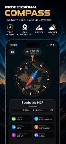



Description by 铸前 高 Written by the developer, not by AppBrain. Click to read.
Whether you are hiking through mountains, exploring a new city, camping in the wilderness, cycling on a trail, or recording your journey, this app helps you understand your location and surroundings anytime, anywhere.
POWERFUL GPS COMPASS & NAVIGATION
• Digital compass with magnetic north and true north
• Real-time direction, heading, and azimuth information
• GPS coordinates and current location details
• Quickly find your position wherever you go
ALTIMETER & ENVIRONMENT DATA
• Accurate altitude and elevation information
• Atmospheric pressure and magnetic field strength
• Temperature, feels-like temperature, humidity, UV index
• Visibility, wind speed, wind direction
• Sunrise and sunset times
• Oxygen level and water boiling point based on altitude
EXPLORE WITH ADVANCED MAPS
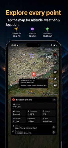
• View your location on interactive 3D maps
• Switch between standard, dark, and satellite maps
• Tap anywhere on the map to check coordinates, address, altitude, and weather information
• Discover new places with detailed location data
TRACK EVERY ADVENTURE
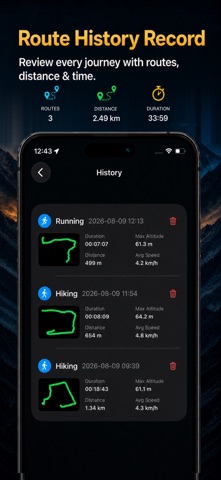
• Record hiking, walking, running, cycling, driving, and outdoor activities
• Save GPS routes and review your travel history
• Track distance, duration, average speed, maximum speed, highest and lowest elevation
GPS WATERMARK CAMERA
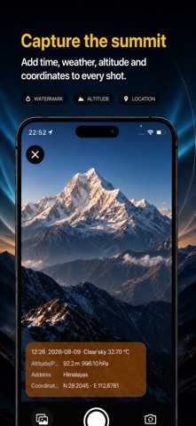
Capture memorable moments with location information.
Add useful details directly to your photos:
• GPS coordinates
• Date and time
• Altitude
• Weather conditions
• Temperature
• Pressure
• Address information
Perfect for:
• Hiking and mountain climbing
• Camping and outdoor adventures
• Travel and exploration
• Cycling and running
• Road trips
• Location recording and travel memories
Turn your phone into a complete outdoor companion. Know your direction, understand your environment, and keep a record of every place you discover.
User Agreement: https://www.apple.com/legal/internet-services/itunes/dev/stdeula/