

Compass GPS Altimeter
Compass GPS Altimeter is made and published by 成都关键元素科技有限公司. AppBrain is an independent app data site and isn't affiliated with 成都关键元素科技有限公司. The app name, icon, screenshots and description belong to 成都关键元素科技有限公司 and are shown as published on the App Store.
AppBrain's verdict
- Best rank
- #61
- Top Grossing, Japan
- Rating on App Store
- 4.17
- 6 ratings
- Last updated
- October 5, 2026
It doesn't have enough ratings yet to judge what users think. Its best ranking is #61 in Top Grossing, Travel in Japan.
Rankings
App Store top charts- Highest rank
- #61
- Chart
- Top Grossing
- Travel
- Country
- Japan
Competitors
Similar apps and more from 成都关键元素科技有限公司More from 成都关键元素科技有限公司


Releases
Updates seen on the App Store- Version
- 3.3.4
- Launched
- May 2025
No changelog data
User feedback
Ratings and reviews on the App StoreComments on Compass GPS Altimeter for iOS
We don't have enough comments to show example comments. Please check back later.
Technology
Found in the app by AppBrain- Price
- Free
- App size
- 34.7 MB
- Content rating
- Everyone
Technologies used by Compass GPS Altimeter
About the app and developer
About Compass GPS Altimeter
Compass GPS Altimeter is a travel app developed by 成都关键元素科技有限公司.
User Ratings
Compass GPS Altimeter is rated 4.17 out of 5 stars. The rating is based on 6 ratings.
App Information
Compass GPS Altimeter is freely available from the App Store. The app size is 34.69 MB. The latest version available is 3.3.4. The last update was on October 5, 2026.
Technical Requirements
The app has a content rating of Everyone. The app has been available on the App Store since May 2025.
Developer information for 成都关键元素科技有限公司
Address:
Store listing
By 成都关键元素科技有限公司, from the App Store


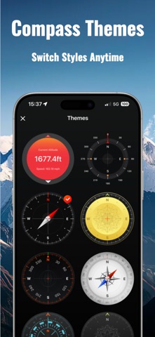

Description by 成都关键元素科技有限公司 Written by the developer, not by AppBrain. Click to read.
Engineered for hikers, mountaineers, campers, off-roaders, wildlife photographers, and field researchers, this professional-grade app provides hyper-accurate geographic and positioning data.
Whether navigating deep canyons or dense forests, the built-in offline GPS engine delivers precision metrics without cellular signal. Stay safe, connected, and oriented on every expedition.
---
Smart Compass & Navigation
1. Precision Compass: Real-time heading, coordinates (supports multiple grid systems), and current altitude.
2. Wind Angle Display: Track environmental wind direction changes—essential for campsite setup and outdoor photography.
3. Magnetic Field Monitoring: Detects local magnetic interference and issues warnings to ensure heading accuracy.
4. Qibla Finder: Automatically calculates the exact direction of Mecca based on your global position.
High-Precision Altimeter & Barometer
1. Multi-Source Altitude: Blends satellite GPS data with built-in barometric sensors to display absolute altitude, relative elevation, and vertical trends.
2. Comprehensive Weather Station: Real-time tracking for barometric pressure, temperature, humidity, wind speed, and sunrise/sunset times.
3. Terrain Risk Alerts: Analyzes rapid elevation changes to help mitigate physical exertion and altitude risks during alpine ascents or skiing.
4. Tap to Check Elevation (New): Interactive map upgrade—tap any point on the map to instantly reveal its elevation and live weather.
Professional Altitude Camera
1. Geo-Data Watermarking: Overlay timestamps, exact coordinates, altitude, magnetic strength, and wind angles directly onto your photos.
2. Field Documentation: Perfect for hiking check-ins, surveying, industrial inspections, and tamper-proof legal record-keeping.
GPS Track Recording & Analysis
1. Multi-Activity Tracking: Tailored modes for hiking, trail running, cycling, off-roading, and paddling.
2. Anti-Drift GPS Engine: Proprietary smoothing algorithm captures clean, precise tracks even under heavy tree canopy or mountainous terrain.
3. Post-Trip Review: Replay routes and examine vertical profile graphs to break down your performance.
Wilderness Survival System
1. 100% Offline Capability: Core positioning, compass tools, and track logs run completely independent of cellular networks.
2. Intelligent Hazards Alerts: Automatic warnings for severe pressure drops (storm alerts), rapid elevation gains, and magnetic anomalies.
3. One-Tap SOS Location: Generates an instant emergency text containing your precise coordinates and status for rapid search-and-rescue response.
---
Target Scenarios
Hiking & Mountaineering, Alpine Exploration, Wilderness Photography, Land Surveying, Off-Road Overlanding, Emergency SAR, Qibla Orientation.
---
Subscription & Auto-Renewal Details
1. Full Access Free Trial: New users receive a 3-day complimentary trial to unlock all premium features.
2. Auto-Renewal Policy: Subscriptions automatically renew unless auto-renew is turned off at least 24 hours prior to the end of the current billing cycle.
3. Account Management: Payment will be charged to your iTunes Account upon confirmation of purchase. Subscriptions can be managed or canceled in Account Settings on your iPhone.
4. Trial Forfeiture: Any unused portion of a free trial period will be forfeited when a premium subscription is purchased.
Terms of Service: https://docs.qq.com/doc/p/97cdbba9be34dbc1f6804390efdc7ef24972c038
Privacy Policy: https://docs.qq.com/doc/p/96ab925dd885b9b031999a3c86f6477459ce3493