

Compass i16 GeoTag GPS Camera
Compass i16 GeoTag GPS Camera is made and published by Tigran Mkhitaryan. AppBrain is an independent app data site and isn't affiliated with Tigran Mkhitaryan. The app name, icon, screenshots and description belong to Tigran Mkhitaryan and are shown as published on the App Store.
AppBrain's verdict
- Last updated
- May 19, 2025
- Size
- 7.78 MB
User feedback
Ratings and reviews on the App StoreComments on Compass i16 GeoTag GPS Camera for iOS
We don't have enough comments to show example comments. Please check back later.
Store listing
By Tigran Mkhitaryan, from the App Store


Description by Tigran Mkhitaryan Written by the developer, not by AppBrain. Click to read.
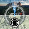
Dual-mode Compass – switch between True & Magnetic North with one tap; built-in calibration coach keeps sensors razor-accurate.
AR Viewfinder & Grid – horizon line, vanishing-point guides and a 15× zoom slider help you compose precision shots.
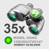
All Major Coordinate Systems – DMS, Decimal Degrees, UTM and MGRS/USNG, plus customizable date & time formats.
Sun & Moon Tracker – live rise/set arcs with exact local & GMT times for golden-hour planning.
Offline 2D/3D Maps – topo and satellite tiles cache automatically; keep navigating after the connection drops.
Instant Weather Panel – temperature, barometric pressure, wind speed, visibility and air-density readouts refreshed in real time.
Photo Overlay Capture – saves compass bearing, course, lat/long, altitude, timestamp and custom description into every shot.
Quick Share – export your annotated image or current location via Messages, AirDrop, email or any cloud drive.
Pro Settings – Metric/Imperial units, dark UI, flash toggle, sensor-status LEDs.
Perfect for
• Hikers, backpackers & overlanders
• Photographers lining up sunrise / sunset angles
• SAR, military & aviation crews needing MGRS accuracy
• Surveyors, field scientists and inspectors
• Urban explorers & weekend travelers:
Safety and technology
Found in the app by AppBrain- Price
- Free
- App size
- 7.78 MB
- Content rating
- Everyone
Technologies used by Compass i16 GeoTag GPS Camera
Releases
Updates seen on the App Store- Version
- 1.1
- Launched
- May 2025
No changelog data
Alternatives
Similar apps and more from Tigran MkhitaryanMore from Tigran Mkhitaryan





Rankings
App Store top chartsApp Store Rankings for Compass i16 GeoTag GPS Camera
About the app and developer
About Compass i16 GeoTag GPS Camera
Compass i16 GeoTag GPS Camera is a navigation app developed by Tigran Mkhitaryan.
User Ratings
The app has no ratings yet.
App Information
Compass i16 GeoTag GPS Camera is freely available from the App Store. The app size is 7.78 MB. The latest version available is 1.1. The last update was on May 19, 2025.
Technical Requirements
The app has a content rating of Everyone. The app has been available on the App Store since May 2025.
Developer information for Tigran Mkhitaryan
Address: