

Course d’Orientation GPS
Course d’Orientation GPS is made and published by Louis Questel. AppBrain is an independent app data site and isn't affiliated with Louis Questel. The app name, icon, screenshots and description belong to Louis Questel and are shown as published on the App Store.
AppBrain's verdict
- Last updated
- October 13, 2025
Rankings
App Store top chartsApp Store Rankings for Course d’Orientation GPS
Competitors
Similar apps and more from Louis QuestelMore from Louis Questel


Releases
Updates seen on the App Store- Version
- 1.0
- Launched
- October 2025
No changelog data
User feedback
Ratings and reviews on the App StoreComments on Course d’Orientation GPS for iOS
We don't have enough comments to show example comments. Please check back later.
Technology
Found in the app by AppBrain- Price
- Free
- App size
- 5.50 MB
- Content rating
- Everyone
Technologies used by Course d’Orientation GPS
About the app and developer
About Course d’Orientation GPS
Course d’Orientation GPS is a sports app developed by Louis Questel.
User Ratings
The app has no ratings yet.
App Information
Course d’Orientation GPS is freely available from the App Store. The app size is 5.50 MB. The latest version available is 1.0. The last update was on October 13, 2025.
Technical Requirements
The app has a content rating of Everyone. The app has been available on the App Store since October 2025.
Developer information for Louis Questel
Address:
Store listing
By Louis Questel, from the App Store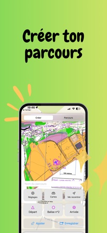



Description by Louis Questel Written by the developer, not by AppBrain. Click to read.
Mode Création
• Placez départ, arrivée et balises numérotées.
• Importez une image de carte et calibrez-la en 2 points GPS (zoom/pan précis).
• Ajustez et verrouillez échelle / rotation / opacité de la carte.
• Enregistrez/ouvrez vos parcours (JSON) et partagez-les.
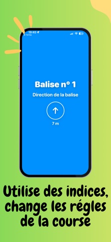
Mode Parcours
• Démarrez quand vous êtes proche du départ.
• Validation automatique par GPS (rayon réglable) ou validation manuelle avec tentatives limitées.
• Demandez un indice (boussole directionnelle) pour vous guider.
• Suivez votre trace GPS en temps réel.
Résultats et partage
• Recevez une image récapitulative : temps, balises validées, indices/refus, trace, nom du parcours et du participant.
• Enregistrez et partagez en un geste.
Pensé pour l’EPS et l’extérieur
• Fonctionne hors ligne.
• Localisation “Lorsque l’app est active” uniquement, pour valider les balises.
• Idéal pour profs d’EPS, clubs, associations, sorties nature ou événements.