

Digital ROW Utilities
Digital ROW Utilities is made and published by PurposeBuilt Systems, LLC. AppBrain is an independent app data site and isn't affiliated with PurposeBuilt Systems, LLC. The app name, icon, screenshots and description belong to PurposeBuilt Systems, LLC and are shown as published on the App Store.
AppBrain's verdict
- Last updated
- September 13, 2026
Rankings
App Store top chartsApp Store Rankings for Digital ROW Utilities
Competitors
Similar apps and more from PurposeBuilt Systems, LLCAlternatives to Digital ROW Utilities





More from PurposeBuilt Systems, LLC

Releases
Updates seen on the App Store- Version
- 1.0.2
- Launched
- April 2026
No changelog data
User feedback
Ratings and reviews on the App StoreComments on Digital ROW Utilities for iOS
We don't have enough comments to show example comments. Please check back later.
Technology
Found in the app by AppBrain- Price
- Free
- App size
- 50.1 MB
- Content rating
- Everyone
Technologies used by Digital ROW Utilities
About the app and developer
About Digital ROW Utilities
Digital ROW Utilities is an utilities app developed by PurposeBuilt Systems, LLC.
User Ratings
The app has no ratings yet.
App Information
Digital ROW Utilities is freely available from the App Store. The app size is 50.08 MB. The latest version available is 1.0.2. The last update was on September 13, 2026.
Technical Requirements
The app has a content rating of Everyone. The app has been available on the App Store since April 2026.
Developer information for PurposeBuilt Systems, LLC
Address:
Store listing
By PurposeBuilt Systems, LLC, from the App Store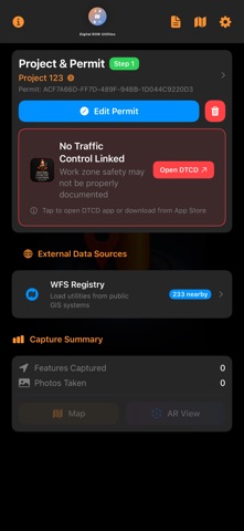



Description by PurposeBuilt Systems, LLC Written by the developer, not by AppBrain. Click to read.
CAPTURE UTILITY ASSETS
• Point and linear feature capture with iPhone GPS
• AI-powered infrastructure detection (fire hydrants, manholes, valve boxes)
• LiDAR depth measurement on iPhone Pro models
• Material certification scanning — photograph a cert tag and auto-fill specs via OCR
• Upload cert PDFs for provenance tracking
• Geotagged photo documentation
ASCE 75-22 COMPLIANT
• All Table 2-4 mandatory attributes included
• Quality Level auto-calculated from GPS accuracy
• Positional Accuracy Levels
• Feature types, conveyance, cross-section, dimensions
• Data certification with SHA-256 audit trails
AR VISUALIZATION
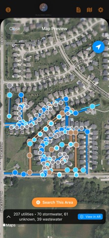
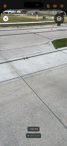
• View WFS utility data overlaid in augmented reality
• See captured assets, imported KML files, and digitized PDF plan sheets - all layers at once
• Utility-color-coded by domain (water, sewer, gas, electric, telecom)
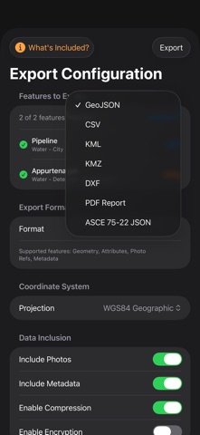
EXPORT 11 FORMATS
• GeoJSON, CSV, KML, KMZ, DXF, PDF Report, and more
• Material cert PDFs bundled in KMZ exports
• Real coordinate projections (WGS84, Web Mercator, UTM)
• AES-GCM encryption for sensitive infrastructure data
FIELD WORKFLOW
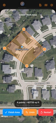
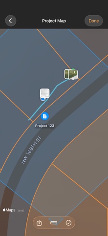
• Permit management with work area mapping
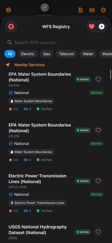
• WFS catalog with 230+ utility data sources nationwide
• Cross-app integration with Digital Traffic Control Diary
• Material cert photo saved with each asset for traceability
GPS & POSITIONING
• iPhone GPS with auto-calculated quality levels
• External GNSS & RTK support in beta testing - visit purposebuilt.systems to participate
• 18 state CORS networks pre-configured including Iowa IaRTN
Built by Purpose Built Systems for contractors, utility engineers, and DOT inspectors who need professional field documentation.
Visit https://purposebuilt.systems for beta testing, support, and updates.