
Forest Maps 2
Forest Maps 2 is made and published by Kinnaman Software LLC. AppBrain is an independent app data site and isn't affiliated with Kinnaman Software LLC. The app name, icon, screenshots and description belong to Kinnaman Software LLC and are shown as published on the App Store.
AppBrain's verdict
EstablishedLoved by users- Rating on App Store
- 4.71
- 594 ratings
- Last updated
- June 16, 2022
Users love it: 4.7 stars from 594 ratings.
Rankings
App Store top chartsApp Store Rankings for Forest Maps 2
Competitors
Similar apps and more from Kinnaman Software LLCAlternatives to Forest Maps 2






More from Kinnaman Software LLC

Releases
Updates seen on the App Store- Version
- 2.7.2
- Launched
- September 2017
No changelog data
User feedback
Ratings and reviews on the App StoreComments on Forest Maps 2 for iOS
We don't have enough comments to show example comments. Please check back later.
Technology
Found in the app by AppBrain- Price
- Free
- App size
- 95.1 MB
- Content rating
- Everyone
Technologies used by Forest Maps 2
About the app and developer
About Forest Maps 2
Forest Maps 2 is a navigation app developed by Kinnaman Software LLC.
User Ratings
Forest Maps 2 is rated 4.71 out of 5 stars. The rating is based on 590 ratings.
App Information
Forest Maps 2 is freely available from the App Store. The app size is 95.13 MB. The latest version available is 2.7.2. The last update was on June 16, 2022.
Technical Requirements
The app has a content rating of Everyone. The app has been available on the App Store since September 2017.
Developer information for Kinnaman Software LLC
Address:
Store listing
By Kinnaman Software LLC, from the App Store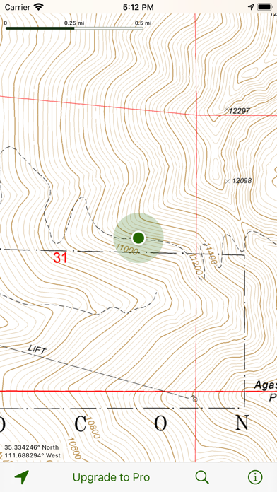
Description by Kinnaman Software LLC Written by the developer, not by AppBrain. Click to read.
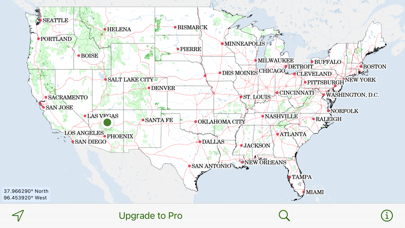
Save favorite spots with map markers that use iCloud to synchronize across your devices.
Upgrade to Pro and get:
• Map downloads. Going off the grid? Download entire forests for use when the Internet is unavailable. GPS-enabled devices such as the iPhone and the Wi-Fi + Cellular iPad show your current location on the map, even when you have no network connection.
• Track recording. Record your track to see where you've been. Each track shows its distance, duration, average speed, and elevation profile. Share your tracks with other Forest Maps users, open them in Google Earth, or export to a GPX file.
This app was not created by and is not affiliated with the United States National Forest Service.