

Geoglight is made and published by keiji matsumoto. AppBrain is an independent app data site and isn't affiliated with keiji matsumoto. The app name, icon, screenshots and description belong to keiji matsumoto and are shown as published on the App Store.
AppBrain's verdict
- Last updated
- October 14, 2026
Rankings
App Store top chartsApp Store Rankings for Geoglight
Competitors
Similar apps and more from keiji matsumotoMore from keiji matsumoto





Releases
Updates seen on the App Store- Version
- 1.0.5
- Launched
- June 2026
No changelog data
User feedback
Ratings and reviews on the App StoreComments on Geoglight for iOS
We don't have enough comments to show example comments. Please check back later.
Technology
Found in the app by AppBrain- Price
- Free
- App size
- 14.1 MB
- Content rating
- Everyone
Technologies used by Geoglight
About the app and developer
About Geoglight
Geoglight is a navigation app developed by keiji matsumoto.
What is the rating of Geoglight?
Geoglight has no ratings yet.
Is Geoglight free?
Geoglight is free. The app size is 14.13 MB. The latest version available is 1.0.5. The last update was on October 14, 2026.
What are the requirements for Geoglight?
The app has a content rating of Everyone. The app has been available on the App Store since June 2026.
Developer information for keiji matsumoto
Address:
Frequently asked questions about Geoglight
Is Geoglight free?
Yes. Geoglight is free on the App Store.
Is Geoglight still available?
Yes. Geoglight is on the App Store, and the last update we saw was on October 14, 2026.
How large is Geoglight?
Geoglight is 14.13 MB.
Is Geoglight suitable for children?
App Store rates the content of Geoglight as suitable for everyone.
Who made Geoglight?
Geoglight was developed by keiji matsumoto. It is listed in the navigation category on the App Store.
Store listing
By keiji matsumoto, from the App Store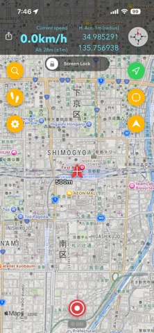

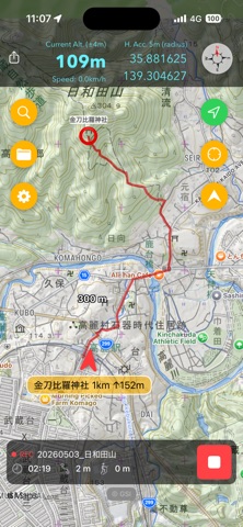

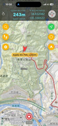
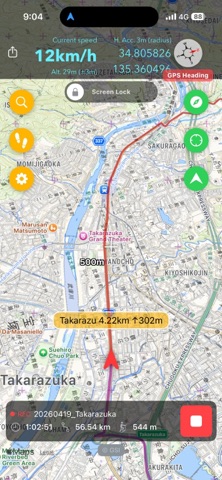
Description by keiji matsumoto Written by the developer, not by AppBrain. Click to read.
Key Features
- Start and stop GPS track recording with a single tap
- Switch between GSI maps / OpenStreetMap / OpenTopoMap
- View cached map tiles even offline
- Accurate elevation recording using elevation tiles in Japan
- Stable background recording
- Export in GPX format
- Import GPX / KML files
- Automatic backup and restore to Google Drive
- A lightweight app focused purely on GPS track recording and management, without unnecessary features. Perfect for hiking, cycling, walking, and travel logging.
Terms of Use (EULA): https://www.apple.com/legal/internet-services/itunes/dev/stdeula/
Privacy Policy: https://kzi.jp/privacy-policy.html