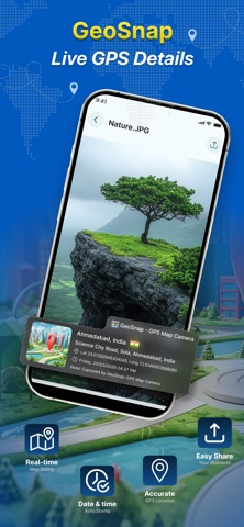
GeoSnap- GPS Map Camera is made and published by
Tejas Patel.
AppBrain is an independent app data site and isn't affiliated with Tejas Patel.
The app name, icon, screenshots and description belong to Tejas Patel and are shown as
published on the App Store.
About GeoSnap- GPS Map Camera
GeoSnap- GPS Map Camera is a photo & video app developed by Tejas Patel.
User Ratings
The app has no ratings yet.
App Information
GeoSnap- GPS Map Camera is freely available from the App Store. The app size is 85.82 MB. The latest version available is 2.0.4. The last update was on September 25, 2026.
Technical Requirements
The app has a content rating of Everyone. The app has been available on the App Store since March 2026.
Description by Tejas Patel(from the App Store)
GeoSnap – GPS Map Camera
Turn every photo into a clear record of where and when it was captured with GeoSnap, a powerful GPS Map Camera and Location Stamp Camera.
GeoSnap adds GPS coordinates, location, address, date, time, and map information directly to your photos. Whether you're working on a construction site, inspecting a property, conducting a field survey, or exploring a new destination, GeoSnap helps you capture location-based photos quickly and easily.
Key Features
GPS Map Camera
Capture photos with your current GPS location and map details directly on the image.
GPS Photo Stamp
Add location information to photos so you can easily identify where the photo was taken.
Location & Address Stamp
Display the location and address on your photos for better documentation.
GPS Coordinates
Show latitude and longitude coordinates on your images.
Date & Time Stamp
Automatically add the date and time to captured photos.
Map Overlay
Show a map location along with your photo for better visual context.
Geotagged Photos
Create photos with useful location information for records, reports, and documentation.
Easy Photo Sharing
Share GPS-stamped photos with clients, colleagues, teams, or on social media.
Simple & Fast Camera
Capture and stamp photos without complicated setup.
Industries & Use Cases
Construction & Infrastructure
Document construction progress, site conditions, inspections, and completed work with GPS-stamped photos.
Real Estate
Capture property visits, site locations, inspections, and property conditions with location and date information.
Surveying & Engineering
Record field survey locations, measurements, site observations, and project activities with GPS coordinates.
Inspection & Field Service
Create location-based photo records during inspections, maintenance visits, service calls, and field operations.
NGOs & Field Surveys
Document field activities, surveys, community visits, environmental work, and project locations with geotagged photos.
Manufacturing
Capture plant inspections, equipment conditions, maintenance activities, and site documentation with location details.
Logistics & Delivery
Create photo records for deliveries, site visits, and field activities with date, time, and location information.
Travel
Capture travel memories with GPS location, map, date, and time details so you can remember exactly where your photos were taken.
Field Teams
Help field employees create consistent photo documentation while working across different locations. Turn Photos Into Location Proof
A normal photo tells a story.
A GeoSnap GPS photo can show the story, location, date, time, and coordinates together. Use GeoSnap whenever you need reliable location-stamped photos, GPS photo documentation, or geotagged images.
Perfect For
GPS Map Camera GPS Photo Stamp Location Stamp Camera GPS Coordinates Geotagged Photos Date & Time Stamp Property Documentation Construction Site Photos Field Surveys Site Inspections Real Estate Visits Travel Photos
Capture it. Locate it. Document it.
Download GeoSnap – GPS Map Camera and make every important photo more informative.
Each subscription will automatically renew 3 days before the expiration date for
the same time period. Subscriptions can be cancelled at any time before the renewal.