

Geotag Photos: GPS Map Camera
Geotag Photos: GPS Map Camera is made and published by Mazahr Kaleem. AppBrain is an independent app data site and isn't affiliated with Mazahr Kaleem. The app name, icon, screenshots and description belong to Mazahr Kaleem and are shown as published on the App Store.
AppBrain's verdict
- Best rank
- #84
- Top Grossing, India
- Last updated
- July 13, 2026
Rankings
App Store top charts- Highest rank
- #84
- Chart
- Top Grossing
- Travel
- Country
- India
App Store Rankings for Geotag Photos: GPS Map Camera
Top rankings
| Rank | Country | Category | List |
|---|---|---|---|
| 84 | India | Travel | Top Grossing |
Ranking history in India
Competitors
Similar apps and more from Mazahr KaleemAlternatives to Geotag Photos: GPS Map Camera


More from Mazahr Kaleem


Releases
Updates seen on the App Store- Version
- 2.2
- Launched
- October 2024
No changelog data
User feedback
Ratings and reviews on the App StoreComments on Geotag Photos: GPS Map Camera for iOS
We don't have enough comments to show example comments. Please check back later.
Technology
Found in the app by AppBrain- Price
- Free
- App size
- 34.7 MB
- Content rating
- Everyone
Technologies used by Geotag Photos: GPS Map Camera
About the app and developer
About Geotag Photos: GPS Map Camera
Geotag Photos: GPS Map Camera is a travel app developed by Mazahr Kaleem.
What is the rating of Geotag Photos: GPS Map Camera?
Geotag Photos: GPS Map Camera has no ratings yet.
Is Geotag Photos: GPS Map Camera free?
Geotag Photos: GPS Map Camera is free. The app size is 34.68 MB. The latest version available is 2.2. The last update was on July 13, 2026.
What are the requirements for Geotag Photos: GPS Map Camera?
The app has a content rating of Everyone. The app has been available on the App Store since October 2024.
Developer information for Mazahr Kaleem
Address:
Frequently asked questions about Geotag Photos: GPS Map Camera
Is Geotag Photos: GPS Map Camera free?
Yes. Geotag Photos: GPS Map Camera is free on the App Store.
Is Geotag Photos: GPS Map Camera still available?
Yes. Geotag Photos: GPS Map Camera is on the App Store, and the last update we saw was on July 13, 2026.
How large is Geotag Photos: GPS Map Camera?
Geotag Photos: GPS Map Camera is 34.68 MB.
Is Geotag Photos: GPS Map Camera suitable for children?
App Store rates the content of Geotag Photos: GPS Map Camera as suitable for everyone.
Who made Geotag Photos: GPS Map Camera?
Geotag Photos: GPS Map Camera was developed by Mazahr Kaleem. It is listed in the travel category on the App Store.
What are the best alternatives to Geotag Photos: GPS Map Camera?
People looking at Geotag Photos: GPS Map Camera also look at these travel apps: GPS Camera : Timestamp Photo, GPS Map Camera - Geo Timestamp, MapStamp - GPS Map Camera, Find This Place, تحويل العملات.
Store listing
By Mazahr Kaleem, from the App Store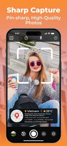


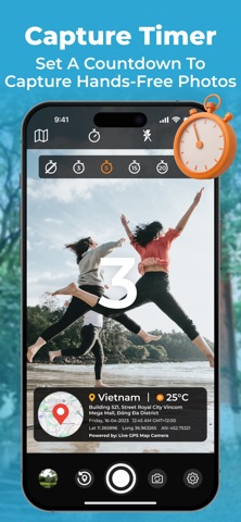


Description by Mazahr Kaleem Written by the developer, not by AppBrain. Click to read.
Capture, Locate, and Share:
Ever wanted to capture a moment and instantly know its exact location? Geotag Photos: GPS Map Camera is your answer. This innovative iOS app combines the power of a camera with the precision of GPS technology, allowing you to geotag your photos effortlessly.
Elevate your photography experience with the Live GPS Map Camera, a powerful geotag map camera designed for explorers and memory makers. This innovative GPS camera lets you capture stunning images while automatically embedding precise coordinates, ensuring every moment is tagged with accurate photo navigation data.
Key Features:
Real-time GPS Tracking: Accurately pinpoint your location while taking photos, ensuring each image is tagged with its precise coordinates.
Interactive Map Integration: View your captured photos on a real-time map, making it easy to navigate and relive your adventures.
Seamless Geotagging: Automatically embed GPS data into your photos, creating a valuable record of where they were taken.
Precise Coordination: Access detailed latitude and longitude information for each photo, perfect for sharing with friends, family, or fellow explorers.
Enhanced Photo Navigation: Use the map to find and revisit specific locations captured in your photos.
Versatile Photo Tagging: Add additional tags or descriptions to your photos for better organization and search capabilities.
Intuitive User Interface: Enjoy a user-friendly design that makes geotagging a breeze, even for beginners.
Why Choose Geotag Photos: GPS Map Camera?
Experience the ultimate in geotagging with our geo tagging camera and transform your geo pictures into memorable stories. With support for GPS map camera geotag photos, your images will never lose their context.
Adventure Enthusiasts: Capture and document your outdoor adventures, hikes, and travels with precision.
Travelers: Create a personalized photo journal of your trips, complete with location information.
Photographers: Enhance your photography by adding a geotag dimension to your work.
Real Estate Professionals: Capture property listings with accurate location data.
Researchers and Field Workers: Document field observations and data collection with ease.
https://sites.google.com/view/gamingworldltd/home
https://sites.google.com/view/mazhar-kaleem-terms-of-use/home