GPS Area Measure Map is an overall app developed by Kuldeep Ghoghari.
How many times has GPS Area Measure Map been downloaded?
What is the rating of GPS Area Measure Map?
GPS Area Measure Map has no ratings yet.
Is GPS Area Measure Map free?
GPS Area Measure Map is free to download. The APK download size is 71.74 MB. The latest version available is 4.0. The last update was on December 31, 2025.
What are the requirements for GPS Area Measure Map?
The app has a content rating of High Maturity. The app has been available on Google Play June 2025.
Description
Measure, Map, and Mark — All in One App!
GPS Area Measure Map is a powerful, easy-to-use GPS measurement tool designed to help users calculate area, distance, and accurately mark locations on the map—perfect for professionals and enthusiasts across agriculture, landscaping, construction, real estate, and outdoor activities. Whether you’re measuring a large farm, mapping out a construction site, or simply tracking your hiking route, this app provides a comprehensive set of tools in a sleek and user-friendly interface.
With GPS Area Measure Map, you can instantly calculate the size of any land parcel or surface by placing points on the map or by walking/driving around the perimeter. The built-in GPS and satellite view provide precise geolocation capabilities to ensure highly accurate measurements, making your mapping tasks simpler and more reliable.
Key Features:
Distance Measure: Measure the distance between any two or more points on the map. Ideal for planning routes, measuring travel paths, or checking property lengths.
Area Size Calculator: Easily calculate the total area of any polygon you draw on the map. Whether it's a garden, a field, or an entire estate, just tap around the borders to instantly get size estimates.
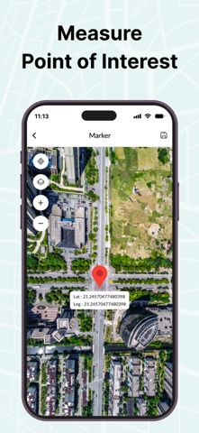
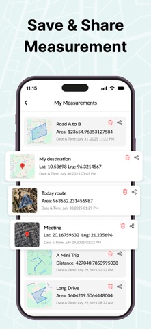
Mark Location: Pinpoint and save important locations with custom markers. Perfect for noting landmarks, property boundaries, water sources, or waypoints during travel.
Various map modes: standard, terrain, hybrid, and satellite. Each view provides unique insights to suit your needs — from land structure to elevation.
Satellite Compass: Leverage satellite imagery combined with a digital compass to better understand orientation and direction in any location. Ideal for aligning property lines or navigating unfamiliar terrain.
Camera Compass: Use your device’s camera in augmented reality mode with an integrated compass overlay to enhance on-ground surveying and navigation.
Speedometer: Real-time speed tracking for walking, biking, or driving—useful for field scouting or travel logs.
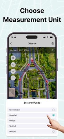
Multiple Units Supported: Choose from various measurement units such as meters, kilometers, feet, miles, acres, and hectares to suit your region and project requirements.
Simple Interface: A clean, intuitive interface that makes mapping fast and hassle-free, even for beginners. All tools are accessible with minimal taps and clear visuals.
Whether you're a farmer, engineer, surveyor, contractor, or a curious explorer, GPS Area Measure Map transforms your iPhone into a robust field measurement tool. Download today and start measuring with confidence and precision!
Each subscription will automatically renew 3 days before the expiration date for
the same time period. Subscriptions can be cancelled at any time before the renewal.