

GPS Camera: Live Map & Geotag
GPS Camera: Live Map & Geotag is made and published by rida el hachmi. AppBrain is an independent app data site and isn't affiliated with rida el hachmi. The app name, icon, screenshots and description belong to rida el hachmi and are shown as published on the App Store.
AppBrain's verdict
- Rating on App Store
- 5.00
- 1 ratings
- Last updated
- April 4, 2026
It doesn't have enough ratings yet to judge what users think.
Rankings
App Store top chartsApp Store Rankings for GPS Camera: Live Map & Geotag
Competitors
Similar apps and more from rida el hachmiAlternatives to GPS Camera: Live Map & Geotag


More from rida el hachmi


Releases
Updates seen on the App Store- Version
- 1.3
- Launched
- March 2026
No changelog data
User feedback
Ratings and reviews on the App StoreComments on GPS Camera: Live Map & Geotag for iOS
We don't have enough comments to show example comments. Please check back later.
Technology
Found in the app by AppBrain- Price
- Free
- App size
- 5.98 MB
- Content rating
- Everyone
Technologies used by GPS Camera: Live Map & Geotag
About the app and developer
About GPS Camera: Live Map & Geotag
GPS Camera: Live Map & Geotag is a navigation app developed by rida el hachmi.
What is the rating of GPS Camera: Live Map & Geotag?
GPS Camera: Live Map & Geotag is rated 5.00 out of 5 stars, based on one rating ratings.
Is GPS Camera: Live Map & Geotag free?
GPS Camera: Live Map & Geotag is free. The app size is 5.98 MB. The latest version available is 1.3. The last update was on April 4, 2026.
What are the requirements for GPS Camera: Live Map & Geotag?
The app has a content rating of Everyone. The app has been available on the App Store since March 2026.
Developer information for rida el hachmi
Address:
Frequently asked questions about GPS Camera: Live Map & Geotag
Is GPS Camera: Live Map & Geotag free?
Yes. GPS Camera: Live Map & Geotag is free on the App Store.
Is GPS Camera: Live Map & Geotag still available?
Yes. GPS Camera: Live Map & Geotag is on the App Store, and the last update we saw was on April 4, 2026.
How large is GPS Camera: Live Map & Geotag?
GPS Camera: Live Map & Geotag is 5.98 MB.
Is GPS Camera: Live Map & Geotag suitable for children?
App Store rates the content of GPS Camera: Live Map & Geotag as suitable for everyone.
How do people rate GPS Camera: Live Map & Geotag?
GPS Camera: Live Map & Geotag has one rating of 5.00 stars on the App Store.
Who made GPS Camera: Live Map & Geotag?
GPS Camera: Live Map & Geotag was developed by rida el hachmi. It is listed in the navigation category on the App Store.
What are the best alternatives to GPS Camera: Live Map & Geotag?
People looking at GPS Camera: Live Map & Geotag also look at these navigation apps: Max Taxi Customer, Travel Camera - Timestamp, GPS Simulator Tool - Routes Go, RABA Taxi - South Sudan, MapStamp - GPS Map Camera.
Store listing
By rida el hachmi, from the App Store
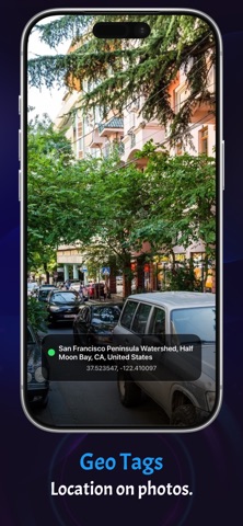
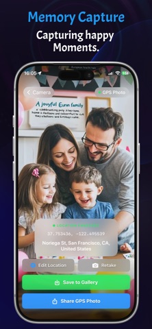

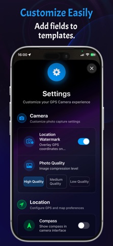
Description by rida el hachmi Written by the developer, not by AppBrain. Click to read.
Capture your moments with accurate GPS location, live map, and smart geotags — all in one photo.
GPS Camera turns every picture into a powerful memory by adding real-time location data, including coordinates, address directly onto your photos.
Whether you're traveling, working, or documenting important events, GPS Camera ensures your photos are organized, verifiable, and location-rich.
Key Features :
-GPS Camera
Capture photos with real-time location data
- Live Map View
See your exact location while taking photos
- Auto GeoTagging
Add coordinates & address
- Photo Evidence Ready
Perfect for work reports, delivery proof, or documentation
- Accurate & Fast
High-precision GPS tagging with smooth performance
Perfect For :
- Travelers & explorers
- Field workers & engineers
- Delivery & logistics proof
- Real estate & inspections
- Everyday memory capturing
Legal :
-Terms of Use : https://livepincameraapp.blogspot.com/p/terms-of-use.html
-Privacy Policy : https://livepincameraapp.blogspot.com/p/privacy-policy.html