




AppBrain's verdict
- Rating on App Store
- 4.60
- 15 ratings
- Last updated
- April 29, 2026
- Size
- 89.9 MB
It doesn't have enough ratings yet to judge what users think.
User feedback
Ratings and reviews on the App StoreComments on GPS Map Camera - Geotag Photo for iOS
We don't have enough comments to show example comments. Please check back later.
Store listing
By Sejalben Nimeshkumar Savaliya, from the App StoreDescription by Sejalben Nimeshkumar Savaliya Written by the developer, not by AppBrain. Click to read.
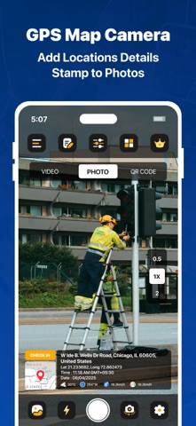
Struggling to recall where you took that perfect photo? GPS Map Camera 2025 helps you geotag your photos and videos with location, date, time, latitude, longitude, altitude, and weather — all in real-time.
Whether you're a traveler, blogger, or professional, this app lets you capture and stamp your moments with essential location details to preserve your memories with precision.
Key Features:
Custom GPS Camera with grid, ratio, selfie mode, flash, front camera, selfie camera, focus, mirror, timer, dashcam mode, dashcamera level, capture sound, scenes & filters
QR Code Scanner for fast, easy, and reliable scanning anytime.
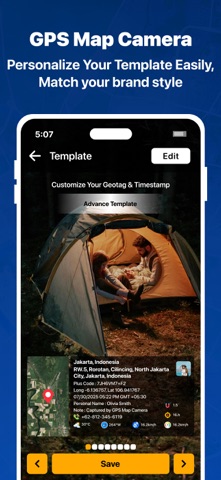
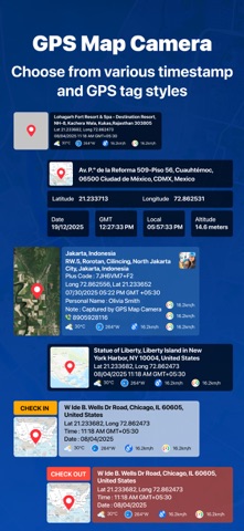
Classic Template includes auto-fetched stamp details like date, time, geolocation tags, timestamps, location, and more.
GPS Location Stamp
Automatically adds your real-time address when taking photos.
Date & Time Stamp
Embed the exact time and date you capture each photo or video.
GPS Map on Photos
Overlay live map view (normal, satellite, terrain, hybrid) onto your images.
Latitude & Longitude
Display GPS coordinates to pinpoint exact photo location.
Altitude Stamp
Add the elevation level of your current location.
Address Stamp
Use manual or auto location to mark your address on images.
Accuracy
Capture photos with auto-calculated location accuracy info.
Geo-Tagging Camera (GPS Camera tags)
Photos are saved with precise location metadata for future reference.
Real-Time Preview
See live previews of all stamps before clicking a photo.
Perfect For:
- Intelligent Location Auto-Tagging - Auto Tag Locations
- Travelers, Photographers & Adventurers
- Existing photo geotagging
- Real Estate & Construction Pros
- Automatic GPS coordinates in real-time
- Event Shooters: Weddings, Festivals, Birthdays
- Smart album creation
- capture photos and videos
- High-resolution photo and video capture
- Corporate Field Visits & Meetings
- Customizable folder templates
- Lifestyle, Food & Travel Bloggers
- Local Business Promotions
- High-quality video recording
- Smart location recognition system
With GPS Map Camera, every image becomes a detailed memory — ready to be shared with friends, family, or colleagues, complete with its exact location and moment captured.
By using this app, you confirm that you acknowledge and accept our Privacy Policy and Terms of Service:
Privacy Policy: https://sejaliosapps.blogspot.com/2025/09/privacy-policy-gps-map-camera-geotag.html
Terms of Service: https://sejaliosapps.blogspot.com/2025/09/terms-conditions-gps-map-camera-geotag.html
Safety and technology
Found in the app by AppBrain- Price
- Free
- App size
- 89.9 MB
- Content rating
- Everyone
Technologies used by GPS Map Camera - Geotag Photo
Releases
Updates seen on the App Store- Version
- 1.5
- Launched
- September 2025
No changelog data
Alternatives
Similar apps and more from Sejalben Nimeshkumar SavaliyaMore from Sejalben Nimeshkumar Savaliya


Rankings
App Store top chartsApp Store Rankings for GPS Map Camera - Geotag Photo
About the app and developer
About GPS Map Camera - Geotag Photo
GPS Map Camera - Geotag Photo is a photo & video app developed by Sejalben Nimeshkumar Savaliya.
User Ratings
GPS Map Camera - Geotag Photo is rated 4.60 out of 5 stars. The rating is based on 15 ratings.
App Information
GPS Map Camera - Geotag Photo is freely available from the App Store. The app size is 89.91 MB. The latest version available is 1.5. The last update was on April 29, 2026.
Technical Requirements
The app has a content rating of Everyone. The app has been available on the App Store since September 2025.
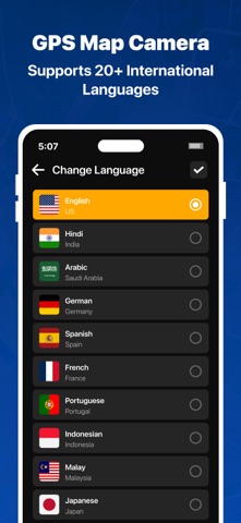
GPS Map Camera - Geotag Photo is made and published by Sejalben Nimeshkumar Savaliya. AppBrain is an independent app data site and isn't affiliated with Sejalben Nimeshkumar Savaliya. The app name, icon, screenshots and description belong to Sejalben Nimeshkumar Savaliya and are shown as published on the App Store.
Developer information for Sejalben Nimeshkumar Savaliya
Address: