GPX Trail Maps is made and published by
Aric Thomas.
AppBrain is an independent app data site and isn't affiliated with Aric Thomas.
The app name, icon, screenshots and description belong to Aric Thomas and are shown as
published on the App Store.
About GPX Trail Maps
GPX Trail Maps is a health & fitness app developed by Aric Thomas.
What is the rating of GPX Trail Maps?
GPX Trail Maps has no ratings yet.
Is GPX Trail Maps free?
GPX Trail Maps is free. The app size is 5.55 MB. The latest version available is 1.1. The last update was on April 9, 2026.
What are the requirements for GPX Trail Maps?
The app has a content rating of Everyone. The app has been available on the App Store since April 2026.
Description by Aric Thomas(from the App Store)
GPX Trail Maps lets you record, upload, and explore all your hiking trails on a stunning interactive map.
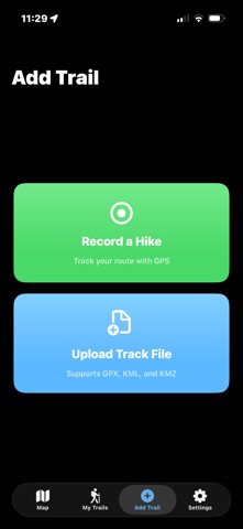
RECORD YOUR HIKES Hit record and start hiking. GPX Trail Maps tracks your route in real-time using GPS, even when your phone is locked or the app is in the background. See your distance, duration, elevation gain, and estimated step count when you're done.
HIKE DETAILS Every hike captures the weather from when you hiked — conditions, temperature, wind, and precipitation — alongside start and end times. Attach photos to remember the view from the trail.
UPLOAD YOUR TRAILS Already have GPX or KML files from other apps or GPS devices? Import them with a tap. Supports GPX, KML, and KMZ file formats. Upload multiple files at once.
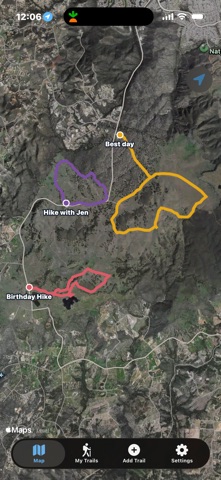
SEE YOUR TRAILS ON THE MAP Every hike you record or import appears as a colorful trail on a beautiful satellite map. Zoom out to see all your adventures across the world, or tap a trail to see the full route with start and end markers.
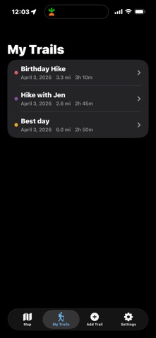
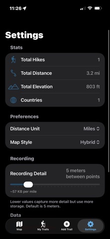
TRACK YOUR STATS View distance, duration, elevation gain, and estimated steps for every hike. See your total stats including countries visited, total distance, and total elevation in Settings.
FINE-TUNE YOUR RECORDING Adjust how often GPS points are captured to balance trail precision with storage. See the estimated storage cost per mile before you hike.
EXPORT & SHARE Export any hike as a standard GPX file. Share with friends via AirDrop, email, or save to Files.
SIMPLE & FUNCTIONAL No account required. No subscriptions. Your data stays on your device. Just open the app and start hiking.
Features: • Record hikes with real-time GPS tracking • Weather history for every recorded hike • Estimated step count • Photo attachments for your trails • Start and end times for every hike • Adjustable GPS recording detail with storage estimates • Import GPX, KML, and KMZ trail files • View all trails on a satellite, hybrid, or standard map • Track distance, duration, and elevation gain • Export hikes as GPX files • Background recording — works with screen locked • GPS spike filtering for clean trail lines • Miles or kilometers — your choice • Rename and manage your trail collection
Each subscription will automatically renew 3 days before the expiration date for
the same time period. Subscriptions can be cancelled at any time before the renewal.