

Himika Navi
Himika Navi is made and published by PLANNERS HIGH, LIMITED LIABILITY CO. AppBrain is an independent app data site and isn't affiliated with PLANNERS HIGH, LIMITED LIABILITY CO. The app name, icon, screenshots and description belong to PLANNERS HIGH, LIMITED LIABILITY CO. and are shown as published on the App Store.
AppBrain's verdict
- Last updated
- March 17, 2022
Rankings
App Store top chartsApp Store Rankings for Himika Navi
Competitors
Similar apps and more from PLANNERS HIGH, LIMITED LIABILITY CO.Alternatives to Himika Navi





More from PLANNERS HIGH, LIMITED LIABILITY CO.


Releases
Updates seen on the App Store- Version
- 1.2.2
- Launched
- January 2020
No changelog data
User feedback
Ratings and reviews on the App StoreComments on Himika Navi for iOS
We don't have enough comments to show example comments. Please check back later.
Technology
Found in the app by AppBrain- Price
- Free
- App size
- 18.1 MB
- Content rating
- Everyone
Technologies used by Himika Navi
About the app and developer
About Himika Navi
Himika Navi is a travel app developed by PLANNERS HIGH, LIMITED LIABILITY CO.
User Ratings
The app has no ratings yet.
App Information
Himika Navi is freely available from the App Store. The app size is 18.13 MB. The latest version available is 1.2.2. The last update was on March 17, 2022.
Technical Requirements
The app has a content rating of Everyone. The app has been available on the App Store since January 2020.
Developer information for PLANNERS HIGH, LIMITED LIABILITY CO.
PLANNERS HIGH, LIMITED LIABILITY CO.
Address:
Store listing
By PLANNERS HIGH, LIMITED LIABILITY CO., from the App Store

Description by PLANNERS HIGH, LIMITED LIABILITY CO. Written by the developer, not by AppBrain. Click to read.
This application is designed to have a pleasant stay at Yoshinogari Historical Park.
You can access all kinds of interesting contents including facility information, spot descriptions, a stamp library that provide pictures taken at the time of the excavation, your own snapshots, and more.
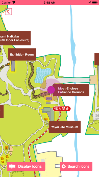
■ Park Map
The Yoshinogari Historical Park map presents your current location, various spots in the park, facilities, and other information.
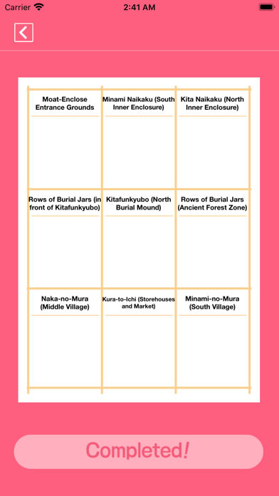
■ Stamp Collection
When you visit certain spots in the park, you can collect stamps that allow you to see photos of those spots taken at the time of the excavation.
Let's walk around Yoshinogari Historical Park to complete your stamp collection!
Once you collect all the stamps, you could get an park original completion certificate!
■ Take a Snapshot
You can take snapshots with original frames available in the app.
*You need Internet connection to access some of the contents.
*You need to enable the GPS function to be able to collect the stamps.
*You need to allow the application to access your camera and storage to be able to use the snapshot function.