

LandPKS Soil ID is made and published by Tech Matters. AppBrain is an independent app data site and isn't affiliated with Tech Matters. The app name, icon, screenshots and description belong to Tech Matters and are shown as published on the App Store.
AppBrain's verdict
- Rating on App Store
- 5.00
- 1 ratings
- Last updated
- October 14, 2026
It doesn't have enough ratings yet to judge what users think.
Rankings
App Store top chartsApp Store Rankings for LandPKS Soil ID
Competitors
Similar apps and more from Tech MattersAlternatives to LandPKS Soil ID


Also available on Google Play

Releases
Updates seen on the App Store- Version
- 1.4.8
- Launched
- July 2024
No changelog data
User feedback
Ratings and reviews on the App StoreComments on LandPKS Soil ID for iOS
We don't have enough comments to show example comments. Please check back later.
Technology
Found in the app by AppBrain- Price
- Free
- App size
- 88.8 MB
- Content rating
- Medium
Technologies used by LandPKS Soil ID
About the app and developer
About LandPKS Soil ID
LandPKS Soil ID is an utilities app developed by Tech Matters.
User Ratings
LandPKS Soil ID is rated 5.00 out of 5 stars. The rating is based on one rating ratings.
App Information
LandPKS Soil ID is freely available from the App Store. The app size is 88.84 MB. The latest version available is 1.4.8. The last update was on October 14, 2026.
Technical Requirements
The app has a content rating of Medium Maturity. The app has been available on the App Store since July 2024.
Developer information for Tech Matters
Address:
Store listing
By Tech Matters, from the App Store
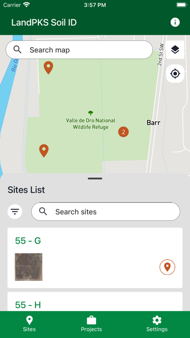


Description by Tech Matters Written by the developer, not by AppBrain. Click to read.
Key Features:
- Soil matching from global map data: Create a site and immediately see a ranked list of potential soils based on soil survey maps for that location. As site observations are entered, the ranking refines further by weighing similarity between observed properties and each potential soil.
- Guided data collection: Step-by-step tools for slope, soil color, texture, rock fragments, surface cracks, and depth-by-depth soil profile observations.
- Projects and teams: Create projects to organize sites, invite team members, and set standardized data collection requirements across locations.
- Fully offline capable: Create sites and collect data without cell or internet service. Data syncs automatically when connectivity returns.
- Data ownership and privacy: Control who can access site data. Export observations for use in other tools and reports.
Who it's for: LandPKS Soil ID is used by agricultural consultants, soil scientists, extension agents, researchers, educators, government field staff, farmers, and ranchers — anyone who needs to identify or characterize soils on-site. It supports both solo fieldwork and coordinated data collection across organizations.
Built on trusted partnerships: LandPKS is a long-running collaboration between government agencies, universities, and nonprofits dedicated to accessible soil science tools. Learn more at https://landpotential.org