MarineRadioMap is the essential VHF radio reference for boaters on Canadian and US waters. Know instantly which channels to use — wherever you are.
NEAR ME — INSTANT ANSWERS
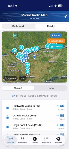
Open the app and your location is detected automatically. See the correct hailing channel, working channels, weather broadcast frequency, and local Coast Guard channel for your exact region — no searching required. A zone boundary alert warns you when you're approaching a neighbouring VHF zone, useful on the Trent-Severn or St. Lawrence where conventions change mid-trip.
CONDITIONS
Live marine weather via Apple WeatherKit — temperature, wind speed and direction, gusts, pressure, dew point, UV index, and visibility. Water conditions include wave height, wave period, swell, and sea surface temperature. 7-day NOAA marine forecast with expandable period cards. Live NOAA buoy network map with water temperature, wave height, wind, and air pressure from buoys across all covered regions.
EXPLORE
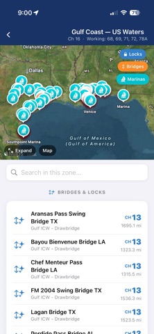
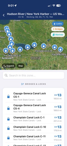
Interactive map of all VHF zones across Canada, the US, and Hawaii. Tap any zone to see its channels, bridges, locks, and marinas with full detail. Search any place or waterway by name and get instant channel information before you leave the dock. Navigation buttons jump instantly to West, Central, East, Hawaii, or the full North America view.
BRIDGES AND LOCKS AND DRAW BRIDGES
The only app with a comprehensive structured database of Canadian and US waterway bridges and locks — Trent-Severn Waterway (44 locks), Rideau Canal (45 locks), St. Lawrence Seaway, Welland Canal, US East Coast ICW drawbridges, and Great Lakes connecting channels — each with their VHF call channel, operator, and operating hours.
WORKS OFFLINE
All channel data, zone boundaries, bridges, locks, marinas, and Coast Guard stations are bundled in the app as a local database. No cell signal needed. Works perfectly on the water where you need it most.
COVERS CANADIAN AND US WATERS INCLUDING HAWAII
Channel rules differ between the Great Lakes, Atlantic, Pacific, Hawaii, and inland regions — in both Canada and the US. MarineRadioMap knows the rules for wherever you are, including the US mode vs International mode difference on Channel 22 that catches many boaters off guard.
INCLUDES:
· All 59 VHF channels with frequencies and permitted uses (US and Canada)
· 20+ regional zones — Great Lakes, Atlantic, Pacific, Gulf, ICW, Trent-Severn, Rideau, St. Lawrence, Newfoundland, and Hawaii
· Weather broadcast channels (NOAA and Environment Canada)
· Bridges and locks with VHF call channels and operating info
· Coast Guard stations (USCG and Canadian Coast Guard)
· NOAA buoy network with live readings
· 2030 VDES channel transition notes
· Channel 22 US mode vs International mode explainer
· Emergency procedures — MAYDAY, PAN-PAN, SÉCURITÉ
Show more
Show less