

MilGPS+ is made and published by mustafa pistofoglu. AppBrain is an independent app data site and isn't affiliated with mustafa pistofoglu. The app name, icon, screenshots and description belong to mustafa pistofoglu and are shown as published on the App Store.



AppBrain's verdict
- Rating on App Store
- 5.00
- 1 ratings
- Last updated
- July 4, 2026
- Size
- 40.8 MB
It doesn't have enough ratings yet to judge what users think. Its best ranking is #38 in Top Paid, Navigation in United Kingdom.
User feedback
Ratings and reviews on the App StoreComments on MilGPS+ for iOS
We don't have enough comments to show example comments. Please check back later.
Store listing
By mustafa pistofoglu, from the App StoreDescription by mustafa pistofoglu Written by the developer, not by AppBrain. Click to read.
When the road ends and the signal dies, MilGPS+ keeps you oriented. MilGPS+ turns your iPhone into a complete tactical field navigation system, built from the ground up for soldiers, reconnaissance and patrol teams, hunters, off-road crews, mountaineers, survivalists, search and rescue units, and every professional who has to move through remote terrain with absolute precision. No network. No signal. No excuses.
Most navigation apps stop working the moment you leave the city. MilGPS+ is the opposite: it is engineered to do its best work exactly where everything else fails — deep in the field, off-grid, and offline.
TACTICAL CAPABILITIES
Mission-Grade Positioning
Get a real-time fix on your exact position with live grid coordinates in WGS84 (LAT/LON) and UTM. Read your location like a paper map sheet — fast, accurate and field-ready. Tap to copy or share any coordinate in seconds for a clean, unambiguous position report.
Full Offline Operation
Pre-load and cache your entire area of operations before you deploy, then navigate completely offline. Download map regions while you still have a connection and carry them into the field with zero dependence on cellular coverage or Wi-Fi. No signal, no network, no compromise — built for the field, not the office.
Waypoints and Target Marking
Mark targets, rally points, observation posts, caches and objectives directly on the map. Organize them into folders, color-code them, and get instant range and bearing to any point. Share a waypoint with your team in a single tap.
Track Recording and Route Planning
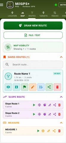
Record every movement as a high-detail track, plan ingress and egress routes in advance, and review your patrol afterward. Distance, elevation and time are logged automatically, so you always know where you have been and how to get back.
Tactical Compass and Bearing
A built-in compass with live target heading lets you move by dead reckoning and hold a precise bearing across any terrain, even when GPS is degraded or you need a backup.
Area and Distance Recon
Measure distances and areas of interest directly on the map. Estimate sectors, perimeters and ranges for rapid field assessment and planning.
Field Weather Intel
Check terrain and weather conditions before you move out, so you can plan around visibility, light and ground conditions.
Professional Geospatial Formats
Import and export the formats real operators and GIS professionals use:
Vector: GPX, KML, KMZ, GeoJSON
Raster and map tiles: GeoTIFF, MBTiles, GeoPDF
Database: GeoPackage (.gpkg)
Open files straight from Mail, Messages or the Files app, layer them over your map, and export your own data to share with command or teammates. Full interoperability with military and professional mapping workflows.
Mission Tools and Briefing
On-map drawing, field notes and tactical planning tools let you sketch a plan, annotate the ground, and build a clean briefing, then share it with your unit.
Map Export and Sharing
Generate a clean tactical map output, including PDF, of your operating area, waypoints and routes, and share it through any channel on your device.
30+ Languages
A fully localized interface, ready for international teams and operations anywhere in the world.
BUILT FOR THE FIELD
Military, reconnaissance and patrol operations
Hunting and tracking
Off-road, overlanding and expedition driving
Mountaineering, hiking and trekking
Search and rescue and emergency response
Survival, bushcraft and preparedness
Drone, survey and field-mapping support
WHY MilGPS+?
100% offline. Operates with no signal and no network.
Tactical dark theme. A low-glow display that is easy on the eyes in the field and at night.
Full privacy. Your position data never leaves your device. Zero servers, zero tracking.
No clutter, no fluff. Every screen is engineered for real field operations.
Pro-format ready. Drops straight into existing GIS and command workflows.
Safety and technology
Found in the app by AppBrain- Price
- $9.99
- App size
- 40.8 MB
- Content rating
- Everyone
Technologies used by MilGPS+
Releases
Updates seen on the App Store- Version
- 1.0
- Launched
- July 2026
No changelog data
Alternatives
Similar apps and more from mustafa pistofogluMore from mustafa pistofoglu


Also available on Google Play

Rankings
App Store top charts- Highest rank
- #38
- Chart
- Top Paid
- Navigation
- Country
- United Kingdom
App Store Rankings for MilGPS+
Top rankings
| Rank | Country | Category | List |
|---|---|---|---|
| 88 | United States | Navigation | Top Paid |
| 38 | United Kingdom | Navigation | Top Paid |
| 84 | Iran | Navigation | Top Paid |
Ranking history in United States
About the app and developer
About MilGPS+
MilGPS+ is a navigation app developed by mustafa pistofoglu.
User Ratings
MilGPS+ is rated 5.00 out of 5 stars. The rating is based on one rating ratings.
App Information
MilGPS+ costs $9.99. The app size is 40.77 MB. The latest version available is 1.0. The last update was on July 4, 2026.
Technical Requirements
The app has a content rating of Everyone. The app has been available on the App Store since July 2026.
Developer information for mustafa pistofoglu
Address:
Frequently asked questions about MilGPS+
Is MilGPS+ free?
No. MilGPS+ costs $9.99 on the App Store.
Is MilGPS+ still available?
Yes. MilGPS+ is on the App Store, and the last update we saw was on July 4, 2026.
How large is MilGPS+?
MilGPS+ is 40.77 MB.
Is MilGPS+ suitable for children?
App Store rates the content of MilGPS+ as suitable for everyone.
How do people rate MilGPS+?
MilGPS+ has one rating of 5.00 stars on the App Store.
Who made MilGPS+?
MilGPS+ was developed by mustafa pistofoglu. It is listed in the navigation category on the App Store.