MiSensorKit is an overall app developed by Efe Tarhan.
Download Statistics
User Ratings
The app has no ratings yet.
App Information
MiSensorKit is FREE to download. The APK download size is 6.60 MB. The latest version available is 1.3. The last update was on May 25, 2026.
Technical Requirements
The app has a content rating of Everyone. The app has been available on Google Play March 2026.
Description
MiSensorKit is a multi-modal field recording application designed for iOS devices. It enables synchronized capture of multiple sensor streams within a single recording session, making it the ideal portable tool for building rich multi-modal datasets in the field.
CAPTURE MULTIPLE MODALITIES
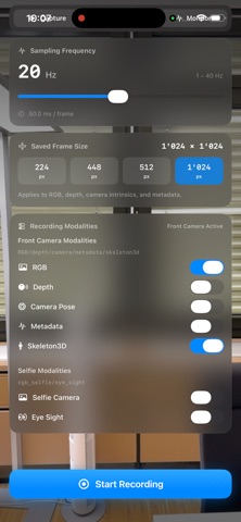
RGB frames saved as high-resolution JPEGs (up to 1024px) LiDAR depth maps stored as UInt16 millimeter buffers Full camera intrinsics and 6-DoF extrinsic pose logged every frame as JSON Real-time 3D body skeleton tracking with joint positions via ARKit Front-facing selfie camera capture Gaze estimation and eye tracking data GPS location with latitude, longitude, altitude, speed, heading, and accuracy metrics IMU data including accelerometer, gyroscope, fused attitude (roll/pitch/yaw), and gravity vector Ambient light intensity and color temperature estimates Barometric pressure readings synchronized with every frame FLEXIBLE RECORDING SETUP
Choose which modalities to record, configure sampling frequency from 1 to 60 Hz, and select output resolution from 224 to 1024 px. A built-in preflight check alerts you to missing permissions or hardware limitations before you start. Monitor sensor status, live FPS, stream health, and session size in real time while recording.
BUILT-IN DATA VIEWER
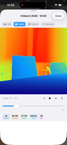
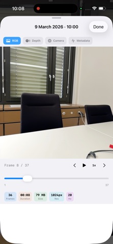
Browse and inspect recorded sessions directly on your device. Scrub through individual frames to view RGB images, depth maps, camera metadata, skeleton data, and sensor readings — without needing to transfer files to a computer.
EXPORT AND SHARE
Export any session as a ZIP archive directly from the app, or share the raw folder via Files and AirDrop. A session summary sheet appears automatically after each recording with key statistics and one-tap sharing options.
STRUCTURED OUTPUT FORMAT
Each recording session creates an organized folder structure with separate directories for RGB, depth, camera pose, skeleton, GPS, IMU, and metadata — ready for your processing pipeline.
REQUIREMENTS
iPhone or iPad with LiDAR sensor (required for depth recording only) iOS 26.0 or later Designed for researchers and developers who need a portable, easy-to-use tool for multi-modal data collection without external hardware or complex calibration setups.
Each subscription will automatically renew 3 days before the expiration date for
the same time period. Subscriptions can be cancelled at any time before the renewal.