

Outdoor Nice Côte d'Azur
Outdoor Nice Côte d'Azur is made and published by Outdooractive AG. AppBrain is an independent app data site and isn't affiliated with Outdooractive AG. The app name, icon, screenshots and description belong to Outdooractive AG and are shown as published on the App Store.
AppBrain's verdict
- Last updated
- October 14, 2024
Rankings
App Store top chartsApp Store Rankings for Outdoor Nice Côte d'Azur
Competitors
Similar apps and more from Outdooractive AG








Releases
Updates seen on the App Store- Version
- 1.0
- Launched
- October 2024
No changelog data
User feedback
Ratings and reviews on the App StoreComments on Outdoor Nice Côte d'Azur for iOS
We don't have enough comments to show example comments. Please check back later.
Technology
Found in the app by AppBrain- Price
- Free
- App size
- 87.4 MB
- Content rating
- Everyone
Technologies used by Outdoor Nice Côte d'Azur
About the app and developer
About Outdoor Nice Côte d'Azur
Outdoor Nice Côte d'Azur is a travel app developed by Outdooractive AG.
What is the rating of Outdoor Nice Côte d'Azur?
Outdoor Nice Côte d'Azur has no ratings yet.
Is Outdoor Nice Côte d'Azur free?
Outdoor Nice Côte d'Azur is free. The app size is 87.44 MB. The latest version available is 1.0. The last update was on October 14, 2024.
What are the requirements for Outdoor Nice Côte d'Azur?
The app has a content rating of Everyone. The app has been available on the App Store since October 2024.
Developer information for Outdooractive AG
Address:
Store listing
By Outdooractive AG, from the App Store



Description by Outdooractive AG Written by the developer, not by AppBrain. Click to read.
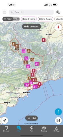
Outdoor Nice Côte d'Azur is a free app, designed for hiking, trail running and cycling (mountain biking, gravel, road biking), both for the day and when out and about. The app is also a mine of information on local events, restaurants, accommodation and outdoor sports in all their forms (tyrolean traverse, viaferrata, etc.).
A host of features:
- Find routes around you using maps and your geolocation
- Access all the technical information on the routes and view the altimeter profile
- Download GPS tracks
- Create and share your own routes
- Let yourself be guided along the hiking trails: voice and GPS guidance / Outdooractive and OpenStreetMap map base integrating the routes
- Accessible without a network and in aeroplane mode to save battery power
- Join the community by commenting and sharing your routes and photos
- Take part in challenges
If you have a question, drop us a message at outdoor@nicecotedazur.org
Recorded tracks can be saved as workouts in Apple Health. Your heart rate and biometric data from Apple Health can be used to calculate calories spent during the track recording. No Health data is used for marketing or advertising purposes