

Public transport map Valencia
Public transport map Valencia is made and published by Khrystyna Skliarova. AppBrain is an independent app data site and isn't affiliated with Khrystyna Skliarova. The app name, icon, screenshots and description belong to Khrystyna Skliarova and are shown as published on the App Store.
AppBrain's verdict
- Last updated
- April 27, 2026
Rankings
App Store top chartsApp Store Rankings for Public transport map Valencia
Competitors
Similar apps and more from Khrystyna SkliarovaAlternatives to Public transport map Valencia


 Visit València Official guide



More from Khrystyna Skliarova






Also available on Google Play

Releases
Updates seen on the App Store- Version
- 4.3.6
- Launched
- December 2024
No changelog data
User feedback
Ratings and reviews on the App StoreComments on Public transport map Valencia for iOS
We don't have enough comments to show example comments. Please check back later.
Technology
Found in the app by AppBrain- Price
- Free
- App size
- 84.7 MB
- Content rating
- Everyone
Technologies used by Public transport map Valencia
About the app and developer
About Public transport map Valencia
Public transport map Valencia is a navigation app developed by Khrystyna Skliarova.
User Ratings
The app has no ratings yet.
App Information
Public transport map Valencia is freely available from the App Store. The app size is 84.67 MB. The latest version available is 4.3.6. The last update was on April 27, 2026.
Technical Requirements
The app has a content rating of Everyone. The app has been available on the App Store since December 2024.
Developer information for Khrystyna Skliarova
Address:
Store listing
By Khrystyna Skliarova, from the App Store



Description by Khrystyna Skliarova Written by the developer, not by AppBrain. Click to read.
Search by station name or route number, saving chosen routes and geo-positioning are available in the basic version.
Why do this app is should be tried?
1) On the screen of your device you will see the whole Valencia's public transport scheme, and the more scale is choosen the more details are given.
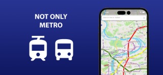
2) The map of Valencia shows not only metro lines, but tram and bus routes as well. Stations of possible metro-tram-bus transfers are grouped.
3) The search by station name will help you to find it on the map and select the proper transport. Search by route number allows you to quickly determine whether it suitable or not.
4) By allowing the application to access the location and mark it on the map, you will see stations nearby. So you won't ever get lost and without any help you will be able to get anywhere in the city.
5) The routes you planned in advance, can be saved in the list and you may use them again at any time.
In an extended version, the app allow you:
6) To use all of the above in offline mode without wasting time searching for the wifi reception.
7) To check a short schedule of public transport routes if it is needed.
8) To know not just where the station is, but where the stops of all routes passing through are located as well.
Confident use of all types of public transport is the key to the most comfortable visiting Valencia.