Riverio: River Levels & Flow came out 81 days ago. It doesn't have enough ratings yet to judge what users think.
Riverio: River Levels & Flow is made and published by
Think Aloud Design s.r.o..
AppBrain is an independent app data site and isn't affiliated with Think Aloud Design s.r.o..
The app name, icon, screenshots and description belong to Think Aloud Design s.r.o. and are shown as
published on the App Store.
About Riverio: River Levels & Flow
Riverio: River Levels & Flow is a weather app developed by Think Aloud Design s.r.o..
User Ratings
Riverio: River Levels & Flow is rated 5.00 out of 5 stars. The rating is based on one rating ratings.
App Information
Riverio: River Levels & Flow is freely available from the App Store. The app size is 23.57 MB. The latest version available is 1.0. The last update was on July 27, 2026.
Technical Requirements
The app has a content rating of Everyone. The app has been available on the App Store since July 2026.
Description by Think Aloud Design s.r.o.(from the App Store)
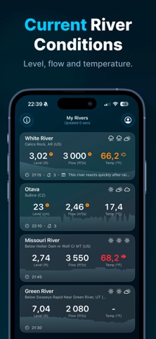
Riverio puts the latest available river conditions in your pocket. Check water levels, flow rates, and official warnings from thousands of rivers and gauging stations—whether you fish, prepare for changing conditions, or simply care about your local river.
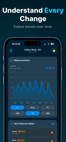
• Live levels & flow – real-time water height and discharge straight from official gauges • Flood alerts – get notified the moment a river rises past your chosen level • Built for anglers – check conditions before you head out and save your best spots • History & trends – see how levels have moved over hours, days and weeks • Favorites & map – save the rivers that matter and find nearby stations at a glance • Custom notifications – set your own thresholds and let Riverio watch the water for you
Clean, fast and reliable. Download Riverio and never be caught off guard by the river again.
DATA SOURCES Riverio combines live data from 100+ official and public hydrometric services worldwide, including (among others): NVE — Norway SMHI — Sweden Finnish Environment Institute (SYKE) USGS — United States NOAA — United States California Data Exchange Center Government of Canada — Water Office Bureau of Meteorology — Australia PEGELONLINE — www.pegelonline.wsv.de HVZ Baden-Württemberg HND Bayern HVZ Rheinland-Pfalz HVZ Sachsen-Anhalt HNZ Thüringen BAFU — Switzerland Kanton Bern Land Kärnten / Niederösterreich / Salzburg / Tirol / Vorarlberg HWZ Steiermark Ennskraftwerke Vigicrues — France Serveur hydrométrique Rhône-Méditerranée Český hydrometeorologický ústav (ČHMÚ) Slovak Hydrometeorological Institute (SHMÚ) Agencija Republike Slovenije za okolje (ARSO) Scottish Environment Protection Agency (SEPA) Shoothill / GaugeMap Rijkswaterstaat — Waterinfo IMGW — Poland Confederaciones Hidrográficas / SAIH — Spain Regione Piemonte
DISCLAIMER Riverio is an independent application and is not affiliated with the organizations listed unless explicitly stated. Riverio and the listed data providers accept no liability for any errors, omissions, delays or interruptions in the information provided, nor for any loss, injury or damage of any kind resulting from its use. Always follow the official warnings of local authorities — never rely on Riverio alone for safety-critical decisions.
Terms of Use (EULA): https://www.apple.com/legal/internet-services/itunes/dev/stdeula/
Each subscription will automatically renew 3 days before the expiration date for
the same time period. Subscriptions can be cancelled at any time before the renewal.