
SatTracker is made and published by GerSpatial. AppBrain is an independent app data site and isn't affiliated with GerSpatial. The app name, icon, screenshots and description belong to GerSpatial and are shown as published on the App Store.
AppBrain's verdict
- Last updated
- May 10, 2023
Rankings
App Store top chartsApp Store Rankings for SatTracker
Competitors
Similar apps and more from GerSpatialMore from GerSpatial

Releases
Updates seen on the App Store- Version
- 2.0
- Launched
- March 2013
No changelog data
User feedback
Ratings and reviews on the App StoreComments on SatTracker for iOS
We don't have enough comments to show example comments. Please check back later.
Technology
Found in the app by AppBrain- Price
- $49.99
- App size
- 317.5 MB
- Content rating
- Everyone
Technologies used by SatTracker
About the app and developer
About SatTracker
SatTracker is an education app developed by GerSpatial.
User Ratings
The app has no ratings yet.
App Information
SatTracker costs $49.99. The app size is 317.52 MB. The latest version available is 2.0. The last update was on May 10, 2023.
Technical Requirements
The app has a content rating of Everyone. The app has been available on the App Store since March 2013.
Developer information for GerSpatial
Address:
Frequently asked questions about SatTracker
Is SatTracker free?
No. SatTracker costs $49.99 on the App Store.
Is SatTracker still available?
Yes. SatTracker is on the App Store, and the last update we saw was on May 10, 2023.
How large is SatTracker?
SatTracker is 317.52 MB.
Is SatTracker suitable for children?
App Store rates the content of SatTracker as suitable for everyone.
Who made SatTracker?
SatTracker was developed by GerSpatial. It is listed in the education category on the App Store.
Store listing
By GerSpatial, from the App Store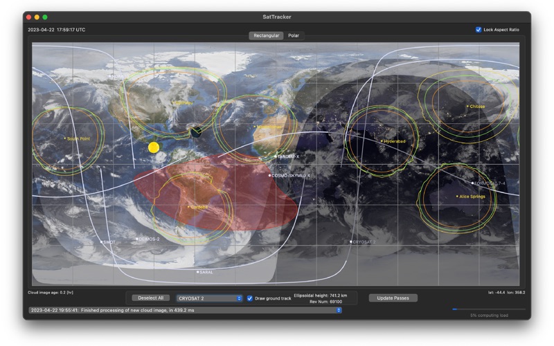






Description by GerSpatial Written by the developer, not by AppBrain. Click to read.
SatTracker has been used during real satellite operations at the European Space Operations Centre, ESOC, in Germany!
SatTracker uses the SGP4 algorithms which are ideally tuned to the publicly-available orbital elements and, as a result, generates the most accurate orbits possible with these orbital elements.
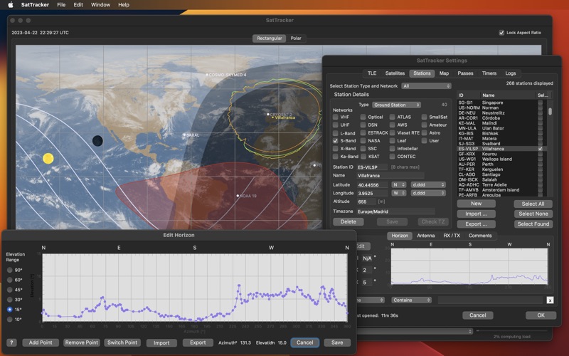
As well as ground tracks, SatTracker calculates daytime, twilight and nighttime regions as well as calculating when each satellite is in sunlight so that it is visible – assuming there’s no cloud. To help with this, SatTrackerBasic can also display global cloud cover updated hourly (though this requires a paid subscription to a third-party data-provider). The various items which can be plotted are configurable, and so is the representation. The map can be displayed in two map projections: a simple rectangular projection or as a pair of azimuthal projections centred on the North and South poles.
Powerful database functionality is built-in to allow the management of thousands of satellites and ground stations.
Features of SatTracker v. 1.0:
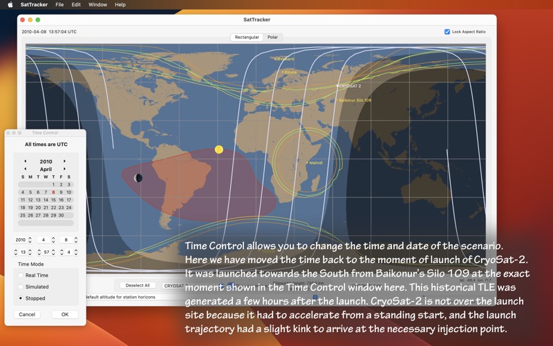
- plots Earth-orbiting satellite positions and ground tracks;
- Sun and Moon position (and Moon phase) are plotted;
- maps show the day and night coverage on the Earth;
- the time can be adjusted freely forwards and backwards, and run in simulated future or past times;
- current cloud cover is optionally downloaded and displayed;
- the location of the South Atlantic Anomaly (which can affect satellite operations) is shown for a given satellite;
- ground station horizons are plotted, taking account of the real horizon obstructions, for both transmit and receive links;
- ground stations are grouped into related sets;
- plots are either on a rectangular grid or a pair of polar projections;
- dark mode, retina display and Apple Silicon.
For features of v. 2.0, see “What’s New”
Note also that SatTracker is a not a video-games quality, 3d graphics simulation, and was never intended to be. It was designed with the needs of satellite professionals in mind, particularly those in Mission Control Rooms who need to see where relatively few satellites are with respect to the visibility horizons of the available ground stations. Specifically for these engineers, the location of the South Atlantic Anomaly is shown (as requested during the development phase of the App).
For a full explanation of what SatTracker v2.0 can do (and a useful tutorial on satellites, orbits, TLEs, satellite radio links etc), please download the User Manual available at https://www.gersastronomie.com/sattracker.