Storm Chaser Atlas is a weather app developed by Michael Olbinski.
User Ratings
Storm Chaser Atlas is rated 4.20 out of 5 stars. The rating is based on 5 ratings.
App Information
Storm Chaser Atlas is FREE to download. The download size is 60.66 MB. The latest version available is 1.4.0. The last update was on August 20, 2026.
Technical Requirements
The app has a content rating of Medium Maturity. The app has been available on the App Store since March 2026.
Description
Storm Chaser Atlas is a privacy-first, crowd-sourced mapping, history and route tracking app built for storm chasers. Track chase miles, log routes, post geo-tagged storm records, report hazards (optionally anonymous), and explore community history—without turning your location into public surveillance. Take advantage of a rich repository of chasers favorite restaurants, coffee shops, motels, gas stations and landmarks. Keep track of your close friends on a chase day, explore a live feed of storm events, hazards and log your own epic excursions.
Excellent for storm chasers, tour guests and even just weather lovers who want to see all the latest storm photos happening real-time and historical.
FEATURE LIST:
TRACK YOUR CHASES
Automatically track routes with maps, miles, and trip history Log mileage for easy tax and deduction tracking Keep drives organized for the season
ROAD CONFIDENCE (COMMUNITY COVERAGE)
See roads highlighted from blue to purple based on how often they’ve been driven Helps you trust remote routes—especially dirt roads—by showing real-world connectivity Contributions are anonymous and delayed (not live)
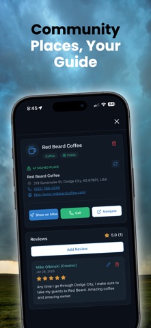
PLACES (PUBLIC + PERSONAL)
Add public places you love: motels, coffee shops, landmarks, parks, and more Create personal locations: overlooks, shoot spots, notes—kept private by default Import your existing saved locations from Google Maps (JSON)
HAZARDS + SPOTTER NETWORK
Report hazards while chasing: flooded roads, closures, emergencies, and more Option to post hazards anonymously Spotter Network integration: submit a report to Spotter Network and Atlas at the same time
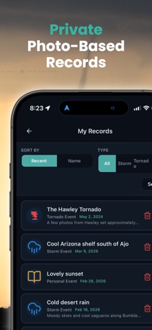
RECORDS (PHOTO-BASED STORM LOGGING)
Upload photos with GPS, date/time, title, and description Batch upload multiple images at once Keep records private or share publicly for community viewing
HISTORY + EXPLORE
History map: pick a day and view public records pinned anywhere in the world Explore feed: see the latest records, filter by friends and categories
FRIENDS + LOCATION SHARING (WITH EXPIRATION)
Add friends and create friend circles Share your live location with friends when you choose—sharing automatically expires
PRIVACY FIRST
No data sold Road Confidence is anonymous and updates on a delay (not live) Home Privacy Zone prevents Road Confidence contributions near your home Anonymous hazard reporting available
Built for chasers. Designed for trust. Focused on privacy.
Privacy Policy: https://stormchaseratlas.com/privacy // Terms of Use: https://stormchaseratlas.com/terms
Each subscription will automatically renew 3 days before the expiration date for
the same time period. Subscriptions can be cancelled at any time before the renewal.