

TerraFlow Mobile
TerraFlow Mobile is made and published by TerraFlow Geomatics Inc. AppBrain is an independent app data site and isn't affiliated with TerraFlow Geomatics Inc. The app name, icon, screenshots and description belong to TerraFlow Geomatics Inc and are shown as published on the App Store.
AppBrain's verdict
- Last updated
- June 20, 2026
Rankings
App Store top chartsApp Store Rankings for TerraFlow Mobile
Competitors
Similar apps and more from TerraFlow Geomatics IncAlternatives to TerraFlow Mobile


Also available on Google Play

Releases
Updates seen on the App Store- Version
- 2.0.79
- Launched
- May 2025
No changelog data
User feedback
Ratings and reviews on the App StoreComments on TerraFlow Mobile for iOS
We don't have enough comments to show example comments. Please check back later.
Technology
Found in the app by AppBrain- Price
- Free
- App size
- 144.0 MB
- Content rating
- Everyone
Technologies used by TerraFlow Mobile
About the app and developer
About TerraFlow Mobile
TerraFlow Mobile is a business app developed by TerraFlow Geomatics Inc.
User Ratings
The app has no ratings yet.
App Information
TerraFlow Mobile is freely available from the App Store. The app size is 144.00 MB. The latest version available is 2.0.79. The last update was on June 20, 2026.
Technical Requirements
The app has a content rating of Everyone. The app has been available on the App Store since May 2025.
Developer information for TerraFlow Geomatics Inc
Address:
Store listing
By TerraFlow Geomatics Inc, from the App Store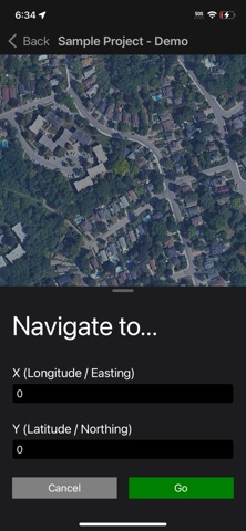
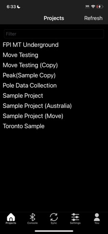

Description by TerraFlow Geomatics Inc Written by the developer, not by AppBrain. Click to read.
TerraFlow Mobile connects to any GNSS/RTK receiver you already own. No locked-in hardware. No adapters. No workarounds. Your equipment works.
WHAT YOU CAN MAP
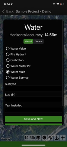
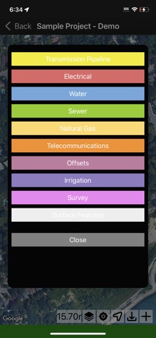
→ Underground utilities (gas, electric, telecom, water, sewer)
→ Poles and overhead infrastructure
→ Surface features and markers
→ Sensor and inspection data
Each collection type has its own workflow built for how the job actually runs in the field. You're not fighting the app to match your process.
HOW IT WORKS
Tap your locate point. TerraFlow captures coordinates, depth, signal strength, and utility attributes in one shot. Add a field sketch on top of the map. Move to the next flag.
Every record ties back to the ticket or work order it belongs to. Nothing gets lost between the field and the office.
BUILT FOR THE FIELD
→ Works with any RTK/GNSS receiver (vendor-neutral)
→ Centimeter-level positioning when your gear supports it
→ Offline-capable for areas with no cell coverage
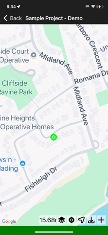
→ Field sketching directly on the map
→ Auto-syncs to Data Engine when you're back online
YOUR DATA GOES SOMEWHERE
TerraFlow Mobile connects directly to Data Engine, the back-office platform that processes, validates, and delivers your field data. What you collect in the morning is ready for QA by afternoon.
No emailing CSVs. No USB drives. No re-keying coordinates into a second system.
Used by locators, surveyors, and field crews across utilities and pipeline operators globally.
Supports utility locate sets from Radiodetection, Vivax - Metrotech and Rycom
Sketch Management tools within the supporting Data Engine environment can be leveraged to visualize captured information and draw in offset data, buildings, notes and other reference data.
Trimble, Eos, Bad Elf, Juniper and other receivers are supported through the location system.