topo^alpin is made and published by
Timo Braun.
AppBrain is an independent app data site and isn't affiliated with Timo Braun.
The app name, icon, screenshots and description belong to Timo Braun and are shown as
published on the App Store.
About topo^alpin
topo^alpin is a navigation app developed by Timo Braun.
What is the rating of topo^alpin?
topo^alpin has no ratings yet.
Is topo^alpin free?
topo^alpin is free. The app size is 9.40 MB. The latest version available is 3.7.0. The last update was on September 24, 2026.
What are the requirements for topo^alpin?
The app has a content rating of Everyone. The app has been available on the App Store since March 2026.
Description by Timo Braun(from the App Store)
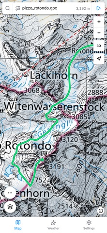
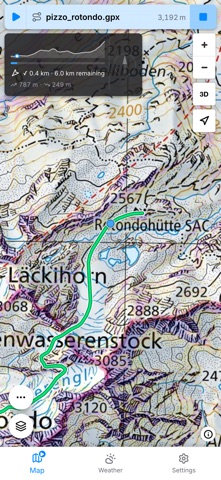
topo^alpin is your planning tool for alpine mountain tours. Draw your route directly on the map or upload a GPX file, analyse slope angles and elevation profiles, and navigate to the summit via GPS – all in one app.
Interactive maps: - slopemap HD: custom base map and slope angle maps at 5 m resolution for the entire Alps - Official topographic maps from swisstopo (CH), BEV (AT), LDBV (BY) and IGN (FR) - Aerial imagery from the official sources of the Alpine countries, one tap to switch - 3D relief: tilt the map onto the elevation model and rotate it – look at a south face from the south - Avalanche terrain classification ATES (AutoATES v2) for the Alps and SLF CAT/ATH - Ski touring, snowshoe and hiking trails - Wildlife and herd protection zones - Offline maps: download map tiles in advance for areas without reception
Route planning: - Draw your route on the map with automatic DEM elevation data - Upload GPX files and analyse the elevation profile with slope angles - Open up the elevation profile with your finger and study key sections in detail - Export drawn routes as GPX files - Share a tour as a PDF: map, tour figures and elevation profile on one sheet – to pass on or print out - GPS navigation to the summit or along your route - Slope meter with live device sensor - Compass rose, distance, elevation delta and progress indicator - Dynamic Island and Lock Screen: remaining distance and elevation at a glance
Mountain weather: - 6 weather models (ICON EU, ICON D2, AROME, ECMWF, GFS, AIFS) as a weighted ensemble - 2-day weather summary with avalanche danger level at a glance - 10-day overview and 48-hour detail view with colour weather icons - Elevation grid: rain or snow per elevation band, with the snow line as a line - Thunderstorm risk, summit wind at various elevation levels - Freezing level and cloud base - Fresh snow (24h/72h/7d) from the nearest station – automatically during snow season - Sunrise, sunset and daylight hours – elevation-corrected - Weather warnings from MeteoAlarm for the Alpine region - Real-time mountain weather stations from CH, AT, DE, IT, FR and SI
Emergency location: - Your own position in decimal degrees, degrees/minutes and UTM – to read out to a dispatcher - Elevation, GPS accuracy and the age of the fix, offline too - Nearest named terrain feature where there is signal, e.g. "600 m north-east of Schwarz Berg" - Emergency numbers by area: 140 (AT), 1414 Rega (CH), 144 (Valais), 118 (Veneto), 112 - Copy the coordinates or share them as a prefilled text message - Dialling only after a five-second hold, so nothing is triggered by accident - Not an emergency service: topo^alpin dials through the phone app and transmits no data to a control room itself
Tour-Check: - Risk assessment of your GPX tour with key-section markers directly in the elevation profile - ATES avalanche terrain classification and terrain risk overlay along the whole tour - Toggle in the elevation profile between Tour-Check and terrain risk - Avalanche danger level fallback in Settings if no current bulletin is available
On iPad: - The same app with more map: the tabs at the bottom, the map across the full screen - Portrait and landscape, and in a window beside another app - No dialling: an iPad cannot place a call, not even with a cellular SIM. The emergency location screen still shows coordinates, altitude and the report text – to pass on by phone or radio
topo^alpin is a self-responsibility tool. It does not replace alpine experience or careful tour planning.
Each subscription will automatically renew 3 days before the expiration date for
the same time period. Subscriptions can be cancelled at any time before the renewal.