

Topoferrarisviewer
Topoferrarisviewer is made and published by NGI-IGN National Geograhical Institute of Belgium. AppBrain is an independent app data site and isn't affiliated with NGI-IGN National Geograhical Institute of Belgium. The app name, icon, screenshots and description belong to NGI-IGN National Geograhical Institute of Belgium and are shown as published on the App Store.
AppBrain's verdict
- Best rank
- #94
- Top Free, Belgium
- Last updated
- June 9, 2026
Rankings
App Store top charts- Highest rank
- #94
- Chart
- Top Free
- Navigation
- Country
- Belgium
App Store Rankings for Topoferrarisviewer
Top rankings
| Rank | Country | Category | List |
|---|---|---|---|
| 94 | Belgium | Navigation | Top Free |
Ranking history in Belgium
Competitors
Similar apps and more from NGI-IGN National Geograhical Institute of BelgiumAlso available on Google Play

Releases
Updates seen on the App Store- Version
- 1.0.4
- Launched
- June 2026
No changelog data
User feedback
Ratings and reviews on the App StoreComments on Topoferrarisviewer for iOS
We don't have enough comments to show example comments. Please check back later.
Technology
Found in the app by AppBrain- Price
- Free
- App size
- 104.6 MB
- Content rating
- Everyone
Technologies used by Topoferrarisviewer
About the app and developer
About Topoferrarisviewer
Topoferrarisviewer is a navigation app developed by NGI-IGN National Geograhical Institute of Belgium.
User Ratings
The app has no ratings yet.
App Information
Topoferrarisviewer is freely available from the App Store. The app size is 104.65 MB. The latest version available is 1.0.4. The last update was on June 9, 2026.
Technical Requirements
The app has a content rating of Everyone. The app has been available on the App Store since June 2026.
Developer information for NGI-IGN National Geograhical Institute of Belgium
Store listing
By NGI-IGN National Geograhical Institute of Belgium, from the App Store


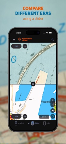

Description by NGI-IGN National Geograhical Institute of Belgium Written by the developer, not by AppBrain. Click to read.
If you would like to know which traces of the past are still visible today, or how the landscape you are traveling through has changed over the past 250 years, select one of the walking suggestions or import your own GPX track, and head out with Topoferrarisviewer.