Trails MTB is a navigation app developed by TDY AS.
User Ratings
The app has no ratings yet.
App Information
Trails MTB is FREE to download. The download size is 14.54 MB. The latest version available is 2.70. The last update was on September 25, 2026.
Technical Requirements
The app has a content rating of Everyone. The app has been available on the App Store since June 2026.
Description
A mountain bike map, ride tracker and planner, with more than 2.5 million trails worldwide.
Trails shows the MTB trails around you on a 3D terrain map, colour-coded by difficulty. Plan a route by tapping the trails you want. Record your ride, add photos, and share it as a flyover video on Instagram.
1.7 MILLION NEW TRAILS • We analyzed known paths to find the rideable ones. They're dashed on the map. • Ride one, grade it, and it's on the map for everyone.
PLAN • Tap the trails you want and Trails links the gaps. • Distance, climb and difficulty as you build. • Save routes, share them as GPX, or preview them as a flyover.
RIDE • A 3D map that picks the right view on its own. • Records with the screen locked. Distance and time on the lock screen. • Steep sections ahead are colour-coded, so they don't surprise you.
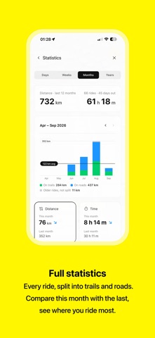
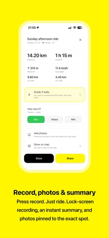
AFTER THE RIDE • A summary with distance, climb, speed, trail vs road and weather. • Photos pinned to where you took them. • Flyover video of your ride, as an Instagram Reel, Post or widescreen. • Statistics by week, month and year, with your areas, routes and graded trails.
CONDITIONS • Dry, damp or wet, painted on the terrain from rain, sun and the ground. Best in the Nordics, works worldwide.
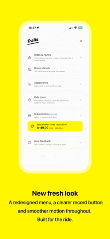
Trails requires a subscription (Trails Pro), which starts with a 7-day free trial. It renews automatically unless cancelled at least 24 hours before the period ends. Manage or cancel in your App Store account settings.
Privacy Policy: https://trailsapp.vercel.app/privacy Terms of Use: https://www.apple.com/legal/internet-services/itunes/dev/stdeula/
Each subscription will automatically renew 3 days before the expiration date for
the same time period. Subscriptions can be cancelled at any time before the renewal.