Urban Fieldwork is made and published by
Robert Frost.
AppBrain is an independent app data site and isn't affiliated with Robert Frost.
The app name, icon, screenshots and description belong to Robert Frost and are shown as
published on the App Store.
About Urban Fieldwork
Urban Fieldwork is an education app developed by Robert Frost.
User Ratings
The app has no ratings yet.
App Information
Urban Fieldwork costs $1.99. The app size is 4.34 MB. The latest version available is 1.2.2. The last update was on August 19, 2026.
Technical Requirements
The app has a content rating of Everyone. The app has been available on the App Store since November 2025.
Description by Robert Frost(from the App Store)
Collect, analyse, and report A-level and GCSE Geography fieldwork data directly from your iPhone.
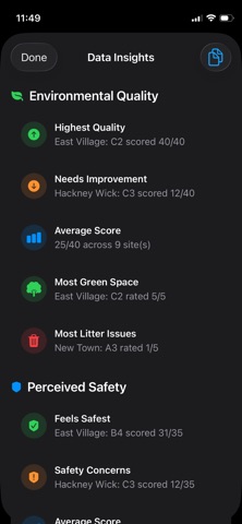
Urban Fieldwork is designed for teachers and students carrying out urban fieldwork investigations. It turns your iPhone into a complete data collection and analysis toolkit, helping you gather consistent, high-quality data in the field, visualise results instantly, and export reports in seconds.
Whether you are investigating environmental quality, perceived crime, regeneration, or inner-city change, Urban Fieldwork keeps everything organised, visual, and ready for classroom or NEA use.
Key Features:
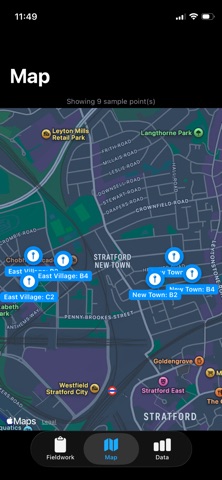
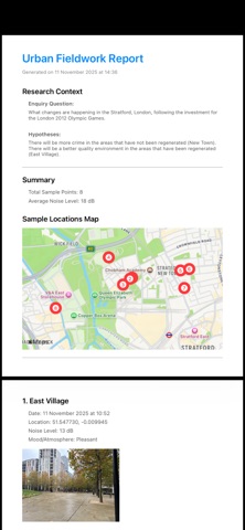
Record site locations Automatically capture GPS coordinates for each site, displayed instantly on Apple Maps. Ideal for mapping transects or zones of urban change.
Automatic Transcription and Summary of Interviews (devices with Apple Intelligence only) Automatically transcribe, summarise and analyse public interview or questionnaire responses, highlighting key quotes, themes and sentiment alongside the rest of your fieldwork data.
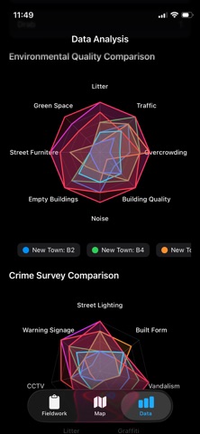
Environmental Quality Surveys (EQS) Record environmental quality using sliders and descriptors aligned with GCSE and A-level fieldwork methods.
Perceived crime and safety Log perceptions of safety to compare human responses with physical indicators.
Mood or wellbeing scores Add a “Mood Meter” value to explore emotional responses to different environments.
Decibel readings Use your iPhone’s microphone to measure sound levels and compare noise across sites.
Pedestrian counts Record pedestrian numbers and age-group estimates to analyse demographics and activity levels. Helps assess how different urban spaces are used and by whom.
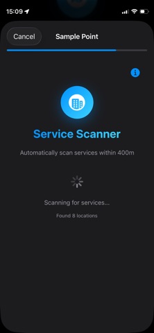
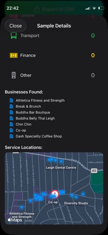
Service provision scan Automatically scan a 400m radius (around a five-minute walk) using Apple Maps to identify nearby businesses and services. Provides insight into how well an area is serviced and its overall character, supporting analysis of regeneration, inequality, and land use.
Add photos Take or attach photos during sampling. Each image links to its site and appears in the final report.
Learn about each method Access concise explanations on how to collect each type of data and what it reveals about urban areas, supporting independent learning and understanding of fieldwork techniques.
Visualise Results In The Field View sampling points on an interactive Apple Map. Tap a site to review or edit data, photos, and notes, and identify spatial patterns.
Export and Share CSV Export – Create spreadsheets including coordinates, scores, pedestrian data, and notes for use in Excel, Numbers, or GIS. HTML Report – Produce a formatted report showing all sites, photos, and key data, with optional headline and AI analysis. Exports are stored locally. You choose when and how to share them. HTML format allows for editing and conversion into Word, Pages or Google docs.
Apple Intelligence (Optional) On supported devices, generate an AI summary of your dataset highlighting key findings and contrasts. Runs fully on-device for privacy and can be added to the exported report.
Privacy Urban Fieldwork does not collect or transmit personal data. All information, including location, photos, and readings, stays on your device and is deleted when the app is removed. No login, no account creation, no third-party sharing.
Ideal For GCSE and A-level Geography students and teachers Fieldwork and NEA preparation School and college geography departments Urban investigation projects
Requirements iPhone with iOS 17 or later Location, Camera, and Microphone permissions Works offline (internet only needed for maps and exports)
Why Teachers Use It Urban Fieldwork saves time, standardises data collection, and helps students focus on interpretation and analysis. It reduces transcription errors, improves data quality, and promotes understanding of urban fieldwork techniques, all while keeping data secure and offline.
Each subscription will automatically renew 3 days before the expiration date for
the same time period. Subscriptions can be cancelled at any time before the renewal.