

YourTrail is made and published by Swann Faucon. AppBrain is an independent app data site and isn't affiliated with Swann Faucon. The app name, icon, screenshots and description belong to Swann Faucon and are shown as published on the App Store.
AppBrain's verdict
- Last updated
- September 25, 2026
- Size
- 45.2 MB
User feedback
Ratings and reviews on the App StoreComments on YourTrail for iOS
We don't have enough comments to show example comments. Please check back later.
Store listing
By Swann Faucon, from the App Store

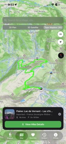
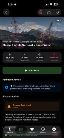
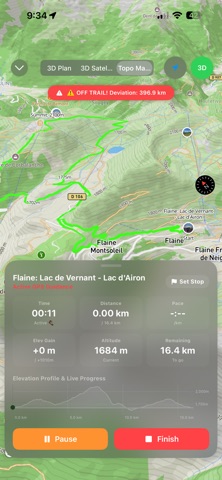


Screenshots by Swann Faucon, from the the App Store listing
Description by Swann Faucon Written by the developer, not by AppBrain. Click to read.
YourTrail is the ultimate companion for your outdoor adventures, mountain treks, and hikes. Import any GPX or KML track or discover community routes on stunning, dynamic 3D topographic maps.
Key Features & What's New:
NEW: Community Hikes & 1-Click Sharing Share your hikes instantly using YourTrail web links. Friends open your track directly inside the app with full GPX coordinates, elevation profiles, geotagged photos, and bivouac advice. Browse public hikes shared by the community on the interactive map.
NEW: Standalone Apple Watch Companion App Track your hike from your wrist with a high-contrast compass arrow and color-coded off-trail alerts (Green = On Track, Orange = Adjust Bearing, Red = Off-Trail). Features 100% Standalone Backup Mode: if your iPhone disconnects or runs out of battery, your Watch automatically takes over navigation using its native hardware GPS and compass!
NEW: Bivouac & Wild Camping Regulations Know where you can legally pitch your tent. Automatically evaluates location-aware wild camping rules along your route across France, Norway, Switzerland, Spain, USA, Canada, and more.
NEW: Target Point & Bivouac Stop Planner Drag and place bivouac stops or target points anywhere on the trail. Get instant real-time calculations for remaining distance, elevation gain (+D+), and estimated time to reach your stop.
Hydration Advice & Mountain Shelters Automatic detection of nearby natural water sources (lakes, streams), shelters, and bivouac spots along your route (powered by OpenStreetMap).
Live Activities & Dynamic Island Track your elapsed time, distance covered, and elevation gain live right on your iPhone Lock Screen and Dynamic Island.
3D Topographic Maps & 100% Offline Mode Visualize real terrain and summits with high precision and interactive elevation profile scrubbing. Download topo maps before leaving to navigate safely without any cellular network.
Safety and technology
Found in the app by AppBrain- Price
- $2.99
- App size
- 45.2 MB
- Content rating
- Everyone
Technologies used by YourTrail
Releases
Updates seen on the App Store- Version
- 3.1.6
- Launched
- July 2026
No changelog data
Alternatives
Similar apps and more from Swann FauconMore from Swann Faucon

Rankings
App Store top chartsApp Store Rankings for YourTrail
This app is not ranked
About the app and developer
About YourTrail
YourTrail is a navigation app developed by Swann Faucon.
What is the rating of YourTrail?
YourTrail has no ratings yet.
Is YourTrail free?
YourTrail costs $2.99. The app size is 45.25 MB. The latest version available is 3.1.6. The last update was on September 25, 2026.
What are the requirements for YourTrail?
The app has a content rating of Everyone. The app has been available on the App Store since July 2026.
Developer information for Swann Faucon
Address: