

Zugerseen is made and published by Mappuls AG. AppBrain is an independent app data site and isn't affiliated with Mappuls AG. The app name, icon, screenshots and description belong to Mappuls AG and are shown as published on the App Store.
AppBrain's verdict
- Last updated
- February 25, 2026
Rankings
App Store top chartsApp Store Rankings for Zugerseen
Competitors
Similar apps and more from Mappuls AG


Releases
Updates seen on the App Store- Version
- 2.2.0
- Launched
- March 2021
No changelog data
User feedback
Ratings and reviews on the App StoreComments on Zugerseen for iOS
We don't have enough comments to show example comments. Please check back later.
Technology
Found in the app by AppBrain- Price
- Free
- App size
- 150.4 MB
- Content rating
- Everyone
Technologies used by Zugerseen
About the app and developer
About Zugerseen
Zugerseen is a navigation app developed by Mappuls AG.
What is the rating of Zugerseen?
Zugerseen has no ratings yet.
Is Zugerseen free?
Zugerseen is free. The app size is 150.35 MB. The latest version available is 2.2.0. The last update was on February 25, 2026.
What are the requirements for Zugerseen?
The app has a content rating of Everyone. The app has been available on the App Store since March 2021.
Developer information for Mappuls AG
Address:
Frequently asked questions about Zugerseen
Is Zugerseen free?
Yes. Zugerseen is free on the App Store.
Is Zugerseen still available?
Yes. Zugerseen is on the App Store, and the last update we saw was on February 25, 2026.
How large is Zugerseen?
Zugerseen is 150.35 MB.
Is Zugerseen suitable for children?
App Store rates the content of Zugerseen as suitable for everyone.
Who made Zugerseen?
Zugerseen was developed by Mappuls AG. It is listed in the navigation category on the App Store.
What are the best alternatives to Zugerseen?
People looking at Zugerseen also look at these navigation apps: Outdoor Schwyz, Migrol, BnB Switzerland, MountainAccess, TCS - Touring Club Schweiz.
Store listing
By Mappuls AG, from the App Store



Description by Mappuls AG Written by the developer, not by AppBrain. Click to read.
Unterstützung bei der Navigation auf dem See (keine Internetverbindung nötig):
• Aktuelle Position auf der Karte anzeigen
• Geschwindigkeit in Knoten und Km/h
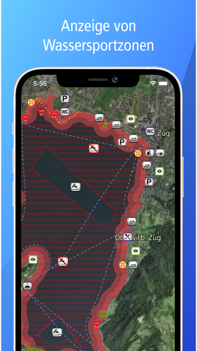
• Uferzonen mit Geschwindigkeitslimit, Hinweis bei Überschreitung
• Sperr- und Naturschutzzonen
• Sportverbotszonen für Windsurfing, Kitesurfing und Wakeboarding
• Bilder von Orientierungspunkten
• Eigene Punkte auf der Karte speichern und mit Notizen versehen
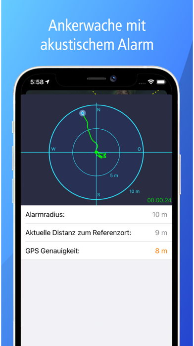
• Ankerwache mit akustischem Alarm
Nützliche Informationen und Kontakte:
• Sämtliche Häfen und deren Infrastruktur
• Anlegestellen und Gästeplätze
• Restaurants, WCs und Parkplätze
• Bestimmungen, Regeln und Signale
• Informationen zur Sicherheit und für den Notfall
• Aktueller Wasserstand und aktuelle Wassertemperatur
• Kursschiffstationen mit Abfahrtszeiten
• Nützliche Kontakte