Android Apps
>
Maps & Navigation
> Paid
Category
Maps & Navigation
Sort by
Trending
Recent downloads
All-time downloads
Top rated
Popular in
Filter by
Off
Free
Paid
New
Updated
Price Reduced
No ads
Page 7 of the popular Paid Maps & Navigation Apps for Android in Thailand
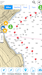
Mount Rainier Offline Topo Map
XDivide Geospatial

Designed with simplicity in mind, this app offers an intuitive user interface that enables you to quickly and easily find information about surroundings, without any prior technical knowledge or expe…


$0.99
0.0
1+ downloads
|
Maps & Navigation
0.0
$0.99
XDivide Geospatial
1+ downloads
TRANSPORTATION
1+ downloads
TRANSPORTATION
Mount Rainier Offline Topo Map
Designed with simplicity in mind, this app offers an intuitive user interface that enables you to quickly and easily fi…
Bluebill WildLife Pond IA Map
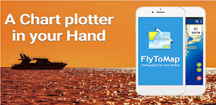
FLYTOMAP

Flytomap is a valid and interesting alternative, Benetti Yachts
Featured on the Deck
Featured on Geomedia
Worldwide Marine and Outdoor Maps available when connected, thanks to viewer.flytomap.com
Wor…


$2.49
0.0
5+ downloads
|
Maps & Navigation
0.0
$2.49
FLYTOMAP
5+ downloads
TRANSPORTATION
5+ downloads
TRANSPORTATION
Bluebill WildLife Pond IA Map
Flytomap is a valid and interesting alternative, Benetti Yachts
Featured on the Deck
Featured on Geomedia
Worldwide Mar…
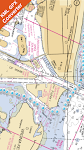
Egadi Island Offline GPS Chart
MAPITECH LTD

MapiTech launches on the market the best official up-to-date RNC (raster) combined with S57 nautical charts (digital): marinas, wrecks, fishing spots, boat ramps, POI.
This app displays seamlessly …


$4.99
0.0
1+ downloads
|
Maps & Navigation
0.0
$4.99
MAPITECH LTD
1+ downloads
TRANSPORTATION
1+ downloads
TRANSPORTATION
Egadi Island Offline GPS Chart
MapiTech launches on the market the best official up-to-date RNC (raster) combined with S57 nautical charts (digital):…
Grand lake o the Cherokees Map
MAPITECH LTD

MapiTech launches on the market the best official up-to-date NOAA RNC (raster) combined with S57 nautical charts (digital): marinas, wrecks, fishing spots, boat ramps, POI.
This app displays seamles…


$4.99
0.0
10+ downloads
|
Maps & Navigation
0.0
$4.99
MAPITECH LTD
10+ downloads
TRANSPORTATION
10+ downloads
TRANSPORTATION
Grand lake o the Cherokees Map
MapiTech launches on the market the best official up-to-date NOAA RNC (raster) combined with S57 nautical charts (digit…
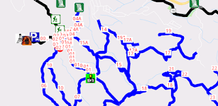
Black Mtn Crab Orchrd ATV Trls
GPSAppGenerator, LLC

Lifetime Map, no annual subscription fee, no in-app purchases. This Area would take a few days to explore. Ozone Falls, is nearby, but you go by car and a short hike to see it. There has been some lo…


$9.99
0.0
5+ downloads
|
Maps & Navigation
0.0
$9.99
GPSAppGenerator, LLC
5+ downloads
TRANSPORTATION
5+ downloads
TRANSPORTATION
Black Mtn Crab Orchrd ATV Trls
Lifetime Map, no annual subscription fee, no in-app purchases. This Area would take a few days to explore. Ozone Falls,…
Martha's Vine & Nantuket chart
FLYTOMAP INC

Flytomap is a valid and interesting alternative,
Featured on the Deck
Featured on Geomedia
Worldwide Marine and Outdoor Maps available when connected, thanks to viewer.flytomap.com
Worldwide Satelli…


$3.99
0.0
1+ downloads
|
Maps & Navigation
0.0
$3.99
FLYTOMAP INC
1+ downloads
TRANSPORTATION
1+ downloads
TRANSPORTATION
Martha's Vine & Nantuket chart
Flytomap is a valid and interesting alternative,
Featured on the Deck
Featured on Geomedia
Worldwide Marine and Outdoo…
Ireland GPS Map Navigator
FLYTOMAP INC

Flytomap is a valid and interesting alternative,
Featured on the Deck
Featured on Geomedia
Worldwide Marine and Outdoor Maps available when connected, thanks to viewer.flytomap.com
Worldwide Satelli…


$3.99
0.0
10+ downloads
|
Maps & Navigation
0.0
$3.99
FLYTOMAP INC
10+ downloads
TRANSPORTATION
10+ downloads
TRANSPORTATION
Ireland GPS Map Navigator
Flytomap is a valid and interesting alternative,
Featured on the Deck
Featured on Geomedia
Worldwide Marine and Outdoo…
Lake St.Clair GPS Navigator
FLYTOMAP INC

Flytomap is a valid and interesting alternative
Featured on the Deck
Featured on Geomedia
Worldwide Marine and Outdoor Maps available when connected, thanks to viewer.flytomap.com
Worldwide Satellite…


$3.99
0.0
100+ downloads
|
Maps & Navigation
0.0
$3.99
FLYTOMAP INC
100+ downloads
TRANSPORTATION
100+ downloads
TRANSPORTATION
Lake St.Clair GPS Navigator
Flytomap is a valid and interesting alternative
Featured on the Deck
Featured on Geomedia
Worldwide Marine and Outdoor …
Spain Mediterranean GPS Charts
FLYTOMAP INC

Flytomap is a valid and interesting alternative,
Featured on the Deck
Featured on Geomedia
Worldwide Marine and Outdoor Maps available when connected, thanks to viewer.flytomap.com
Worldwide Satellit…


$4.99
0.0
50+ downloads
|
Maps & Navigation
0.0
$4.99
FLYTOMAP INC
50+ downloads
TRANSPORTATION
50+ downloads
TRANSPORTATION
Spain Mediterranean GPS Charts
Flytomap is a valid and interesting alternative,
Featured on the Deck
Featured on Geomedia
Worldwide Marine and Outdoor…
Oslo fjord Norway Offline Maps
MAPITECH LTD

MapiTech launches on the market the best official up-to-date RNC (raster) combined with S57 nautical charts (digital): marinas, wrecks, fishing spots, boat ramps, POI.
This app displays seamlessly …


$4.99
0.0
5+ downloads
|
Maps & Navigation
0.0
$4.99
MAPITECH LTD
5+ downloads
TRANSPORTATION
5+ downloads
TRANSPORTATION
Oslo fjord Norway Offline Maps
MapiTech launches on the market the best official up-to-date RNC (raster) combined with S57 nautical charts (digital):…
World Airports Pro
Waterline Software

World Airports Pro is a worldwide database of over 5000 of the world's principle airports and their runways permitting location and orientation through the medium of Google® Maps. Within this ap…


$1.49
0.0
100+ downloads
|
Maps & Navigation
0.0
$1.49
Waterline Software
100+ downloads
TRANSPORTATION
100+ downloads
TRANSPORTATION
World Airports Pro
World Airports Pro is a worldwide database of over 5000 of the world's principle airports and their runways permitting …
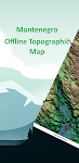
Montenegro Offline Topo Map
XDivide Geospatial

Designed with simplicity in mind, this app offers an intuitive user interface that enables you to quickly and easily find information about surroundings, without any prior technical knowledge or expe…


$3.49
0.0
1+ downloads
|
Maps & Navigation
0.0
$3.49
XDivide Geospatial
1+ downloads
TRANSPORTATION
1+ downloads
TRANSPORTATION
Montenegro Offline Topo Map
Designed with simplicity in mind, this app offers an intuitive user interface that enables you to quickly and easily fi…
Seychelles GPS Map Navigator
FLYTOMAP

Flytomap is a valid and interesting alternative,
Featured on the Deck
Featured on Geomedia
Worldwide Marine and Outdoor Maps available when connected, thanks to viewer.flytomap.com
Worldwide Satelli…


$3.99
0.0
10+ downloads
|
Maps & Navigation
0.0
$3.99
FLYTOMAP
10+ downloads
TRANSPORTATION
10+ downloads
TRANSPORTATION
Seychelles GPS Map Navigator
Flytomap is a valid and interesting alternative,
Featured on the Deck
Featured on Geomedia
Worldwide Marine and Outdoo…
Fiji Islands GPS Map Navigator
FLYTOMAP INC

Flytomap is a valid and interesting alternative,
Worldwide Marine and Outdoor Maps available when connected, thanks to viewer.flytomap.com
Worldwide Satellite images overlay on charts
Worldwide Terr…


$3.99
0.0
10+ downloads
|
Maps & Navigation
0.0
$3.99
FLYTOMAP INC
10+ downloads
TRANSPORTATION
10+ downloads
TRANSPORTATION
Fiji Islands GPS Map Navigator
Flytomap is a valid and interesting alternative,
Worldwide Marine and Outdoor Maps available when connected, thanks to …
Picardie GPS Map Navigator
FLYTOMAP INC

Flytomap is a valid and interesting alternative,
Featured on the Deck
Featured on Geomedia
Worldwide Marine and Outdoor Maps available when connected, thanks to viewer.flytomap.com
Worldwide Satelli…


$3.99
0.0
1+ downloads
|
Maps & Navigation
0.0
$3.99
FLYTOMAP INC
1+ downloads
TRANSPORTATION
1+ downloads
TRANSPORTATION
Picardie GPS Map Navigator
Flytomap is a valid and interesting alternative,
Featured on the Deck
Featured on Geomedia
Worldwide Marine and Outdoo…
Greece West GPS Map Navigator
FLYTOMAP INC

Flytomap is a valid and interesting alternative,
Featured on the Deck
Featured on Geomedia
Worldwide Marine and Outdoor Maps available when connected, thanks to viewer.flytomap.com
Worldwide Satellit…


$3.99
0.0
10+ downloads
|
Maps & Navigation
0.0
$3.99
FLYTOMAP INC
10+ downloads
TRANSPORTATION
10+ downloads
TRANSPORTATION
Greece West GPS Map Navigator
Flytomap is a valid and interesting alternative,
Featured on the Deck
Featured on Geomedia
Worldwide Marine and Outdoor…
Hawaii Offline Topographic map
XDivide Geospatial

Designed with simplicity in mind, this app offers an intuitive user interface that enables you to quickly and easily find information about surroundings, without any prior technical knowledge or expe…


$3.99
0.0
0+ downloads
|
Maps & Navigation
0.0
$3.99
XDivide Geospatial
0+ downloads
TRANSPORTATION
0+ downloads
TRANSPORTATION
Hawaii Offline Topographic map
Designed with simplicity in mind, this app offers an intuitive user interface that enables you to quickly and easily fi…
American Mushroom Forager Map
GeoPOI LLC

A TRUE GAMECHANGER
This app will completely revolutionize the way you look for mushrooms! It leverages multiple highly detailed spatial (map-based) datasets describing local environmental conditions…


$1.99
0.0
5+ downloads
|
Maps & Navigation
0.0
$1.99
GeoPOI LLC
5+ downloads
TRANSPORTATION
5+ downloads
TRANSPORTATION
American Mushroom Forager Map
A TRUE GAMECHANGER
This app will completely revolutionize the way you look for mushrooms! It leverages multiple highly…
Estepona Sines Offline GPS Map
MAPITECH LTD

MapiTech launches on the market the best official up-to-date RNC (raster) combined with S57 nautical charts (digital): marinas, wrecks, fishing spots, boat ramps, POI.
This app displays seamlessly …


$4.99
0.0
5+ downloads
|
Maps & Navigation
0.0
$4.99
MAPITECH LTD
5+ downloads
TRANSPORTATION
5+ downloads
TRANSPORTATION
Estepona Sines Offline GPS Map
MapiTech launches on the market the best official up-to-date RNC (raster) combined with S57 nautical charts (digital):…


More apps
Android Statistics
© 2010-2024 - AppBrain