AppBrain
|
Apps
Apps
Apps being viewed right now
Trending apps today
Most popular apps
All-time most downloaded apps
Top rated apps
Statistics
Docs
Developers
Sign up
Log in
Android Apps
>
Maps & Navigation
>
Paid
Category
Maps & Navigation
Sort by
Trending
Recent downloads
All-time downloads
Top rated
Popular in
Filter by
Off
Free
Paid
New
Updated
Price Reduced
No ads
Page 5 of the
popular Paid Maps & Navigation Apps for Android in Thailand
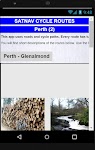
Satnav Cycle Routes – Perth(2) – Click to show
Satnav Cycle Routes – Perth(2)
Ian Lochhead
Perth - Glenalmond. 35 miles Perth - Crieff. 38 miles Perth - Milnathort. 38 miles Satnav Cycle Routes around Perth using cycle paths and roads. Every route has turn-by-turn navigation with voice in…
$0.99
0.0
0+ downloads
|
Maps & Navigation
0.0
$0.99
Ian Lochhead
0+ downloads
TRANSPORTATION
Satnav Cycle Routes – Perth(2)
Perth - Glenalmond. 35 miles Perth - Crieff. 38 miles Perth - Milnathort. 38 miles Satnav Cycle Routes around Perth us…
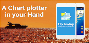
Blue Lake IOWA GPS Charts – Click to show
Blue Lake IOWA GPS Charts
FLYTOMAP
Flytomap is a valid and interesting alternative, Benetti Yachts Featured on the Deck Featured on Geomedia Worldwide Marine and Outdoor Maps available when connected, thanks to viewer.flytomap.com Wor…
$2.99
0.0
1+ downloads
|
Maps & Navigation
0.0
$2.99
FLYTOMAP
1+ downloads
TRANSPORTATION
Blue Lake IOWA GPS Charts
Flytomap is a valid and interesting alternative, Benetti Yachts Featured on the Deck Featured on Geomedia Worldwide Mar…
Como Park Lake Zoo Map & Guide – Click to show
Como Park Lake Zoo Map & Guide
GeoPOI LLC
Como Park is one of the most visited destinations in Minnesota, and for good reason! Located in northwest Saint Paul in Ramsey County, Como Park was established in 1884 and has a rich history as an p…
$0.49
0.0
10+ downloads
|
Maps & Navigation
0.0
$0.49
GeoPOI LLC
10+ downloads
TRANSPORTATION
Como Park Lake Zoo Map & Guide
Como Park is one of the most visited destinations in Minnesota, and for good reason! Located in northwest Saint Paul in…
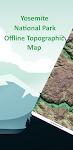
Yosemite Offline Topo Map – Click to show
Yosemite Offline Topo Map
XDivide Geospatial
Designed with simplicity in mind, this app offers an intuitive user interface that enables you to quickly and easily find information about surroundings, without any prior technical knowledge or expe…
$2.99
0.0
0+ downloads
|
Maps & Navigation
0.0
$2.99
XDivide Geospatial
0+ downloads
TRANSPORTATION
Yosemite Offline Topo Map
Designed with simplicity in mind, this app offers an intuitive user interface that enables you to quickly and easily fi…
North York Moors Outdoor Map P
jonshutt
An offline map of the North York Moors National Park in England, ideal for hiking, running, mountain biking / cycling. Being offline means unlike other map apps, you don't need a signal to access det…
$1.99
0.0
10+ downloads
|
Maps & Navigation
0.0
$1.99
jonshutt
10+ downloads
TRANSPORTATION
North York Moors Outdoor Map P
An offline map of the North York Moors National Park in England, ideal for hiking, running, mountain biking / cycling. …
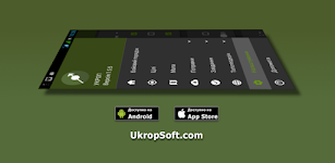
Ukrop
UkropSoft
“UKROP” is intended for calculating target data by artillery units taking into account topographic, meteorological and ballistic training. Suitable for professional work of all military b…
$5.00
0.0
10,000+ downloads
|
Maps & Navigation
0.0
$5.00
UkropSoft
10,000+ downloads
TRANSPORTATION
Ukrop
“UKROP” is intended for calculating target data by artillery units taking into account topographic, meteoro…
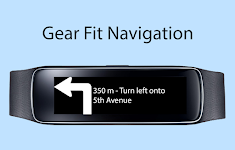
Gear Fit Navigation – Click to show
Gear Fit Navigation
SmartWatch Studios
This application displays Google Navigation instructions on your Samsung Gear Fit 1 smartwatch. (Not compatible with Gear Fit2!) Note: - Supports horizontal and vertical layout - Additional to the …
$1.99
3.4
10,000+ downloads
|
Maps & Navigation
3.4
$1.99
SmartWatch Studios
10,000+ downloads
TRANSPORTATION
Gear Fit Navigation
This application displays Google Navigation instructions on your Samsung Gear Fit 1 smartwatch. (Not compatible with Ge…
Kärnten Lakes - Austria Charts – Click to show
Kärnten Lakes - Austria Charts
MAPITECH LTD
MapiTech launches on the market the best official up-to-date combined with S57 nautical charts (digital): marinas, wrecks, fishing spots, boat ramps, POI. Lakes in this App : Aichwaldsee,AfritzerSe…
$4.99
0.0
5+ downloads
|
Maps & Navigation
0.0
$4.99
MAPITECH LTD
5+ downloads
TRANSPORTATION
Kärnten Lakes - Austria Charts
MapiTech launches on the market the best official up-to-date combined with S57 nautical charts (digital): marinas, wre…
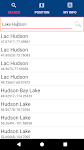
Lake Hudson GPS Map Navigator – Click to show
Lake Hudson GPS Map Navigator
FLYTOMAP INC
Flytomap is a valid and interesting alternative, Featured on the Deck Featured on Geomedia Worldwide Marine and Outdoor Maps available when connected, thanks to viewer.flytomap.com Worldwide Satelli…
$3.99
0.0
0+ downloads
|
Maps & Navigation
0.0
$3.99
FLYTOMAP INC
0+ downloads
TRANSPORTATION
Lake Hudson GPS Map Navigator
Flytomap is a valid and interesting alternative, Featured on the Deck Featured on Geomedia Worldwide Marine and Outdoo…
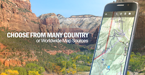
BackCountry Navigator GPS PRO
CritterMap Software LLC
Download topo maps for an offline outdoor navigator! Use your phone or tablet as an offroad topo mapping handheld GPS with the bestselling outdoor navigation app for Android! Explore beyond cell cove…
$14.99
3.8
100,000+ downloads
|
Maps & Navigation
3.8
$14.99
CritterMap Software LLC
100,000+ downloads
TRANSPORTATION
BackCountry Navigator GPS PRO
Download topo maps for an offline outdoor navigator! Use your phone or tablet as an offroad topo mapping handheld GPS w…
Smith Mountain Lake GPS Charts – Click to show
Smith Mountain Lake GPS Charts
FLYTOMAP INC
Flytomap is a valid and interesting alternative, Featured on the Deck Featured on Geomedia Worldwide Marine and Outdoor Maps available when connected, thanks to viewer.flytomap.com Worldwide Satellit…
$3.99
0.0
10+ downloads
|
Maps & Navigation
0.0
$3.99
FLYTOMAP INC
10+ downloads
TRANSPORTATION
Smith Mountain Lake GPS Charts
Flytomap is a valid and interesting alternative, Featured on the Deck Featured on Geomedia Worldwide Marine and Outdoor…
Lake Diamond Valley CA Offline – Click to show
Lake Diamond Valley CA Offline
FLYTOMAP INC
Flytomap is a valid and interesting alternative, Featured on the Deck Featured on Geomedia Worldwide Marine and Outdoor Maps available when connected, thanks to viewer.flytomap.com Worldwide Satelli…
$2.99
0.0
1+ downloads
|
Maps & Navigation
0.0
$2.99
FLYTOMAP INC
1+ downloads
TRANSPORTATION
Lake Diamond Valley CA Offline
Flytomap is a valid and interesting alternative, Featured on the Deck Featured on Geomedia Worldwide Marine and Outdoo…
France Mediterranean GPS Chart – Click to show
France Mediterranean GPS Chart
FLYTOMAP INC
Flytomap is a valid and interesting alternative, Worldwide Marine and Outdoor Maps available when connected, thanks to viewer.flytomap.com Worldwide Satellite images overlay on charts Worldwide Terr…
$4.99
0.0
10+ downloads
|
Maps & Navigation
0.0
$4.99
FLYTOMAP INC
10+ downloads
TRANSPORTATION
France Mediterranean GPS Chart
Flytomap is a valid and interesting alternative, Worldwide Marine and Outdoor Maps available when connected, thanks to …
Guadeloupe Offline GPS Charts – Click to show
Guadeloupe Offline GPS Charts
MAPITECH LTD
MapiTech launches on the market the best official up-to-date RNC (raster) combined with S57 nautical charts (digital): marinas, wrecks, fishing spots, boat ramps, POI. This app displays seamlessly …
$4.99
0.0
1+ downloads
|
Maps & Navigation
0.0
$4.99
MAPITECH LTD
1+ downloads
TRANSPORTATION
Guadeloupe Offline GPS Charts
MapiTech launches on the market the best official up-to-date RNC (raster) combined with S57 nautical charts (digital):…
GPS Attitude
Bergin-IT
GPS Attitude displays and saves to file GPS position, direction and rotation of an Android phone or tablet. The data can be sent to another IP address on the same WiFi network. An XYZ adjacent posit…
$4.49
3.0
500+ downloads
|
Maps & Navigation
3.0
$4.49
Bergin-IT
500+ downloads
TRANSPORTATION
GPS Attitude
GPS Attitude displays and saves to file GPS position, direction and rotation of an Android phone or tablet. The data ca…
Region Of Murcia GPS Navigator – Click to show
Region Of Murcia GPS Navigator
FLYTOMAP INC
Flytomap is a valid and interesting alternative, Worldwide Marine and Outdoor Maps available when connected, thanks to viewer.flytomap.com Worldwide Satellite images overlay on charts Worldwide Terr…
$3.99
0.0
1+ downloads
|
Maps & Navigation
0.0
$3.99
FLYTOMAP INC
1+ downloads
TRANSPORTATION
Region Of Murcia GPS Navigator
Flytomap is a valid and interesting alternative, Worldwide Marine and Outdoor Maps available when connected, thanks to …
Gps For Boat fishing & Car - P
V.Mark.
Be careful after the application is installed and the map appears, close and reopen the application to work properly. Maps: Satellite,Simple,Terrain,OpenStreetMap,Seamap,OpenTopo This GPS is speci…
$12.99
0.0
10+ downloads
|
Maps & Navigation
0.0
$12.99
V.Mark.
10+ downloads
TRANSPORTATION
Gps For Boat fishing & Car - P
Be careful after the application is installed and the map appears, close and reopen the application to work properly. …
Lake Itasca Gps Map Navigator – Click to show
Lake Itasca Gps Map Navigator
FLYTOMAP INC
Flytomap is a valid and interesting alternative, Benetti Yachts Featured on the Deck Featured on Geomedia Worldwide Marine and Outdoor Maps available when connected, thanks to viewer.flytomap.com Wor…
$3.99
0.0
1+ downloads
|
Maps & Navigation
0.0
$3.99
FLYTOMAP INC
1+ downloads
TRANSPORTATION
Lake Itasca Gps Map Navigator
Flytomap is a valid and interesting alternative, Benetti Yachts Featured on the Deck Featured on Geomedia Worldwide Mar…
Satnav CycleRoutes–Dunfermline – Click to show
Satnav CycleRoutes–Dunfermline
Ian Lochhead
Dunfermline - Kincardine. 28.6 miles Dunfermline - Limekilns. 14.4 miles Satnav Cycle Routes around Dunfermline using cycle paths and roads. Every route has turn-by-turn navigation with voice instru…
$0.99
0.0
0+ downloads
|
Maps & Navigation
0.0
$0.99
Ian Lochhead
0+ downloads
TRANSPORTATION
Satnav CycleRoutes–Dunfermline
Dunfermline - Kincardine. 28.6 miles Dunfermline - Limekilns. 14.4 miles Satnav Cycle Routes around Dunfermline using …
The Blue Hills Reservation Map – Click to show
The Blue Hills Reservation Map
FLYTOMAP INC
Flytomap is a valid and interesting alternative, Featured on the Deck Featured on Geomedia Try now the new FlyToMap web viewer to see all available maps worldwide !!! Visit viewer.flytomap.com &ldqu…
$3.99
0.0
10+ downloads
|
Maps & Navigation
0.0
$3.99
FLYTOMAP INC
10+ downloads
TRANSPORTATION
The Blue Hills Reservation Map
Flytomap is a valid and interesting alternative, Featured on the Deck Featured on Geomedia Try now the new FlyToMap web…
United States
United Kingdom
Germany
Norway
Sweden
Australia
Netherlands
Italy
Denmark
Hong Kong
Brazil
France
Canada
Spain
Portugal
South Korea
Japan
Poland
Hungary
India
Finland
Thailand
Russia
General
Overall
Applications
Games
Join AppBrain
Join AppBrain to get app recommendations
Apps
Art & Design
Auto & Vehicles
Beauty
Books & Reference
Business
Comics
Communication
Dating
Education
Entertainment
Events
Finance
Food & Drink
Health & Fitness
House & Home
Libraries & Demo
Lifestyle
Maps & Navigation
Medical
Music & Audio
News & Magazines
Parenting
Personalization
Photography
Productivity
Shopping
Social
Sports
Tools
Travel & Local
Video Players & Editors
Weather
Games
Action
Adventure
Arcade
Board
Card
Casino
Casual
Educational
Music
Puzzle
Racing
Role Playing
Simulation
Sports Games
Strategy
Trivia
Word