AppBrain
|
Apps
Apps
Apps being viewed right now
Trending apps today
Most popular apps
All-time most downloaded apps
Top rated apps
Statistics
Docs
Developers
Sign up
Log in
Android Apps
>
Maps & Navigation
>
Paid
Category
Maps & Navigation
Sort by
Trending
Recent downloads
All-time downloads
Top rated
Popular in
Filter by
Off
Free
Paid
New
Updated
Price Reduced
No ads
Page 7 of the
popular Paid Maps & Navigation Apps for Android in Australia
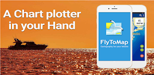
Toledo Bend RSVR Offline Chart – Click to show
Toledo Bend RSVR Offline Chart
FLYTOMAP INC
Flytomap is a valid and interesting alternative, Featured on the Deck Featured on Geomedia Worldwide Marine and Outdoor Maps available when connected, thanks to viewer.flytomap.com Worldwide Satellit…
$3.99
0.0
100+ downloads
|
Maps & Navigation
0.0
$3.99
FLYTOMAP INC
100+ downloads
TRANSPORTATION
Toledo Bend RSVR Offline Chart
Flytomap is a valid and interesting alternative, Featured on the Deck Featured on Geomedia Worldwide Marine and Outdoor…
NZ Charts
Right Place Resources
This app includes a complete set of the LINZ marine charts for New Zealand as well as full route plotting and navigation functions. The charts can be downloaded for off-line use without cellular con…
$2.99
0.0
100+ downloads
|
Maps & Navigation
0.0
$2.99
Right Place Resources
100+ downloads
TRANSPORTATION
NZ Charts
This app includes a complete set of the LINZ marine charts for New Zealand as well as full route plotting and navigatio…
Lake Como GPS Map Navigator – Click to show
Lake Como GPS Map Navigator
FLYTOMAP INC
Flytomap is a valid and interesting alternative, Featured on the Deck Featured on Geomedia Worldwide Marine and Outdoor Maps available when connected, thanks to viewer.flytomap.com Worldwide Satelli…
$3.99
0.0
10+ downloads
|
Maps & Navigation
0.0
$3.99
FLYTOMAP INC
10+ downloads
TRANSPORTATION
Lake Como GPS Map Navigator
Flytomap is a valid and interesting alternative, Featured on the Deck Featured on Geomedia Worldwide Marine and Outdoo…
Compass Eye Bearing Compass
Electric Pocket
A Professional Bearing Compass with Augmented Reality and upto 8x zoom designed to help navigate on land, sea and air and used much like a pair of Compass Binoculars. When held vertically it shows th…
$6.49
0.0
100+ downloads
|
Maps & Navigation
0.0
$6.49
Electric Pocket
100+ downloads
TRANSPORTATION
Compass Eye Bearing Compass
A Professional Bearing Compass with Augmented Reality and upto 8x zoom designed to help navigate on land, sea and air a…
Sextant – This app may contain mature content
Sextant
Navigational Algorithms
Celestial navigation - Astronavigation For training or improving your skills with a marine sextant, an aircraft octant (bubble), an artificial horizon, or a theodolite. - Real time calculation of t…
$1.99
0.0
500+ downloads
|
Maps & Navigation
0.0
$1.99
Navigational Algorithms
500+ downloads
TRANSPORTATION
Sextant
Celestial navigation - Astronavigation For training or improving your skills with a marine sextant, an aircraft octant…
Lake Itasca Gps Map Navigator – Click to show
Lake Itasca Gps Map Navigator
FLYTOMAP INC
Flytomap is a valid and interesting alternative, Benetti Yachts Featured on the Deck Featured on Geomedia Worldwide Marine and Outdoor Maps available when connected, thanks to viewer.flytomap.com Wor…
$3.99
0.0
0+ downloads
|
Maps & Navigation
0.0
$3.99
FLYTOMAP INC
0+ downloads
TRANSPORTATION
Lake Itasca Gps Map Navigator
Flytomap is a valid and interesting alternative, Benetti Yachts Featured on the Deck Featured on Geomedia Worldwide Mar…
France Mediterranean GPS Chart – Click to show
France Mediterranean GPS Chart
FLYTOMAP INC
Flytomap is a valid and interesting alternative, Worldwide Marine and Outdoor Maps available when connected, thanks to viewer.flytomap.com Worldwide Satellite images overlay on charts Worldwide Terr…
$4.99
0.0
10+ downloads
|
Maps & Navigation
0.0
$4.99
FLYTOMAP INC
10+ downloads
TRANSPORTATION
France Mediterranean GPS Chart
Flytomap is a valid and interesting alternative, Worldwide Marine and Outdoor Maps available when connected, thanks to …
UTM Grid Ref Compass
Mike Irving
Never be lost again! Find out your current UTM Grid Reference Map location anywhere in the world. UTM refers to the Universal Transverse Mercator geographic coordinate system. Your current Compass …
$0.99
0.0
100+ downloads
|
Maps & Navigation
0.0
$0.99
Mike Irving
100+ downloads
TRANSPORTATION
UTM Grid Ref Compass
Never be lost again! Find out your current UTM Grid Reference Map location anywhere in the world. UTM refers to the Un…
Boating Sydney Nautical Charts – Click to show
Boating Sydney Nautical Charts
FLYTOMAP INC
Flytomap is a valid and interesting alternative, Featured on Geomedia Worldwide Marine and Outdoor Maps available when connected, thanks to viewer.flytomap.com Worldwide Satellite images overlay on …
$3.99
0.0
10+ downloads
|
Maps & Navigation
0.0
$3.99
FLYTOMAP INC
10+ downloads
TRANSPORTATION
Boating Sydney Nautical Charts
Flytomap is a valid and interesting alternative, Featured on Geomedia Worldwide Marine and Outdoor Maps available when…
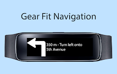
Gear Fit Navigation – Click to show
Gear Fit Navigation
SmartWatch Studios
This application displays Google Navigation instructions on your Samsung Gear Fit 1 smartwatch. (Not compatible with Gear Fit2!) Note: - Supports horizontal and vertical layout - Additional to the …
$1.99
2.5
10,000+ downloads
|
Maps & Navigation
2.5
$1.99
SmartWatch Studios
10,000+ downloads
TRANSPORTATION
Gear Fit Navigation
This application displays Google Navigation instructions on your Samsung Gear Fit 1 smartwatch. (Not compatible with Ge…
Lake Tahoe California GPS Maps – Click to show
Lake Tahoe California GPS Maps
FLYTOMAP INC
Flytomap is a valid and interesting alternative, Worldwide Marine and Outdoor Maps available when connected, thanks to viewer.flytomap.com Worldwide Satellite images overlay on charts Worldwide Ter…
$3.99
0.0
0+ downloads
|
Maps & Navigation
0.0
$3.99
FLYTOMAP INC
0+ downloads
TRANSPORTATION
Lake Tahoe California GPS Maps
Flytomap is a valid and interesting alternative, Worldwide Marine and Outdoor Maps available when connected, thanks to…
Lake Diamond Valley CA Offline – Click to show
Lake Diamond Valley CA Offline
FLYTOMAP INC
Flytomap is a valid and interesting alternative, Featured on the Deck Featured on Geomedia Worldwide Marine and Outdoor Maps available when connected, thanks to viewer.flytomap.com Worldwide Satelli…
$2.99
0.0
0+ downloads
|
Maps & Navigation
0.0
$2.99
FLYTOMAP INC
0+ downloads
TRANSPORTATION
Lake Diamond Valley CA Offline
Flytomap is a valid and interesting alternative, Featured on the Deck Featured on Geomedia Worldwide Marine and Outdoo…
Navigation [Huawei watches] – Click to show
Navigation [Huawei watches]
Mobiteka
This is a companion app of Navigation Viewer client app for Huawei Harmony NEXT / Harmony OS / Harmony Lite OS series smartwatches. ⓘ If your watch is connected but this app shows unauthorized stat…
$2.99
0.0
10,000+ downloads
|
Maps & Navigation
0.0
$2.99
Mobiteka
10,000+ downloads
TRANSPORTATION
Navigation [Huawei watches]
This is a companion app of Navigation Viewer client app for Huawei Harmony NEXT / Harmony OS / Harmony Lite OS series …
Float Murray
Jason Sanford
Lake Murray's boating app. Learn your way around Lake Murray. Navigate to marinas, boat launches, restaurants, and more. Save your favorite spots and share them with friends. Favorites - Save your f…
$2.99
0.0
10+ downloads
|
Maps & Navigation
0.0
$2.99
Jason Sanford
10+ downloads
TRANSPORTATION
Float Murray
Lake Murray's boating app. Learn your way around Lake Murray. Navigate to marinas, boat launches, restaurants, and more…
XploraPro
Jonathan Ide
XploraPro is a powerful navigation and tracking app designed for adventurers, explorers or anyone who wants to keep a detailed real-time view and historical record of their journeys. Whether you're h…
$2.99
0.0
1+ downloads
|
Maps & Navigation
0.0
$2.99
Jonathan Ide
1+ downloads
TRANSPORTATION
XploraPro
XploraPro is a powerful navigation and tracking app designed for adventurers, explorers or anyone who wants to keep a d…
North York Moors Outdoor Map P – Click to show
North York Moors Outdoor Map P
jonathan shutt
An offline map of the North York Moors National Park in England, ideal for hiking, running, mountain biking / cycling. Being offline means unlike other map apps, you don't need a signal to access det…
$1.99
0.0
50+ downloads
|
Maps & Navigation
0.0
$1.99
jonathan shutt
50+ downloads
TRANSPORTATION
North York Moors Outdoor Map P
An offline map of the North York Moors National Park in England, ideal for hiking, running, mountain biking / cycling. …
Guadeloupe Offline GPS Charts – Click to show
Guadeloupe Offline GPS Charts
MAPITECH LTD
MapiTech launches on the market the best official up-to-date RNC (raster) combined with S57 nautical charts (digital): marinas, wrecks, fishing spots, boat ramps, POI. This app displays seamlessly …
$4.99
0.0
1+ downloads
|
Maps & Navigation
0.0
$4.99
MAPITECH LTD
1+ downloads
TRANSPORTATION
Guadeloupe Offline GPS Charts
MapiTech launches on the market the best official up-to-date RNC (raster) combined with S57 nautical charts (digital):…
US Rivers GPS Map Navigator – Click to show
US Rivers GPS Map Navigator
FLYTOMAP INC
Flytomap is a valid and interesting alternative, Worldwide Marine and Outdoor Maps available when connected, thanks to viewer.flytomap.com Worldwide Satellite images overlay on charts Worldwide Terr…
$4.99
0.0
100+ downloads
|
Maps & Navigation
0.0
$4.99
FLYTOMAP INC
100+ downloads
TRANSPORTATION
US Rivers GPS Map Navigator
Flytomap is a valid and interesting alternative, Worldwide Marine and Outdoor Maps available when connected, thanks to …
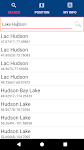
Lake Hudson GPS Map Navigator – Click to show
Lake Hudson GPS Map Navigator
FLYTOMAP INC
Flytomap is a valid and interesting alternative, Featured on the Deck Featured on Geomedia Worldwide Marine and Outdoor Maps available when connected, thanks to viewer.flytomap.com Worldwide Satelli…
$3.99
0.0
0+ downloads
|
Maps & Navigation
0.0
$3.99
FLYTOMAP INC
0+ downloads
TRANSPORTATION
Lake Hudson GPS Map Navigator
Flytomap is a valid and interesting alternative, Featured on the Deck Featured on Geomedia Worldwide Marine and Outdoo…
Virgin Islands Offline Charts – Click to show
Virgin Islands Offline Charts
MAPITECH LTD
MapiTech launches on the market the best official up-to-date RNC (raster) combined with S57 nautical charts (digital): marinas, wrecks, fishing spots, boat ramps, POI. This app displays seamlessly …
$5.99
0.0
5+ downloads
|
Maps & Navigation
0.0
$5.99
MAPITECH LTD
5+ downloads
TRANSPORTATION
Virgin Islands Offline Charts
MapiTech launches on the market the best official up-to-date RNC (raster) combined with S57 nautical charts (digital):…
United States
United Kingdom
Germany
Norway
Sweden
Australia
Netherlands
Italy
Denmark
Hong Kong
Brazil
France
Canada
Spain
Portugal
South Korea
Japan
Poland
Hungary
India
Finland
Thailand
Russia
General
Overall
Applications
Games
Join AppBrain
Join AppBrain to get app recommendations
Apps
Art & Design
Auto & Vehicles
Beauty
Books & Reference
Business
Comics
Communication
Dating
Education
Entertainment
Events
Finance
Food & Drink
Health & Fitness
House & Home
Libraries & Demo
Lifestyle
Maps & Navigation
Medical
Music & Audio
News & Magazines
Parenting
Personalization
Photography
Productivity
Shopping
Social
Sports
Tools
Travel & Local
Video Players & Editors
Weather
Games
Action
Adventure
Arcade
Board
Card
Casino
Casual
Educational
Music
Puzzle
Racing
Role Playing
Simulation
Sports Games
Strategy
Trivia
Word