AppBrain
|
Apps
Apps
Apps being viewed right now
Trending apps today
Most popular apps
All-time most downloaded apps
Top rated apps
Statistics
Docs
Developers
Sign up
Log in
Android Apps
>
Maps & Navigation
>
Paid
Category
Maps & Navigation
Sort by
Trending
Recent downloads
All-time downloads
Top rated
Popular in
Filter by
Off
Free
Paid
New
Updated
Price Reduced
No ads
Page 3 of the
popular Paid Maps & Navigation Apps for Android in Australia
Agro Measure Map Pro
Blue Blink One, SL
Agro Measure Map Pro lets you quickly and easily measure multiple distances, perimeters and areas with laser sharp precision! It even takes into account the curvature of the earth’s surface. Us…
$94.99
4.4
500+ downloads
|
Maps & Navigation
4.4
$94.99
Blue Blink One, SL
500+ downloads
TRANSPORTATION
Agro Measure Map Pro
Agro Measure Map Pro lets you quickly and easily measure multiple distances, perimeters and areas with laser sharp prec…
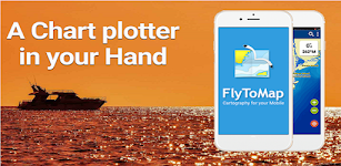
Lake Chiemsee GPS Navigator – Click to show
Lake Chiemsee GPS Navigator
FLYTOMAP INC
Flytomap is a valid and interesting alternative, Featured on the Deck Featured on Geomedia Worldwide Marine and Outdoor Maps available when connected, thanks to viewer.flytomap.com Worldwide Satelli…
$3.99
0.0
10+ downloads
|
Maps & Navigation
0.0
$3.99
FLYTOMAP INC
10+ downloads
TRANSPORTATION
Lake Chiemsee GPS Navigator
Flytomap is a valid and interesting alternative, Featured on the Deck Featured on Geomedia Worldwide Marine and Outdoo…
Cancun GPS Map Navigator – Click to show
Cancun GPS Map Navigator
FLYTOMAP INC
Flytomap is a valid and interesting alternative, Featured on the Deck Featured on Geomedia Worldwide Marine and Outdoor Maps available when connected, thanks to viewer.flytomap.com Worldwide Satellit…
$3.99
0.0
5+ downloads
|
Maps & Navigation
0.0
$3.99
FLYTOMAP INC
5+ downloads
TRANSPORTATION
Cancun GPS Map Navigator
Flytomap is a valid and interesting alternative, Featured on the Deck Featured on Geomedia Worldwide Marine and Outdoor…
Arst Finder - Premium
Luca Sanna
ARST FINDER permette la ricerca di tratte e prezzi dei mezzi pubblici ARST. Permette la visualizzazione di: - Orari e prezzi inserendo la fermata di partenza e di arrivo. - Dettaglio del percor…
$0.99
0.0
100+ downloads
|
Maps & Navigation
0.0
$0.99
Luca Sanna
100+ downloads
TRANSPORTATION
Arst Finder - Premium
ARST FINDER permette la ricerca di tratte e prezzi dei mezzi pubblici ARST. Permette la visualizzazione di: - Orari…
Transit Tracker+ - Chicago
hillman apps
Transit Tracker is not affiliated with any transit or government agency; this is not an official CTA app. All data is obtained through public APIs provided by CTA. Details can be found here: https://…
$1.99
5.0
1+ downloads
|
Maps & Navigation
5.0
$1.99
hillman apps
1+ downloads
TRANSPORTATION
Transit Tracker+ - Chicago
Transit Tracker is not affiliated with any transit or government agency; this is not an official CTA app. All data is o…
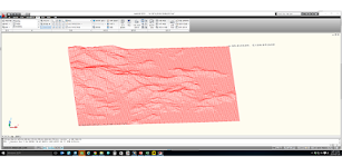
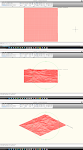
Terrain To DXF
우승호
Convert the terrain within N: -83 ~ 83 degree range as DXF files. The max resolution : 30m × 30m , Elevation : within 7~14m error CAD files can be used in a variety modeling and analysis. Rece…
$3.99
0.0
10+ downloads
|
Maps & Navigation
0.0
$3.99
우승호
10+ downloads
TRANSPORTATION
Terrain To DXF
Convert the terrain within N: -83 ~ 83 degree range as DXF files. The max resolution : 30m × 30m , Elevation : wi…
PORTA DEL CEL – Click to show
PORTA DEL CEL
Jorge Rodríguez-Flores Esparza
"Porta del Cel" is a medium distance circular route located in the Spanish and French Pyrenees. The trail runs through the "Parc Natural de l'Alt Pirineu" and the "Parc natur…
$1.99
0.0
0+ downloads
|
Maps & Navigation
0.0
$1.99
Jorge Rodríguez-Flores Esparza
0+ downloads
TRANSPORTATION
PORTA DEL CEL
"Porta del Cel" is a medium distance circular route located in the Spanish and French Pyrenees. The trail run…
Lake Walen GPS Map Navigator – Click to show
Lake Walen GPS Map Navigator
FLYTOMAP INC
Flytomap is a valid and interesting alternative, Worldwide Marine and Outdoor Maps available when connected, thanks to viewer.flytomap.com Worldwide Satellite images overlay on charts Worldwide Ter…
$3.99
0.0
10+ downloads
|
Maps & Navigation
0.0
$3.99
FLYTOMAP INC
10+ downloads
TRANSPORTATION
Lake Walen GPS Map Navigator
Flytomap is a valid and interesting alternative, Worldwide Marine and Outdoor Maps available when connected, thanks to…
Luiz Correa-french Guiana maps – Click to show
Luiz Correa-french Guiana maps
FLYTOMAP INC
Flytomap is a valid and interesting alternative, Featured on the Deck Featured on Geomedia Worldwide Marine and Outdoor Maps available when connected, thanks to viewer.flytomap.com Worldwide Satelli…
$3.99
0.0
0+ downloads
|
Maps & Navigation
0.0
$3.99
FLYTOMAP INC
0+ downloads
TRANSPORTATION
Luiz Correa-french Guiana maps
Flytomap is a valid and interesting alternative, Featured on the Deck Featured on Geomedia Worldwide Marine and Outdoo…
Speed Camera AI: Radar Alerts
Slash Idea s.r.o.
Take the stress out of driving with Drive AI, the AI-powered app that makes radar alerts and navigation smarter and easier. Unlike regular speed camera apps, Drive AI learns your daily routes and fig…
$0.99
0.0
10+ downloads
|
Maps & Navigation
0.0
$0.99
Slash Idea s.r.o.
10+ downloads
TRANSPORTATION
Speed Camera AI: Radar Alerts
Take the stress out of driving with Drive AI, the AI-powered app that makes radar alerts and navigation smarter and eas…
ExploreMetro VIP
Matthew Mayer
Purchase this app to become an ExploreMetro VIP, and enjoy our other metro map apps for seven cities in Asia with no ads. Supports: Explore Shanghai, Beijing, Guangzhou, Hong Kong, Singapore, Taipei…
$3.49
5.0
1,000+ downloads
|
Maps & Navigation
5.0
$3.49
Matthew Mayer
1,000+ downloads
TRANSPORTATION
ExploreMetro VIP
Purchase this app to become an ExploreMetro VIP, and enjoy our other metro map apps for seven cities in Asia with no ad…
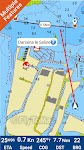
Catalonia GPS Map Navigator – Click to show
Catalonia GPS Map Navigator
FLYTOMAP INC
Flytomap is a valid and interesting alternative, Featured on the Deck Featured on Geomedia Worldwide Marine and Outdoor Maps available when connected, thanks to viewer.flytomap.com Worldwide Satellit…
$3.99
0.0
10+ downloads
|
Maps & Navigation
0.0
$3.99
FLYTOMAP INC
10+ downloads
TRANSPORTATION
Catalonia GPS Map Navigator
Flytomap is a valid and interesting alternative, Featured on the Deck Featured on Geomedia Worldwide Marine and Outdoor…
Harry S Truman RSVR GPS Charts – Click to show
Harry S Truman RSVR GPS Charts
MAPITECH LTD
MapiTech launches on the market the best official up-to-date NOAA RNC (raster) combined with S57 nautical charts (digital): marinas, wrecks, fishing spots, boat ramps, POI. This app displays seamles…
$4.99
0.0
0+ downloads
|
Maps & Navigation
0.0
$4.99
MAPITECH LTD
0+ downloads
TRANSPORTATION
Harry S Truman RSVR GPS Charts
MapiTech launches on the market the best official up-to-date NOAA RNC (raster) combined with S57 nautical charts (digit…
Pickwick Lake Al GPS Charts – Click to show
Pickwick Lake Al GPS Charts
FLYTOMAP INC
Flytomap is a valid and interesting alternative, Featured on the Deck Featured on Geomedia Worldwide Marine and Outdoor Maps available when connected, thanks to viewer.flytomap.com Worldwide Satelli…
$2.99
0.0
1+ downloads
|
Maps & Navigation
0.0
$2.99
FLYTOMAP INC
1+ downloads
TRANSPORTATION
Pickwick Lake Al GPS Charts
Flytomap is a valid and interesting alternative, Featured on the Deck Featured on Geomedia Worldwide Marine and Outdoo…
Lake Wakatipu NZ Offline Chart – Click to show
Lake Wakatipu NZ Offline Chart
MAPITECH LTD
MapiTech launches on the market the best official up-to-date NOAA RNC (raster) combined with S57 nautical charts (digital): marinas, wrecks, fishing spots, boat ramps, POI. This app displays seamles…
$4.99
0.0
0+ downloads
|
Maps & Navigation
0.0
$4.99
MAPITECH LTD
0+ downloads
TRANSPORTATION
Lake Wakatipu NZ Offline Chart
MapiTech launches on the market the best official up-to-date NOAA RNC (raster) combined with S57 nautical charts (digit…
Madeira Island Offline Charts – Click to show
Madeira Island Offline Charts
MAPITECH LTD
MapiTech launches on the market the best official up-to-date RNC (raster) combined with S57 nautical charts (digital): marinas, wrecks, fishing spots, boat ramps, POI. This app displays seamlessly …
$4.99
0.0
10+ downloads
|
Maps & Navigation
0.0
$4.99
MAPITECH LTD
10+ downloads
TRANSPORTATION
Madeira Island Offline Charts
MapiTech launches on the market the best official up-to-date RNC (raster) combined with S57 nautical charts (digital):…
Spain Mediterranean GPS Charts – Click to show
Spain Mediterranean GPS Charts
FLYTOMAP INC
Flytomap is a valid and interesting alternative, Featured on the Deck Featured on Geomedia Worldwide Marine and Outdoor Maps available when connected, thanks to viewer.flytomap.com Worldwide Satellit…
$4.99
0.0
50+ downloads
|
Maps & Navigation
0.0
$4.99
FLYTOMAP INC
50+ downloads
TRANSPORTATION
Spain Mediterranean GPS Charts
Flytomap is a valid and interesting alternative, Featured on the Deck Featured on Geomedia Worldwide Marine and Outdoor…
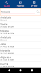
Andalusia GPS Map Navigator – Click to show
Andalusia GPS Map Navigator
FLYTOMAP INC
Flytomap is a valid and interesting alternative, Featured on the Deck Featured on Geomedia Worldwide Marine and Outdoor Maps available when connected, thanks to viewer.flytomap.com Worldwide Satellit…
$3.99
0.0
10+ downloads
|
Maps & Navigation
0.0
$3.99
FLYTOMAP INC
10+ downloads
TRANSPORTATION
Andalusia GPS Map Navigator
Flytomap is a valid and interesting alternative, Featured on the Deck Featured on Geomedia Worldwide Marine and Outdoor…
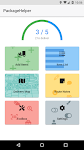
PackageHelper
Netsyms Technologies
Tired of scanning "leftover" Amazon boxes no access? Need to focus your attention on avoiding animal interference? Don't want to worry about finding that white SPR full of pills when you'…
$1.99
4.8
100+ downloads
|
Maps & Navigation
4.8
$1.99
Netsyms Technologies
100+ downloads
TRANSPORTATION
PackageHelper
Tired of scanning "leftover" Amazon boxes no access? Need to focus your attention on avoiding animal interfe…
Cng/Lpg Finder EUR&US&CAN + – Click to show
Cng/Lpg Finder EUR&US&CAN +
Lepus
Cng/Lpg Finder Plus is a route planner and a tool for finding compressed natural gas (Cng) or liquified petroleum gas (Lpg) stations along the route or around a location. It supports Lpg and Cng sta…
$5.00
0.0
1,000+ downloads
|
Maps & Navigation
0.0
$5.00
Lepus
1,000+ downloads
TRANSPORTATION
Cng/Lpg Finder EUR&US&CAN +
Cng/Lpg Finder Plus is a route planner and a tool for finding compressed natural gas (Cng) or liquified petroleum gas …
United States
United Kingdom
Germany
Norway
Sweden
Australia
Netherlands
Italy
Denmark
Hong Kong
Brazil
France
Canada
Spain
Portugal
South Korea
Japan
Poland
Hungary
India
Finland
Thailand
Russia
General
Overall
Applications
Games
Join AppBrain
Join AppBrain to get app recommendations
Apps
Art & Design
Auto & Vehicles
Beauty
Books & Reference
Business
Comics
Communication
Dating
Education
Entertainment
Events
Finance
Food & Drink
Health & Fitness
House & Home
Libraries & Demo
Lifestyle
Maps & Navigation
Medical
Music & Audio
News & Magazines
Parenting
Personalization
Photography
Productivity
Shopping
Social
Sports
Tools
Travel & Local
Video Players & Editors
Weather
Games
Action
Adventure
Arcade
Board
Card
Casino
Casual
Educational
Music
Puzzle
Racing
Role Playing
Simulation
Sports Games
Strategy
Trivia
Word