AppBrain
|
Apps
Apps
Apps being viewed right now
Trending apps today
Most popular apps
All-time most downloaded apps
Top rated apps
Statistics
Docs
Developers
Sign up
Log in
Android Apps
>
Maps & Navigation
>
Paid
Category
Maps & Navigation
Sort by
Trending
Recent downloads
All-time downloads
Top rated
Popular in
Filter by
Off
Free
Paid
New
Updated
Price Reduced
No ads
Page 6 of the
popular Paid Maps & Navigation Apps for Android in Denmark
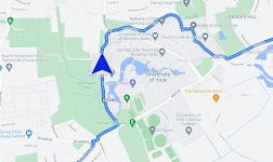
Satnav Cycle Routes – York – Click to show
Satnav Cycle Routes – York
Ian Lochhead
3 Satnav Cycle Routes around York. 1. Around York - 19.5 miles 2. York to Stamford Bridge - 28.3 miles 3. York to Tadcaster - 21.3 miles Satnav Cycle Routes around York using cycle paths and roads. …
$0.99
0.0
1+ downloads
|
Maps & Navigation
0.0
$0.99
Ian Lochhead
1+ downloads
TRANSPORTATION
Satnav Cycle Routes – York
3 Satnav Cycle Routes around York. 1. Around York - 19.5 miles 2. York to Stamford Bridge - 28.3 miles 3. York to Tadca…
Sempach Hallwil Baldegg Charts – Click to show
Sempach Hallwil Baldegg Charts
MAPITECH LTD
MapiTech launches on the market the best official up-to-date RNC (raster) combined with S57 nautical charts (digital): marinas, wrecks, fishing spots, boat ramps, POI. This app displays seamlessly …
$4.99
0.0
10+ downloads
|
Maps & Navigation
0.0
$4.99
MAPITECH LTD
10+ downloads
TRANSPORTATION
Sempach Hallwil Baldegg Charts
MapiTech launches on the market the best official up-to-date RNC (raster) combined with S57 nautical charts (digital):…
Altimeter Pro - Elevation – Click to show
Altimeter Pro - Elevation
dataWorks
This app has developed with love in Switzerland. No data is collected or shared. Support us with the price of a coffee! Thank you!! Main features: • Display of altitude (above sea level), accur…
$1.99
0.0
5+ downloads
|
Maps & Navigation
0.0
$1.99
dataWorks
5+ downloads
TRANSPORTATION
Altimeter Pro - Elevation
This app has developed with love in Switzerland. No data is collected or shared. Support us with the price of a coffee!…
Navigation Pro: Maps on Watch
Smartwatch Studios
Displays Google Navigation instructions from the phone on your Samsung watch. Great for driving, cycling and public transport. Features autostart with navigation, voice output, customizable vibration…
$2.99
4.7
1,000,000+ downloads
|
Maps & Navigation
4.7
$2.99
Smartwatch Studios
1,000,000+ downloads
TRANSPORTATION
Navigation Pro: Maps on Watch
Displays Google Navigation instructions from the phone on your Samsung watch. Great for driving, cycling and public tra…
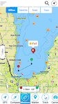
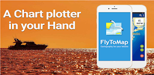
Lake Ontario GPS Map Navigator – Click to show
Lake Ontario GPS Map Navigator
FLYTOMAP INC
Flytomap is a valid and interesting alternative, Worldwide Marine and Outdoor Maps available when connected, thanks to viewer.flytomap.com Worldwide Satellite images overlay on charts Worldwide Ter…
$3.99
0.0
10+ downloads
|
Maps & Navigation
0.0
$3.99
FLYTOMAP INC
10+ downloads
TRANSPORTATION
Lake Ontario GPS Map Navigator
Flytomap is a valid and interesting alternative, Worldwide Marine and Outdoor Maps available when connected, thanks to…
Lake Walen GPS Map Navigator – Click to show
Lake Walen GPS Map Navigator
FLYTOMAP INC
Flytomap is a valid and interesting alternative, Worldwide Marine and Outdoor Maps available when connected, thanks to viewer.flytomap.com Worldwide Satellite images overlay on charts Worldwide Ter…
$3.99
0.0
10+ downloads
|
Maps & Navigation
0.0
$3.99
FLYTOMAP INC
10+ downloads
TRANSPORTATION
Lake Walen GPS Map Navigator
Flytomap is a valid and interesting alternative, Worldwide Marine and Outdoor Maps available when connected, thanks to…
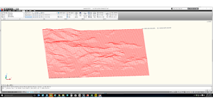
Terrain To DXF
우승호
Convert the terrain within N: -83 ~ 83 degree range as DXF files. The max resolution : 30m × 30m , Elevation : within 7~14m error CAD files can be used in a variety modeling and analysis. Rece…
$3.99
0.0
10+ downloads
|
Maps & Navigation
0.0
$3.99
우승호
10+ downloads
TRANSPORTATION
Terrain To DXF
Convert the terrain within N: -83 ~ 83 degree range as DXF files. The max resolution : 30m × 30m , Elevation : wi…
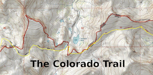
Colorado Trail
ColoradoSingleTrack
The Colorado Trail (#1776) is a collection of roads and trails managed by the United States Forest Service that generally follows the Continental Divide between Denver and Durango. The trail splits i…
$0.99
0.0
50+ downloads
|
Maps & Navigation
0.0
$0.99
ColoradoSingleTrack
50+ downloads
TRANSPORTATION
Colorado Trail
The Colorado Trail (#1776) is a collection of roads and trails managed by the United States Forest Service that general…
Cantabria GPS Map Navigator – Click to show
Cantabria GPS Map Navigator
FLYTOMAP INC
Flytomap is a valid and interesting alternative, Featured on the Deck Featured on Geomedia Worldwide Marine and Outdoor Maps available when connected, thanks to viewer.flytomap.com Worldwide Satellit…
$3.99
0.0
10+ downloads
|
Maps & Navigation
0.0
$3.99
FLYTOMAP INC
10+ downloads
TRANSPORTATION
Cantabria GPS Map Navigator
Flytomap is a valid and interesting alternative, Featured on the Deck Featured on Geomedia Worldwide Marine and Outdoor…
Qibla compass: Direction Mecca
HALALGUIDE LTD., CHK
Qibla Direction is an essential tool for Muslims to find the Qibla wherever they are: • Accurate compass direction • Sun-based alignment method • Location map to see Kaaba direction…
$0.99
0.0
10+ downloads
|
Maps & Navigation
0.0
$0.99
HALALGUIDE LTD., CHK
10+ downloads
TRANSPORTATION
Qibla compass: Direction Mecca
Qibla Direction is an essential tool for Muslims to find the Qibla wherever they are: • Accurate compass directio…
Transit Tracker+ - Chicago
hillman apps
Transit Tracker is not affiliated with any transit or government agency; this is not an official CTA app. All data is obtained through public APIs provided by CTA. Details can be found here: https://…
$1.99
5.0
1+ downloads
|
Maps & Navigation
5.0
$1.99
hillman apps
1+ downloads
TRANSPORTATION
Transit Tracker+ - Chicago
Transit Tracker is not affiliated with any transit or government agency; this is not an official CTA app. All data is o…
樂客導航王 全3D Pro
Kingwaytek Technology Co.,Ltd
1️⃣【特色】 1) 測速照相,罰單掰掰 2) 路口不錯過,匝道放心走 - 複雜路口實景圖超強大 3) 不走小路避塞車 - 路徑規劃超方便 2️⃣【詳細說明】 「樂客導航王全3D Pro」是全台唯一全3D立體導航軟體,業界領先3D圖資,3D立體地標、建物以及獨家立體標誌及立體指引,帶給您賽車級的實境導航體驗及視覺震撼。獨家3D立體高速導航引擎提供多條路徑規劃及前方即時路況之高畫質影像、測速照相…
$30.99
3.3
100,000+ downloads
|
Maps & Navigation
3.3
$30.99
Kingwaytek Technology Co.,Ltd
100,000+ downloads
TRANSPORTATION
樂客導航王 全3D Pro
1️⃣【特色】 1) 測速照相,罰單掰掰 2) 路口不錯過,匝道放心走 - 複雜路口實景圖超強大 3) 不走小路避塞車 - 路徑規劃超方便 2️⃣【詳細說明】 「樂客導航王全3D Pro」是全台唯一全3D立體導航軟體,業界領先3D圖資,…
Vancouver Is. Mushroom Forager – Click to show
Vancouver Is. Mushroom Forager
GeoPOI LLC
The forests and woodlands of the Pacific Northwest and British Columbia, Canada are ecosystems rich with edible wild mushrooms if you know where to look. Trouble is, seasoned wild edible collectors s…
$1.49
0.0
10+ downloads
|
Maps & Navigation
0.0
$1.49
GeoPOI LLC
10+ downloads
TRANSPORTATION
Vancouver Is. Mushroom Forager
The forests and woodlands of the Pacific Northwest and British Columbia, Canada are ecosystems rich with edible wild mu…
Luiz Correa-french Guiana maps – Click to show
Luiz Correa-french Guiana maps
FLYTOMAP INC
Flytomap is a valid and interesting alternative, Featured on the Deck Featured on Geomedia Worldwide Marine and Outdoor Maps available when connected, thanks to viewer.flytomap.com Worldwide Satelli…
$3.99
0.0
0+ downloads
|
Maps & Navigation
0.0
$3.99
FLYTOMAP INC
0+ downloads
TRANSPORTATION
Luiz Correa-french Guiana maps
Flytomap is a valid and interesting alternative, Featured on the Deck Featured on Geomedia Worldwide Marine and Outdoo…
Lake Yellowstone Wyoming Chart – Click to show
Lake Yellowstone Wyoming Chart
FLYTOMAP INC
Flytomap is a valid and interesting alternative, Featured on the Deck Featured on Geomedia Worldwide Marine and Outdoor Maps available when connected, thanks to viewer.flytomap.com Worldwide Satelli…
$3.99
0.0
0+ downloads
|
Maps & Navigation
0.0
$3.99
FLYTOMAP INC
0+ downloads
TRANSPORTATION
Lake Yellowstone Wyoming Chart
Flytomap is a valid and interesting alternative, Featured on the Deck Featured on Geomedia Worldwide Marine and Outdoo…
FootPrint
T.creations
Rediscover your steps with FootPrint! See every street you've explored and every path you've taken with this powerful and private GPS logger. FootPrint is your personal travel diary, designed to map …
$3.49
0.0
100+ downloads
|
Maps & Navigation
0.0
$3.49
T.creations
100+ downloads
TRANSPORTATION
FootPrint
Rediscover your steps with FootPrint! See every street you've explored and every path you've taken with this powerful a…
Lake Chiemsee GPS Navigator – Click to show
Lake Chiemsee GPS Navigator
FLYTOMAP INC
Flytomap is a valid and interesting alternative, Featured on the Deck Featured on Geomedia Worldwide Marine and Outdoor Maps available when connected, thanks to viewer.flytomap.com Worldwide Satelli…
$3.99
0.0
10+ downloads
|
Maps & Navigation
0.0
$3.99
FLYTOMAP INC
10+ downloads
TRANSPORTATION
Lake Chiemsee GPS Navigator
Flytomap is a valid and interesting alternative, Featured on the Deck Featured on Geomedia Worldwide Marine and Outdoo…
Lake Tarpon Florida GPS Charts – Click to show
Lake Tarpon Florida GPS Charts
FLYTOMAP INC
Flytomap is a valid and interesting alternative Featured on the Deck Featured on Geomedia Worldwide Marine and Outdoor Maps available when connected, thanks to viewer.flytomap.com Worldwide Satellite…
$2.99
0.0
0+ downloads
|
Maps & Navigation
0.0
$2.99
FLYTOMAP INC
0+ downloads
TRANSPORTATION
Lake Tarpon Florida GPS Charts
Flytomap is a valid and interesting alternative Featured on the Deck Featured on Geomedia Worldwide Marine and Outdoor …
Speed Camera AI: Radar Alerts
MyCarTracks
Take the stress out of driving with Drive AI, the AI-powered app that makes radar alerts and navigation smarter and easier. Unlike regular speed camera apps, Drive AI learns your daily routes and fig…
$0.99
0.0
10+ downloads
|
Maps & Navigation
0.0
$0.99
MyCarTracks
10+ downloads
TRANSPORTATION
Speed Camera AI: Radar Alerts
Take the stress out of driving with Drive AI, the AI-powered app that makes radar alerts and navigation smarter and eas…
Mojo TSD Navigator
RallyOn
Mojo TSD Navigator allows a time-speed-distance rally navigator (co-driver) to report to the driver whether to speed up or slow down in order to arrive at the next rally checkpoint exactly on time an…
$19.99
0.0
10+ downloads
|
Maps & Navigation
0.0
$19.99
RallyOn
10+ downloads
TRANSPORTATION
Mojo TSD Navigator
Mojo TSD Navigator allows a time-speed-distance rally navigator (co-driver) to report to the driver whether to speed up…
United States
United Kingdom
Germany
Norway
Sweden
Australia
Netherlands
Italy
Denmark
Hong Kong
Brazil
France
Canada
Spain
Portugal
South Korea
Japan
Poland
Hungary
India
Finland
Thailand
Russia
General
Overall
Applications
Games
Join AppBrain
Join AppBrain to get app recommendations
Apps
Art & Design
Auto & Vehicles
Beauty
Books & Reference
Business
Comics
Communication
Dating
Education
Entertainment
Events
Finance
Food & Drink
Health & Fitness
House & Home
Libraries & Demo
Lifestyle
Maps & Navigation
Medical
Music & Audio
News & Magazines
Parenting
Personalization
Photography
Productivity
Shopping
Social
Sports
Tools
Travel & Local
Video Players & Editors
Weather
Games
Action
Adventure
Arcade
Board
Card
Casino
Casual
Educational
Music
Puzzle
Racing
Role Playing
Simulation
Sports Games
Strategy
Trivia
Word