AppBrain
|
Apps
Apps
Apps being viewed right now
Trending apps today
Most popular apps
All-time most downloaded apps
Top rated apps
Statistics
Docs
Developers
Sign up
Log in
Android Apps
>
Maps & Navigation
>
Paid
Category
Maps & Navigation
Sort by
Trending
Recent downloads
All-time downloads
Top rated
Popular in
Filter by
Off
Free
Paid
New
Updated
Price Reduced
No ads
Page 4 of the
popular Paid Maps & Navigation Apps for Android in the Netherlands
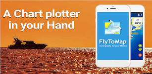
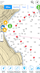
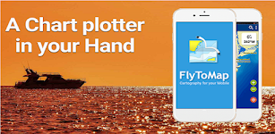
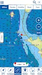
Lake Leman Geneva Offline Maps – Click to show
Lake Leman Geneva Offline Maps
FLYTOMAP INC
Flytomap is a valid and interesting alternative, Featured on the Deck Featured on Geomedia Worldwide Marine and Outdoor Maps available when connected, thanks to viewer.flytomap.com Worldwide Satelli…
$3.99
0.0
100+ downloads
|
Maps & Navigation
0.0
$3.99
FLYTOMAP INC
100+ downloads
TRANSPORTATION
Lake Leman Geneva Offline Maps
Flytomap is a valid and interesting alternative, Featured on the Deck Featured on Geomedia Worldwide Marine and Outdoo…
ViaBus + – Click to show
ViaBus +
SFR71
En ViaBus Facilitamos el trabajo a los profesionales de pasajeros por carretera. Además encuentras todo lo que en nuestro trabajo podemos necesitar. Buscar un Guía oficial de cualquier …
$16.99
0.0
100+ downloads
|
Maps & Navigation
0.0
$16.99
SFR71
100+ downloads
TRANSPORTATION
ViaBus +
En ViaBus Facilitamos el trabajo a los profesionales de pasajeros por carretera. Además encuentras todo lo que e…
PRO Voice Navigator "IGH"
rausNT
This app is a voice-based navigator. "I'm going home" is primarily intended for trekking enthusiasts, since it's a navigator for cross-country conditions. If you are afraid of getting lost…
$2.99
5.0
10,000+ downloads
|
Maps & Navigation
5.0
$2.99
rausNT
10,000+ downloads
TRANSPORTATION
PRO Voice Navigator "IGH"
This app is a voice-based navigator. "I'm going home" is primarily intended for trekking enthusiasts, since …
Andalusia GPS Map Navigator – Click to show
Andalusia GPS Map Navigator
FLYTOMAP INC
Flytomap is a valid and interesting alternative, Featured on the Deck Featured on Geomedia Worldwide Marine and Outdoor Maps available when connected, thanks to viewer.flytomap.com Worldwide Satellit…
$3.99
0.0
10+ downloads
|
Maps & Navigation
0.0
$3.99
FLYTOMAP INC
10+ downloads
TRANSPORTATION
Andalusia GPS Map Navigator
Flytomap is a valid and interesting alternative, Featured on the Deck Featured on Geomedia Worldwide Marine and Outdoor…
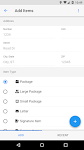
PackageHelper
Netsyms Technologies
Tired of scanning "leftover" Amazon boxes no access? Need to focus your attention on avoiding animal interference? Don't want to worry about finding that white SPR full of pills when you'…
$1.99
4.8
100+ downloads
|
Maps & Navigation
4.8
$1.99
Netsyms Technologies
100+ downloads
TRANSPORTATION
PackageHelper
Tired of scanning "leftover" Amazon boxes no access? Need to focus your attention on avoiding animal interfe…
Lake Ahquabi - IOWA GPS Map – Click to show
Lake Ahquabi - IOWA GPS Map
FLYTOMAP INC
Flytomap is a valid and interesting alternative, Worldwide Marine and Outdoor Maps available when connected, thanks to viewer.flytomap.com Worldwide Satellite images overlay on charts Worldwide Ter…
$1.99
0.0
0+ downloads
|
Maps & Navigation
0.0
$1.99
FLYTOMAP INC
0+ downloads
TRANSPORTATION
Lake Ahquabi - IOWA GPS Map
Flytomap is a valid and interesting alternative, Worldwide Marine and Outdoor Maps available when connected, thanks to…
UK Ireland GPS Map Navigator – Click to show
UK Ireland GPS Map Navigator
FLYTOMAP INC
Flytomap is a valid and interesting alternative, Featured on the Deck Featured on Geomedia Worldwide Marine and Outdoor Maps available when connected, thanks to viewer.flytomap.com Worldwide Satellit…
$4.99
0.0
10+ downloads
|
Maps & Navigation
0.0
$4.99
FLYTOMAP INC
10+ downloads
TRANSPORTATION
UK Ireland GPS Map Navigator
Flytomap is a valid and interesting alternative, Featured on the Deck Featured on Geomedia Worldwide Marine and Outdoor…
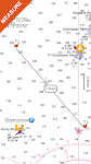
Compass Pro
Fulmine Software
Always be informed about north, your heading (azimuth) and location. Main advantages of our Compass app: • Beautiful and modern material design style. • Status bar notification - know your…
$2.49
4.6
5,000+ downloads
|
Maps & Navigation
4.6
$2.49
Fulmine Software
5,000+ downloads
TRANSPORTATION
Compass Pro
Always be informed about north, your heading (azimuth) and location. Main advantages of our Compass app: • Beauti…
Agro Measure Map Pro
Blue Blink One, SL
Agro Measure Map Pro lets you quickly and easily measure multiple distances, perimeters and areas with laser sharp precision! It even takes into account the curvature of the earth’s surface. Us…
$94.99
4.4
500+ downloads
|
Maps & Navigation
4.4
$94.99
Blue Blink One, SL
500+ downloads
TRANSPORTATION
Agro Measure Map Pro
Agro Measure Map Pro lets you quickly and easily measure multiple distances, perimeters and areas with laser sharp prec…
Cng/Lpg Finder EUR&US&CAN + – Click to show
Cng/Lpg Finder EUR&US&CAN +
Lepus
Cng/Lpg Finder Plus is a route planner and a tool for finding compressed natural gas (Cng) or liquified petroleum gas (Lpg) stations along the route or around a location. It supports Lpg and Cng sta…
$5.00
0.0
1,000+ downloads
|
Maps & Navigation
0.0
$5.00
Lepus
1,000+ downloads
TRANSPORTATION
Cng/Lpg Finder EUR&US&CAN +
Cng/Lpg Finder Plus is a route planner and a tool for finding compressed natural gas (Cng) or liquified petroleum gas …
SledNH 2026
Mapgears
**This purchase allows you to access up-to-date SledNH trail information for the 2025-2026 winter season. A new purchase will be required for the 2026-2027 season.** Out exploring NH on your snowmob…
$4.99
0.0
500+ downloads
|
Maps & Navigation
0.0
$4.99
Mapgears
500+ downloads
TRANSPORTATION
SledNH 2026
**This purchase allows you to access up-to-date SledNH trail information for the 2025-2026 winter season. A new purchas…
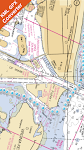
Martha's Vine & Nantuket chart – Click to show
Martha's Vine & Nantuket chart
FLYTOMAP INC
Flytomap is a valid and interesting alternative, Featured on the Deck Featured on Geomedia Worldwide Marine and Outdoor Maps available when connected, thanks to viewer.flytomap.com Worldwide Satelli…
$3.99
0.0
0+ downloads
|
Maps & Navigation
0.0
$3.99
FLYTOMAP INC
0+ downloads
TRANSPORTATION
Martha's Vine & Nantuket chart
Flytomap is a valid and interesting alternative, Featured on the Deck Featured on Geomedia Worldwide Marine and Outdoo…
Lake St.Clair GPS Navigator – Click to show
Lake St.Clair GPS Navigator
FLYTOMAP INC
Flytomap is a valid and interesting alternative Featured on the Deck Featured on Geomedia Worldwide Marine and Outdoor Maps available when connected, thanks to viewer.flytomap.com Worldwide Satellite…
$3.99
0.0
100+ downloads
|
Maps & Navigation
0.0
$3.99
FLYTOMAP INC
100+ downloads
TRANSPORTATION
Lake St.Clair GPS Navigator
Flytomap is a valid and interesting alternative Featured on the Deck Featured on Geomedia Worldwide Marine and Outdoor …
Black Hills NF Map Navigator – Click to show
Black Hills NF Map Navigator
FLYTOMAP INC
Flytomap is a valid and interesting alternative, Featured on the Deck Featured on Geomedia Try now the new FlyToMap web viewer to see all available maps worldwide !!! Visit viewer.flytomap.com &ldqu…
$3.99
0.0
1+ downloads
|
Maps & Navigation
0.0
$3.99
FLYTOMAP INC
1+ downloads
TRANSPORTATION
Black Hills NF Map Navigator
Flytomap is a valid and interesting alternative, Featured on the Deck Featured on Geomedia Try now the new FlyToMap web…
Ireland GPS Map Navigator – Click to show
Ireland GPS Map Navigator
FLYTOMAP INC
Flytomap is a valid and interesting alternative, Featured on the Deck Featured on Geomedia Worldwide Marine and Outdoor Maps available when connected, thanks to viewer.flytomap.com Worldwide Satelli…
$3.99
0.0
10+ downloads
|
Maps & Navigation
0.0
$3.99
FLYTOMAP INC
10+ downloads
TRANSPORTATION
Ireland GPS Map Navigator
Flytomap is a valid and interesting alternative, Featured on the Deck Featured on Geomedia Worldwide Marine and Outdoo…
Grand lake o the Cherokees Map – Click to show
Grand lake o the Cherokees Map
MAPITECH LTD
MapiTech launches on the market the best official up-to-date NOAA RNC (raster) combined with S57 nautical charts (digital): marinas, wrecks, fishing spots, boat ramps, POI. This app displays seamles…
$4.99
0.0
1+ downloads
|
Maps & Navigation
0.0
$4.99
MAPITECH LTD
1+ downloads
TRANSPORTATION
Grand lake o the Cherokees Map
MapiTech launches on the market the best official up-to-date NOAA RNC (raster) combined with S57 nautical charts (digit…
Lake Norman GPS Offline Charts – Click to show
Lake Norman GPS Offline Charts
FLYTOMAP INC
Flytomap is a valid and interesting alternative Featured on the Deck Featured on Geomedia Lake Norman coverage resident in the app. It works WITHOUT mobile coverage! Worldwide Marine and Outdoor M…
$3.99
0.0
100+ downloads
|
Maps & Navigation
0.0
$3.99
FLYTOMAP INC
100+ downloads
TRANSPORTATION
Lake Norman GPS Offline Charts
Flytomap is a valid and interesting alternative Featured on the Deck Featured on Geomedia Lake Norman coverage residen…
Almicantarat
Pierre-Louis Deschamps
Enjoy shooting stars, planets and the Sun with an easy-to-use, professional and accurate celestial navigation app. Features a smooth 3D Sky Map. Check the celestial fix on the device native map. Use …
$4.99
0.0
50+ downloads
|
Maps & Navigation
0.0
$4.99
Pierre-Louis Deschamps
50+ downloads
TRANSPORTATION
Almicantarat
Enjoy shooting stars, planets and the Sun with an easy-to-use, professional and accurate celestial navigation app. Feat…
AllPaths Pro: All the Paths
Tambucho
AllPaths, the application for Android devices specially designed for lovers of nature, Hiking, Mountain, Cycling, MTB, etc. DETAILED MANUAL: http://www.tambucho.es/android/allpaths/allpaths_en.pdf …
$6.99
0.0
1+ downloads
|
Maps & Navigation
0.0
$6.99
Tambucho
1+ downloads
TRANSPORTATION
AllPaths Pro: All the Paths
AllPaths, the application for Android devices specially designed for lovers of nature, Hiking, Mountain, Cycling, MTB, …
Champlain lake Offline Charts – Click to show
Champlain lake Offline Charts
MAPITECH LTD
MapiTech launches on the market the best official up-to-date NOAA RNC (raster) combined with S57 nautical charts (digital): marinas, wrecks, fishing spots, boat ramps, POI. This app displays seamles…
$4.99
0.0
50+ downloads
|
Maps & Navigation
0.0
$4.99
MAPITECH LTD
50+ downloads
TRANSPORTATION
Champlain lake Offline Charts
MapiTech launches on the market the best official up-to-date NOAA RNC (raster) combined with S57 nautical charts (digit…
United States
United Kingdom
Germany
Norway
Sweden
Australia
Netherlands
Italy
Denmark
Hong Kong
Brazil
France
Canada
Spain
Portugal
South Korea
Japan
Poland
Hungary
India
Finland
Thailand
Russia
General
Overall
Applications
Games
Join AppBrain
Join AppBrain to get app recommendations
Apps
Art & Design
Auto & Vehicles
Beauty
Books & Reference
Business
Comics
Communication
Dating
Education
Entertainment
Events
Finance
Food & Drink
Health & Fitness
House & Home
Libraries & Demo
Lifestyle
Maps & Navigation
Medical
Music & Audio
News & Magazines
Parenting
Personalization
Photography
Productivity
Shopping
Social
Sports
Tools
Travel & Local
Video Players & Editors
Weather
Games
Action
Adventure
Arcade
Board
Card
Casino
Casual
Educational
Music
Puzzle
Racing
Role Playing
Simulation
Sports Games
Strategy
Trivia
Word