AppBrain
|
Apps
Apps
Apps being viewed right now
Trending apps today
Most popular apps
All-time most downloaded apps
Top rated apps
Statistics
Docs
Developers
Sign up
Log in
Android Apps
>
Maps & Navigation
>
Paid
Category
Maps & Navigation
Sort by
Trending
Recent downloads
All-time downloads
Top rated
Popular in
Filter by
Off
Free
Paid
New
Updated
Price Reduced
No ads
Page 2 of the
popular Paid Maps & Navigation Apps for Android in Poland
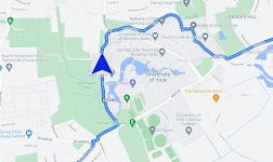
Satnav Cycle Routes – York – Click to show
Satnav Cycle Routes – York
Ian Lochhead
3 Satnav Cycle Routes around York. 1. Around York - 19.5 miles 2. York to Stamford Bridge - 28.3 miles 3. York to Tadcaster - 21.3 miles Satnav Cycle Routes around York using cycle paths and roads. …
$0.99
0.0
1+ downloads
|
Maps & Navigation
0.0
$0.99
Ian Lochhead
1+ downloads
TRANSPORTATION
Satnav Cycle Routes – York
3 Satnav Cycle Routes around York. 1. Around York - 19.5 miles 2. York to Stamford Bridge - 28.3 miles 3. York to Tadca…
GPS Compass Navigation Pro
Darko Belev
From now on your hiking, hill climbing and walking will be easy. Use compass, navigation, record your routes, save your locations, take photos with GPS tag... and much more. COMPASS - Magnetic and t…
$4.99
0.0
50+ downloads
|
Maps & Navigation
0.0
$4.99
Darko Belev
50+ downloads
TRANSPORTATION
GPS Compass Navigation Pro
From now on your hiking, hill climbing and walking will be easy. Use compass, navigation, record your routes, save your…
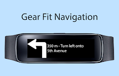
Gear Fit Navigation – Click to show
Gear Fit Navigation
SmartWatch Studios
This application displays Google Navigation instructions on your Samsung Gear Fit 1 smartwatch. (Not compatible with Gear Fit2!) Note: - Supports horizontal and vertical layout - Additional to the …
$1.99
2.5
10,000+ downloads
|
Maps & Navigation
2.5
$1.99
SmartWatch Studios
10,000+ downloads
TRANSPORTATION
Gear Fit Navigation
This application displays Google Navigation instructions on your Samsung Gear Fit 1 smartwatch. (Not compatible with Ge…
Old Hickory Lake GPS Charts – Click to show
Old Hickory Lake GPS Charts
FLYTOMAP INC
Flytomap is a valid and interesting alternative, Featured on the Deck Featured on Geomedia Worldwide Marine and Outdoor Maps available when connected, thanks to viewer.flytomap.com Worldwide Satelli…
$3.99
0.0
1+ downloads
|
Maps & Navigation
0.0
$3.99
FLYTOMAP INC
1+ downloads
TRANSPORTATION
Old Hickory Lake GPS Charts
Flytomap is a valid and interesting alternative, Featured on the Deck Featured on Geomedia Worldwide Marine and Outdoo…
Transportes Andalucía PRO
Fran Caballero Software
AVAILABLE ON ENGLISH. Enhance your journeys across Andalusia (Andalucía, Spain) with our public transportation app. Instantly access updated schedules for buses, trains, metro, and boats acro…
$3.49
0.0
10+ downloads
|
Maps & Navigation
0.0
$3.49
Fran Caballero Software
10+ downloads
TRANSPORTATION
Transportes Andalucía PRO
AVAILABLE ON ENGLISH. Enhance your journeys across Andalusia (Andalucía, Spain) with our public transportation …
Thorsborne Trail
Jonathan Ide
This is the only app for hikers either walking or thinking of walking the iconic Thorsborne Trail on World Heritage listed Hinchinbrook Island in Far North Queensland, Australia. It is the perfect el…
$4.49
0.0
1,000+ downloads
|
Maps & Navigation
0.0
$4.49
Jonathan Ide
1,000+ downloads
TRANSPORTATION
Thorsborne Trail
This is the only app for hikers either walking or thinking of walking the iconic Thorsborne Trail on World Heritage lis…
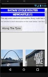
Satnav Cycle Routes-Newcastle1 – Click to show
Satnav Cycle Routes-Newcastle1
Ian Lochhead
1. Along the Tyne - 15 miles 2. Newcastle to Gateshead - 23.5 miles 3. Newcastle to Sunderland - 39 miles Satnav Cycle Routes around Newcastle using cycle paths and roads. Every route has turn-by-tu…
$0.99
0.0
0+ downloads
|
Maps & Navigation
0.0
$0.99
Ian Lochhead
0+ downloads
TRANSPORTATION
Satnav Cycle Routes-Newcastle1
1. Along the Tyne - 15 miles 2. Newcastle to Gateshead - 23.5 miles 3. Newcastle to Sunderland - 39 miles Satnav Cycle…
Isola del Giglio GPS Navigator – Click to show
Isola del Giglio GPS Navigator
FLYTOMAP INC
Flytomap is a valid and interesting alternative, Featured on the Deck Featured on Geomedia Worldwide Marine and Outdoor Maps available when connected, thanks to viewer.flytomap.com Worldwide Satelli…
$3.99
0.0
0+ downloads
|
Maps & Navigation
0.0
$3.99
FLYTOMAP INC
0+ downloads
TRANSPORTATION
Isola del Giglio GPS Navigator
Flytomap is a valid and interesting alternative, Featured on the Deck Featured on Geomedia Worldwide Marine and Outdoo…
Gps For Boat fishing & Car - P
V.Mark.
Be careful after the application is installed and the map appears, close and reopen the application to work properly. Maps: Satellite,Simple,Terrain,OpenStreetMap,Seamap,OpenTopo This GPS is speci…
$12.99
0.0
10+ downloads
|
Maps & Navigation
0.0
$12.99
V.Mark.
10+ downloads
TRANSPORTATION
Gps For Boat fishing & Car - P
Be careful after the application is installed and the map appears, close and reopen the application to work properly. …
Satnav CycleRoutes–Dunfermline – Click to show
Satnav CycleRoutes–Dunfermline
Ian Lochhead
Dunfermline - Kincardine. 28.6 miles Dunfermline - Limekilns. 14.4 miles Satnav Cycle Routes around Dunfermline using cycle paths and roads. Every route has turn-by-turn navigation with voice instru…
$0.99
0.0
0+ downloads
|
Maps & Navigation
0.0
$0.99
Ian Lochhead
0+ downloads
TRANSPORTATION
Satnav CycleRoutes–Dunfermline
Dunfermline - Kincardine. 28.6 miles Dunfermline - Limekilns. 14.4 miles Satnav Cycle Routes around Dunfermline using …
Lake Itasca Gps Map Navigator – Click to show
Lake Itasca Gps Map Navigator
FLYTOMAP INC
Flytomap is a valid and interesting alternative, Benetti Yachts Featured on the Deck Featured on Geomedia Worldwide Marine and Outdoor Maps available when connected, thanks to viewer.flytomap.com Wor…
$3.99
0.0
0+ downloads
|
Maps & Navigation
0.0
$3.99
FLYTOMAP INC
0+ downloads
TRANSPORTATION
Lake Itasca Gps Map Navigator
Flytomap is a valid and interesting alternative, Benetti Yachts Featured on the Deck Featured on Geomedia Worldwide Mar…
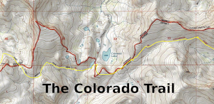
Colorado Trail
ColoradoSingleTrack
The Colorado Trail (#1776) is a collection of roads and trails managed by the United States Forest Service that generally follows the Continental Divide between Denver and Durango. The trail splits i…
$0.99
0.0
50+ downloads
|
Maps & Navigation
0.0
$0.99
ColoradoSingleTrack
50+ downloads
TRANSPORTATION
Colorado Trail
The Colorado Trail (#1776) is a collection of roads and trails managed by the United States Forest Service that general…
Galveston to Rio Grande Charts – Click to show
Galveston to Rio Grande Charts
MAPITECH LTD
MapiTech launches on the market the best official up-to-date NOAA RNC (raster) combined with S57 nautical charts (digital): marinas, wrecks, fishing spots, boat ramps, POI. This app displays seamles…
$4.99
0.0
0+ downloads
|
Maps & Navigation
0.0
$4.99
MAPITECH LTD
0+ downloads
TRANSPORTATION
Galveston to Rio Grande Charts
MapiTech launches on the market the best official up-to-date NOAA RNC (raster) combined with S57 nautical charts (digit…
Luiz Correa-french Guiana maps – Click to show
Luiz Correa-french Guiana maps
FLYTOMAP INC
Flytomap is a valid and interesting alternative, Featured on the Deck Featured on Geomedia Worldwide Marine and Outdoor Maps available when connected, thanks to viewer.flytomap.com Worldwide Satelli…
$3.99
0.0
0+ downloads
|
Maps & Navigation
0.0
$3.99
FLYTOMAP INC
0+ downloads
TRANSPORTATION
Luiz Correa-french Guiana maps
Flytomap is a valid and interesting alternative, Featured on the Deck Featured on Geomedia Worldwide Marine and Outdoo…
Lake Pend Oreille Idaho Charts – Click to show
Lake Pend Oreille Idaho Charts
MAPITECH LTD
MapiTech launches on the market the best official up-to-date NOAA RNC (raster) combined with S57 nautical charts (digital): marinas, wrecks, fishing spots, boat ramps, POI. This app displays seamles…
$4.99
0.0
1+ downloads
|
Maps & Navigation
0.0
$4.99
MAPITECH LTD
1+ downloads
TRANSPORTATION
Lake Pend Oreille Idaho Charts
MapiTech launches on the market the best official up-to-date NOAA RNC (raster) combined with S57 nautical charts (digit…
Lake Leman Geneva Offline Maps – Click to show
Lake Leman Geneva Offline Maps
FLYTOMAP INC
Flytomap is a valid and interesting alternative, Featured on the Deck Featured on Geomedia Worldwide Marine and Outdoor Maps available when connected, thanks to viewer.flytomap.com Worldwide Satelli…
$3.99
0.0
100+ downloads
|
Maps & Navigation
0.0
$3.99
FLYTOMAP INC
100+ downloads
TRANSPORTATION
Lake Leman Geneva Offline Maps
Flytomap is a valid and interesting alternative, Featured on the Deck Featured on Geomedia Worldwide Marine and Outdoo…
Transit Tracker+ - Chicago
hillman apps
Transit Tracker is not affiliated with any transit or government agency; this is not an official CTA app. All data is obtained through public APIs provided by CTA. Details can be found here: https://…
$1.99
5.0
1+ downloads
|
Maps & Navigation
5.0
$1.99
hillman apps
1+ downloads
TRANSPORTATION
Transit Tracker+ - Chicago
Transit Tracker is not affiliated with any transit or government agency; this is not an official CTA app. All data is o…
Lake Yellowstone Wyoming Chart – Click to show
Lake Yellowstone Wyoming Chart
FLYTOMAP INC
Flytomap is a valid and interesting alternative, Featured on the Deck Featured on Geomedia Worldwide Marine and Outdoor Maps available when connected, thanks to viewer.flytomap.com Worldwide Satelli…
$3.99
0.0
0+ downloads
|
Maps & Navigation
0.0
$3.99
FLYTOMAP INC
0+ downloads
TRANSPORTATION
Lake Yellowstone Wyoming Chart
Flytomap is a valid and interesting alternative, Featured on the Deck Featured on Geomedia Worldwide Marine and Outdoo…
樂客導航王 全3D Pro
Kingwaytek Technology Co.,Ltd
1️⃣【特色】 1) 測速照相,罰單掰掰 2) 路口不錯過,匝道放心走 - 複雜路口實景圖超強大 3) 不走小路避塞車 - 路徑規劃超方便 2️⃣【詳細說明】 「樂客導航王全3D Pro」是全台唯一全3D立體導航軟體,業界領先3D圖資,3D立體地標、建物以及獨家立體標誌及立體指引,帶給您賽車級的實境導航體驗及視覺震撼。獨家3D立體高速導航引擎提供多條路徑規劃及前方即時路況之高畫質影像、測速照相…
$30.99
3.3
100,000+ downloads
|
Maps & Navigation
3.3
$30.99
Kingwaytek Technology Co.,Ltd
100,000+ downloads
TRANSPORTATION
樂客導航王 全3D Pro
1️⃣【特色】 1) 測速照相,罰單掰掰 2) 路口不錯過,匝道放心走 - 複雜路口實景圖超強大 3) 不走小路避塞車 - 路徑規劃超方便 2️⃣【詳細說明】 「樂客導航王全3D Pro」是全台唯一全3D立體導航軟體,業界領先3D圖資,…
North York Moors Outdoor Map P – Click to show
North York Moors Outdoor Map P
jonathan shutt
An offline map of the North York Moors National Park in England, ideal for hiking, running, mountain biking / cycling. Being offline means unlike other map apps, you don't need a signal to access det…
$1.99
0.0
50+ downloads
|
Maps & Navigation
0.0
$1.99
jonathan shutt
50+ downloads
TRANSPORTATION
North York Moors Outdoor Map P
An offline map of the North York Moors National Park in England, ideal for hiking, running, mountain biking / cycling. …
United States
United Kingdom
Germany
Norway
Sweden
Australia
Netherlands
Italy
Denmark
Hong Kong
Brazil
France
Canada
Spain
Portugal
South Korea
Japan
Poland
Hungary
India
Finland
Thailand
Russia
General
Overall
Applications
Games
Join AppBrain
Join AppBrain to get app recommendations
Apps
Art & Design
Auto & Vehicles
Beauty
Books & Reference
Business
Comics
Communication
Dating
Education
Entertainment
Events
Finance
Food & Drink
Health & Fitness
House & Home
Libraries & Demo
Lifestyle
Maps & Navigation
Medical
Music & Audio
News & Magazines
Parenting
Personalization
Photography
Productivity
Shopping
Social
Sports
Tools
Travel & Local
Video Players & Editors
Weather
Games
Action
Adventure
Arcade
Board
Card
Casino
Casual
Educational
Music
Puzzle
Racing
Role Playing
Simulation
Sports Games
Strategy
Trivia
Word